Gecatalogiseerde kaart
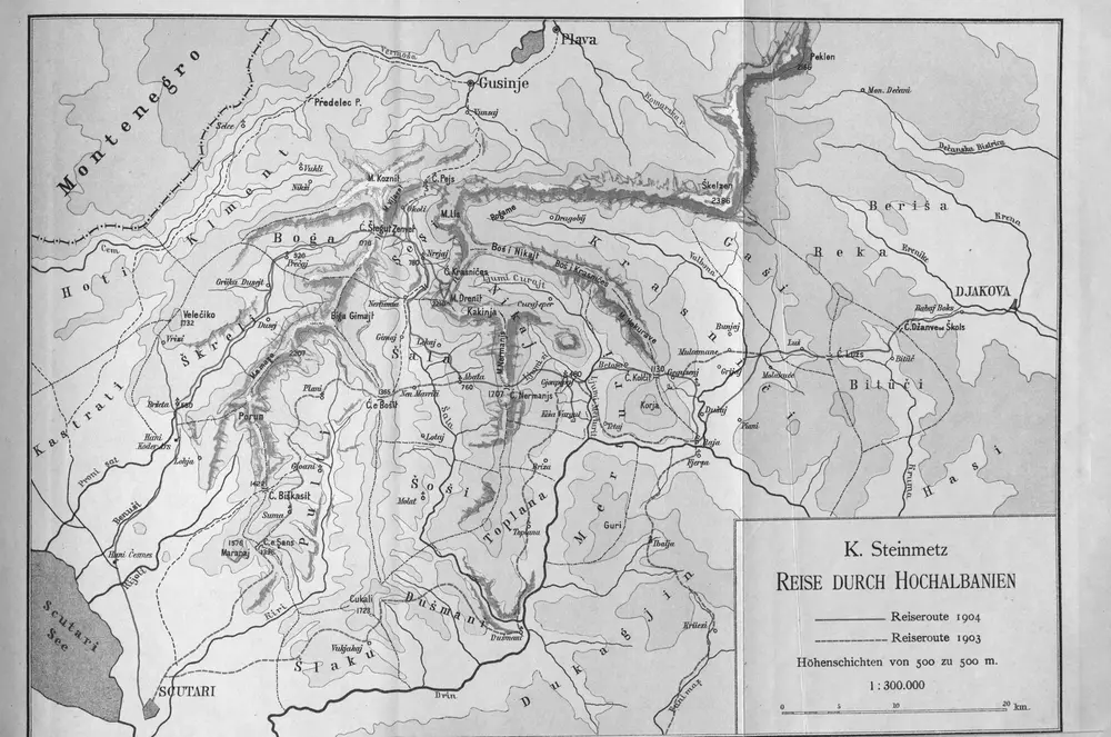
Reise durch Hochalbanien

Volledige titel:Reise durch Hochalbanien
Jaar illustratie:1904 - 1905
Pubdatum:1905
Fysieke grootte:20 x 30 cm
Schaal kaart:1:300 000
Reise durch Hochalbanien
1905
1:300k
[Nordalbanien]
1916
[Nordalbanien]
1916
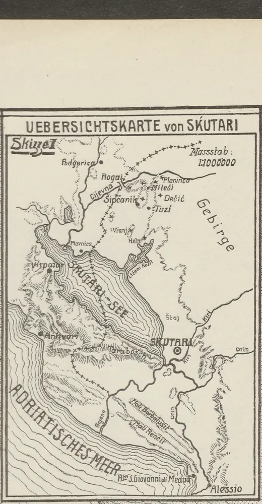
Übersichtskarte von Skutari
1913
1:1m
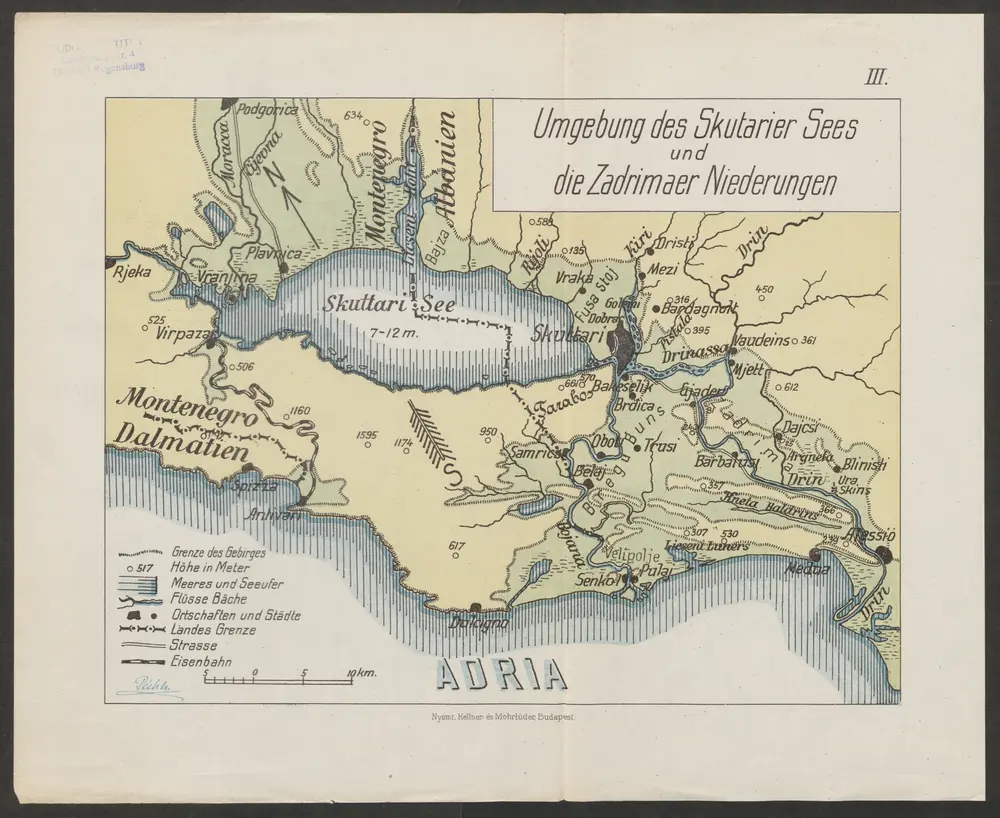
Umgebung des Skutarier Sees und die Zadrimaer Niederungen
1914
Péch, Béla
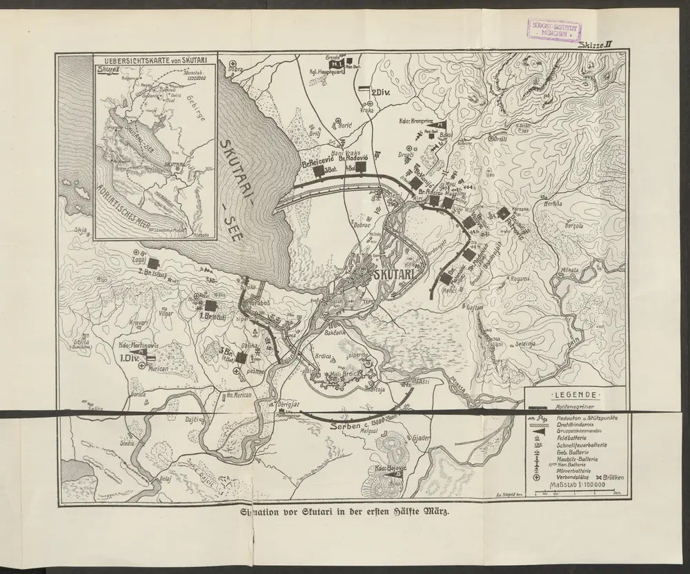
Situation vor Skutari in der ersten Hälfte März
1913
Siegrist, Ed.
1:100k
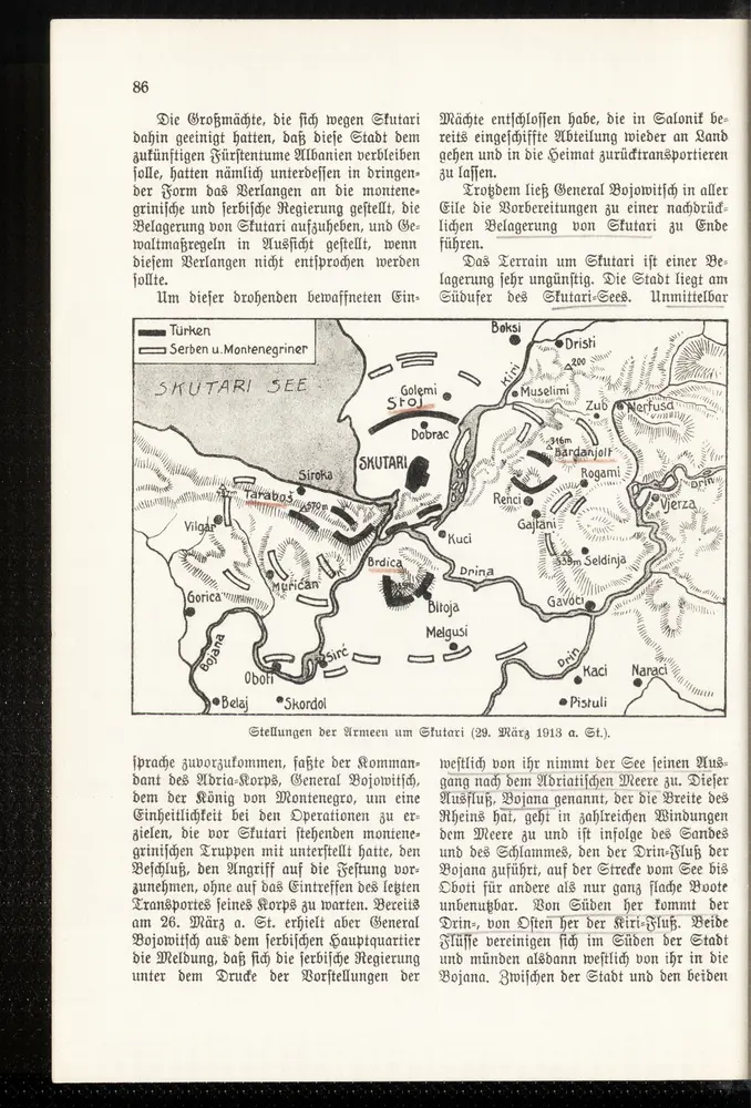
Stellungen der Armeen um Skutari (29. März 1913 a. St.)
1913
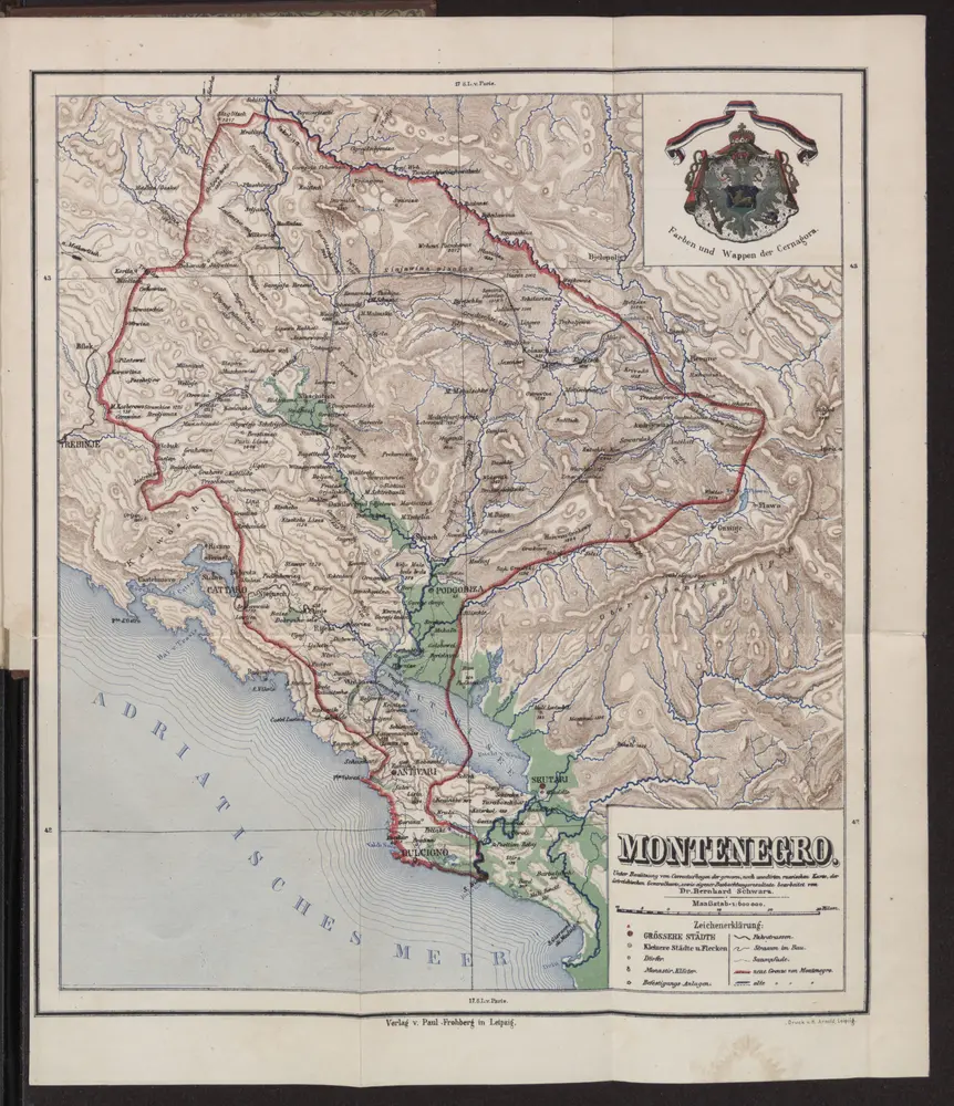
Montenegro
1888
1:600k
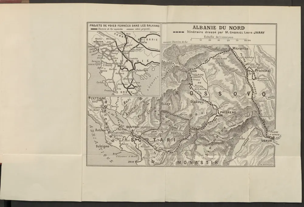
Albanie du nord
1913
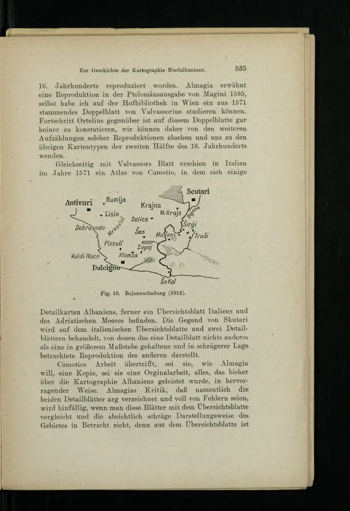
Bojanamündung
1916