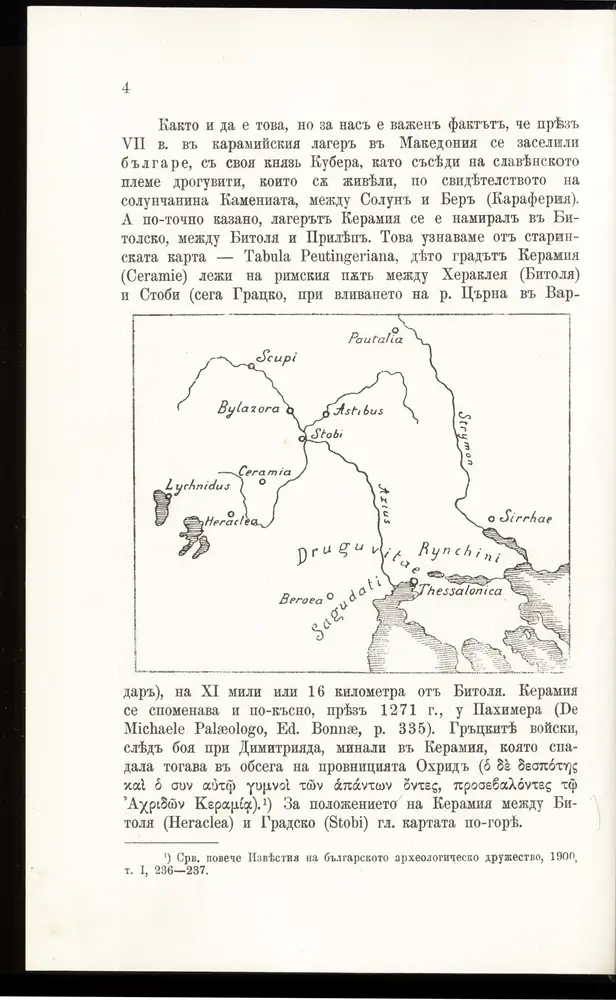
Mapa catalogado
Der von der IMRO geplante Mazedonische Staat

Título completo:Der von der IMRO geplante Mazedonische Staat
Año de ilustración:1973
Fecha de publicación:1973
Tamaño físico:20 x 30 cm
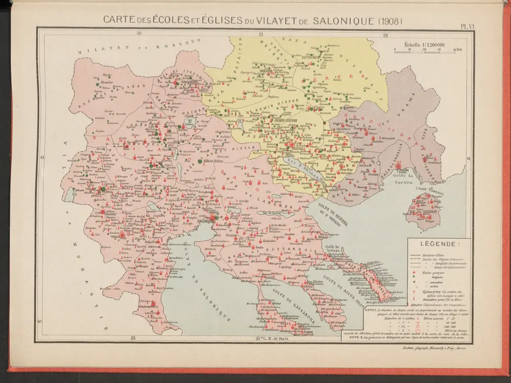
Carte des écoles et églises du vilayet de Salonique (1908)
1908
Kümmerly & Frey
Saloniki, Seres, Xanthi, Kastro, Pharsalos
1917
K. u. k. Militärgeographisches Institut
1:750k
[Romanien]
1790
[Trattner]
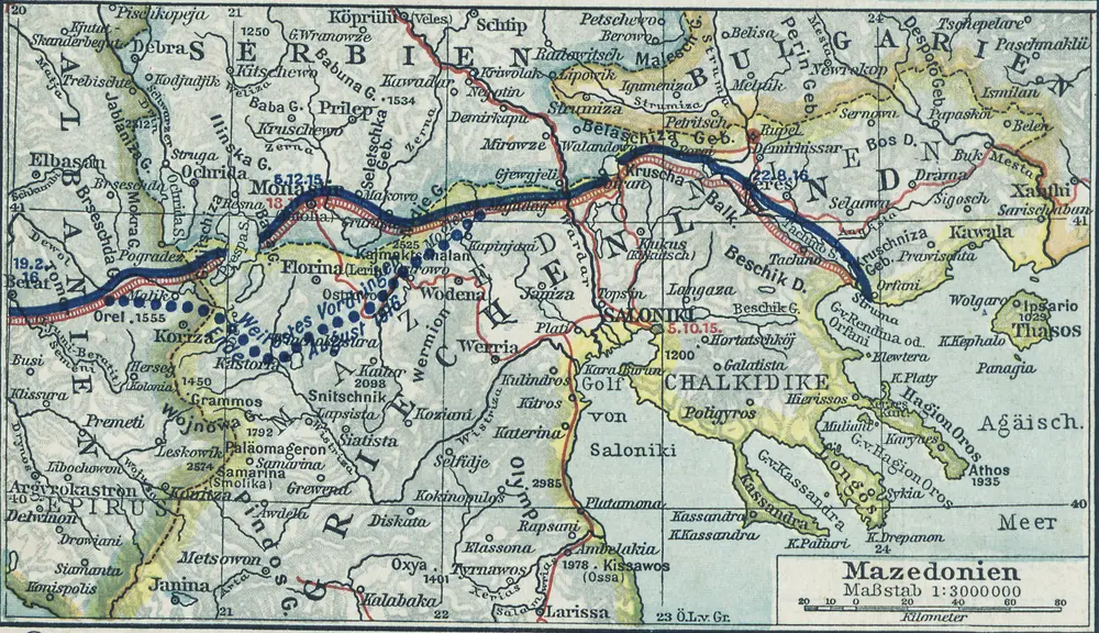
Mazedonien
1916
1:3m
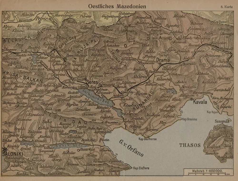
Oestliches Mazedonien
1916
1:600k
[Macedonien]
1790
[Trattner]
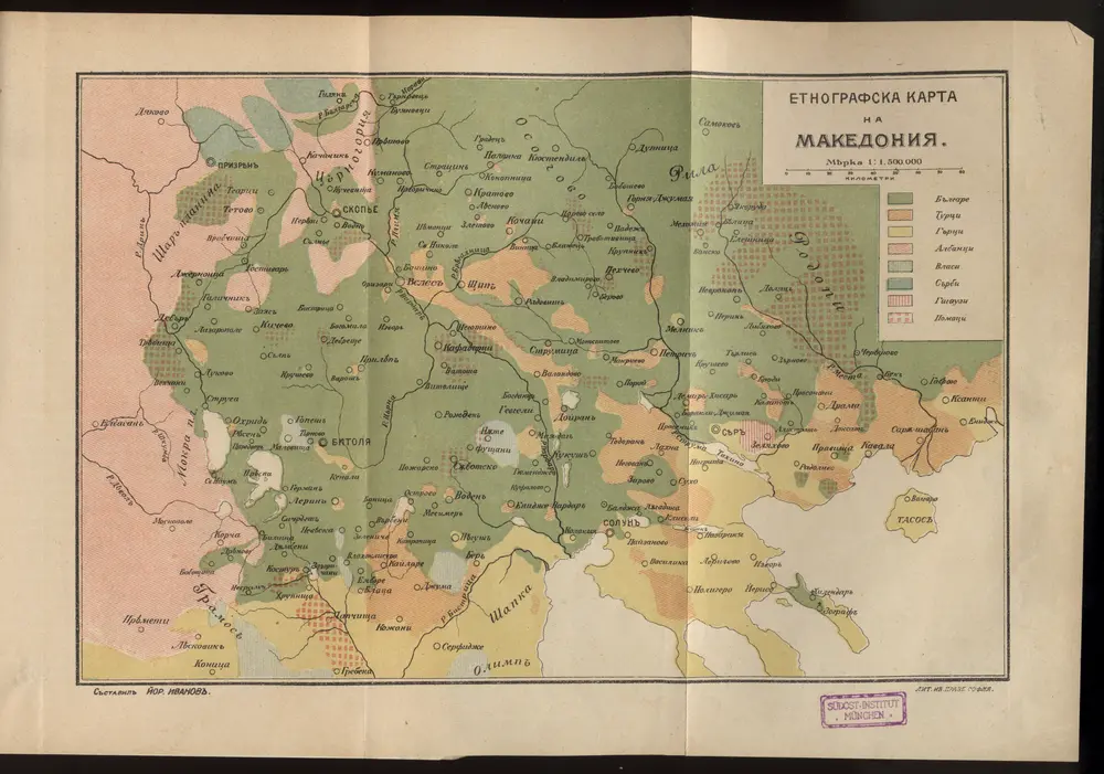
Etnografska karta na Makedonija
1915
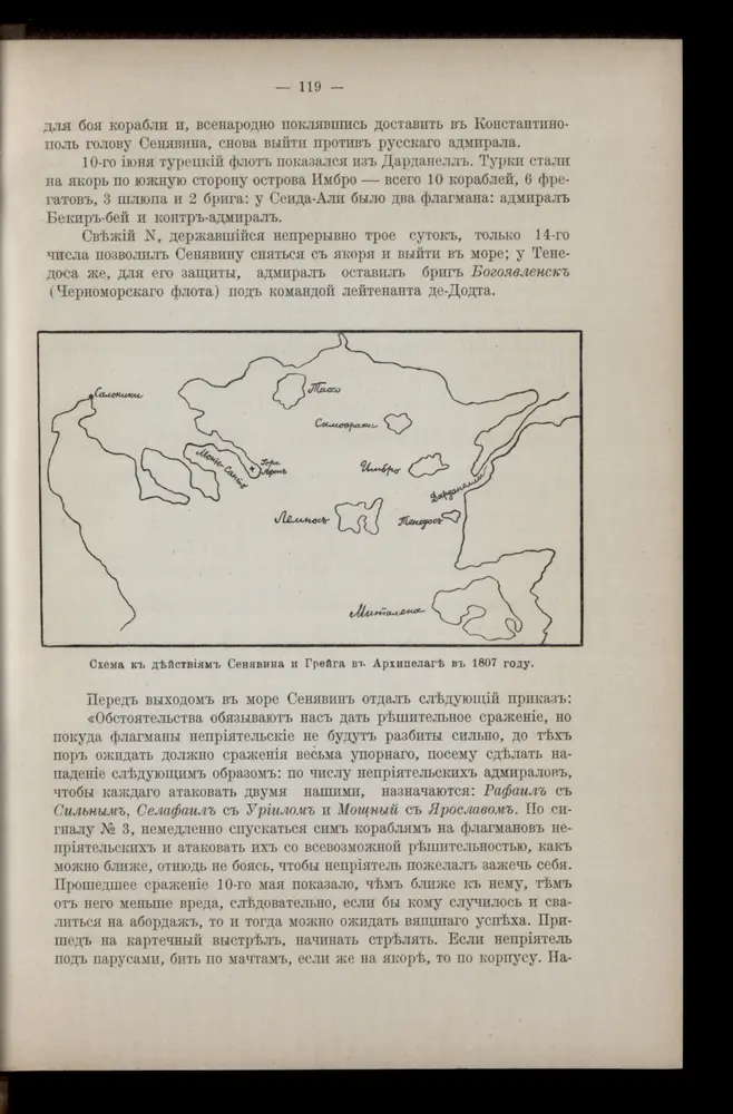
Schema k dějstvījam Senjavina i Grejga v Archipelagě v 1807 godu
1807
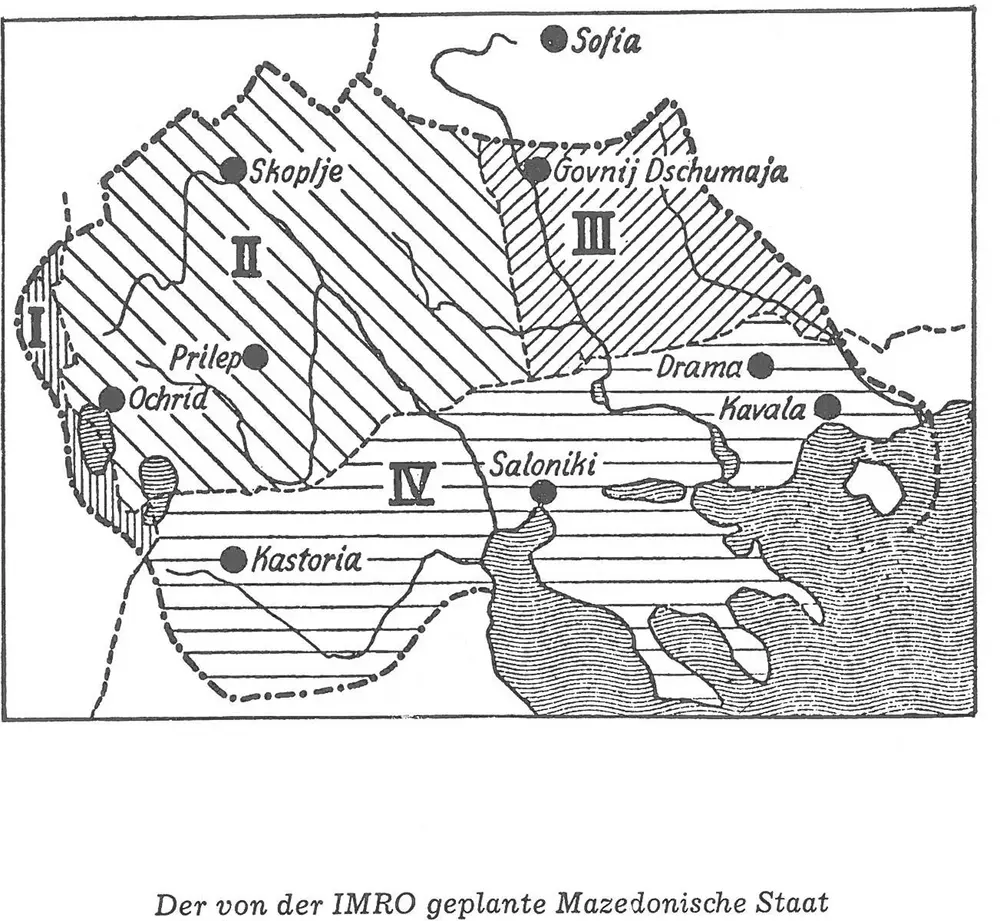
Der von der IMRO geplante Mazedonische Staat
1973
[Mazedonien]
1915