Maps of Romania

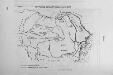
[Siebenbürgen : Oronyme]
Siebenbürgen Bergname, Geografischer Name
Harta Basarabiei
1 : 75000 Besarábie (Moldavsko a Ukrajina) Serviciul Geografic al armatei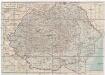
România
1 : 2500000 Rumunsko Kraft &Drotleff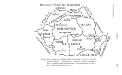
Historische Provinzen Rumäniens
Rumänien Verwaltungseinheit
Geologische-Übersichtskarte des Königreiches Rumänien
1 : 800000 Rumunsko Draghicenu, Mathei M. k. u. k. militär-geographisches Institut
93-94. Rumania. The World Atlas.
1 : 1250000 USSR (Union of Soviet Socialist Republics).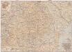
România
1 : 1000000 Brašov (Rumunsko : oblast) Teodorescu, C. Merutiu, Vasile
Carta Rumâniei în relief
1 : 2703000 Rumunsko Bolliac, Cesar Göbl-Rasidescu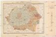
Harta solurilor României
1 : 1500000 Rumunsko Schön, R. Institutul geologic al României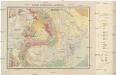
Harta geologică a României
1 : 1500000 Rumunsko Schön, R. Institutul geologic al României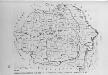
Verwaltungsgliederung 1918-1937
Rumänien Verwaltungsgliederung
Übersichtskarte von Rumänien
1 : 750000 Rakousko-Uhersko k. u. k. Hof- und Universitätsbuchhandlung R. Lechner (W. Müller)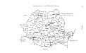
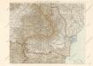
Administrativ-territoriale Gliederung Rumäniens
Rumänien Verwaltungsgliederung
Prehľadná automapa Rumunska
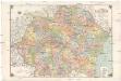
Harta României
1 : 1000000 Rumunsko Moldoveanu, M. D.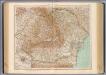
79-80. Romania.
1 : 1500000 Touring club italiano
Handkarte von Rumänien
1 : 1000000 Rumunsko Klammer, Karl G. Freytag & Berndt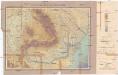
Harta orografică a României
1 : 1500000 Rumunsko Schön, R. Institutul geologic al României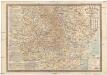
Romania
1 : 1000000 Rumunsko Georgescu, Traian Socec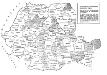
Die Auflösung der Autonomen Madjarischen Region
Rumänien ethnische Gruppe, Magyaren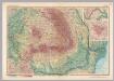
Romania. Pergamon World Atlas.
1 : 1500000 Polish Army Topography Service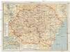
Turistická mapa Rumunska
Rumunsko Fáborský, Jan B. Nipočić, Vasilij Národní turistická kancelář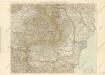
Rumänien
Karte von Rumanien
Territoriale Veränderungen nach 1920
Rumänien
Siedlungsgebiete der deutschen Minderheit in Rumänien
Rumänien Deutsche
Epoca Romana
Rumänien Römerzeit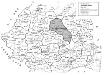
Die Autonome Madjarische Region
Rumänien, Szeklerland, ethnische Gruppe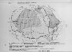
Rumänien 1859/61-1918/20
Rumänien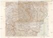
![[Siebenbürgen : Oronyme]](https://images-2.georeferencer.com/images/iiif/347092897217/full/,300/0/native.jpg)

