Maps of Czech Republic

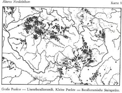
Älteres Neolithikum
Böhmen, Mähren, Archäologie
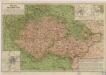
Karte vom Königreich Boehmen der Markgraschaft Maehren und des Herzogthumes Schlesien
1 : 980000 Česko Fried, Franz Artaria
Země Koruny české
země Koruny české Hercík, Emanuel Mikuláš & Knapp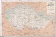
Železniční mapka zemí koruny české [sic]
země Koruny české F.B. Batovec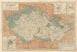
Železniční a národopisná mapka zemí koruny české

Äneolithikum
Böhmen, Mähren, Archäologie
Äneolithikum
Böhmen, Mähren, Archäologie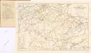
Železniční síť Čech, Moravy, Slezska a zemí sousedních

Jüngeres Neolithikum
Böhmen, Mähren, Archäologie
Bez titulu: Slepá mapa horstev Čech a Moravy

Erste Hälfte des 1. Jahrtausends n. Chr.
Böhmen, Mähren, Archäologie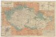
Železniční a národopisná mapka Zemí koruny české 1899
Brno-oblast (Česko) F.B. Batovec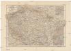
Böhmen, Mähren &. Schlesien, und der nördl. Theil von Ober- und Nieder Österreich
1 : 1000000 Dolní Rakousko (Rakousko) A. Hartleben's Verlag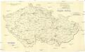
[Andere Metalle]
1 : 750000 Protektorát Čechy a Morava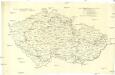
Administrative Gliederung der Sudetenländer 1930
1 : 750000 Protektorát Čechy a Morava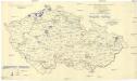
[Andere Metalle]
1 : 750000 Protektorát Čechy a Morava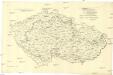
[Eisen- und Stahlindustrie]
1 : 750000 Protektorát Čechy a Morava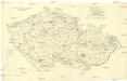
[Eisen- und Stahlindustrie]
1 : 750000 Protektorát Čechy a Morava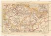
Cestovní mapa železniční pro země Koruny české
1 : 800000 Slovensko Loutocký, Josef J. Loutocký
Äneolithikum
Böhmen, Mähren, Archäologie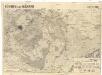
Böhmen und Mähren
1 : 750000 Česko
Mittlere Bronzezeit
Böhmen, Mähren, Archäologie
Ältere Latènezeit
Böhmen, Mähren, Archäologie
Železniční a národopisná mapka zemí koruny České a Rakouska-Uherska s vyznačením diecésáních hranic...

Hallstattzeit
Böhmen, Mähren, Archäologie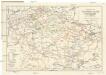
Železniční síť Čech, Moravy, Slezska a zemí sousedních
1 : 1000000 Česko Matějček, Josef Jos. Matějček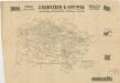
Übersichtskarte von Böhmen, Mähren und Schlesien

Železniční a národopisná mapa Zemí koruny České a Rakouska-Uherska s vyznačením hranic diecésáních [sic] a obvodů obchodních komor
Česko Schnizer, E. von Jungmann, Carl F.B. Batovec
Die Funde vor und nach 1000 n. Chr.
Böhmen, Mähren, Archäologie