Carte cataloguée
Die im Stadtbuch von Zipser Neudorf genannten Orte

Titre complet:Die im Stadtbuch von Zipser Neudorf genannten Orte
Année de l'image:1383 - 1637
Date de publication:1940
Taille physique:20 x 30 cm
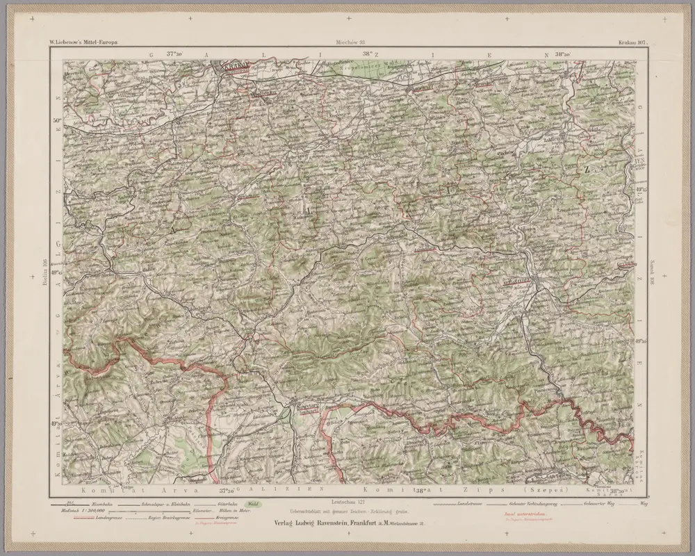
Krakau 107, uit: Special-Karte von Mittel-Europa / nach amtlichen Quellen bearbeitet von W. Liebenow
1899
Johannes Wilhelm Liebenow 1822-1897
1:300k
n/a
1800
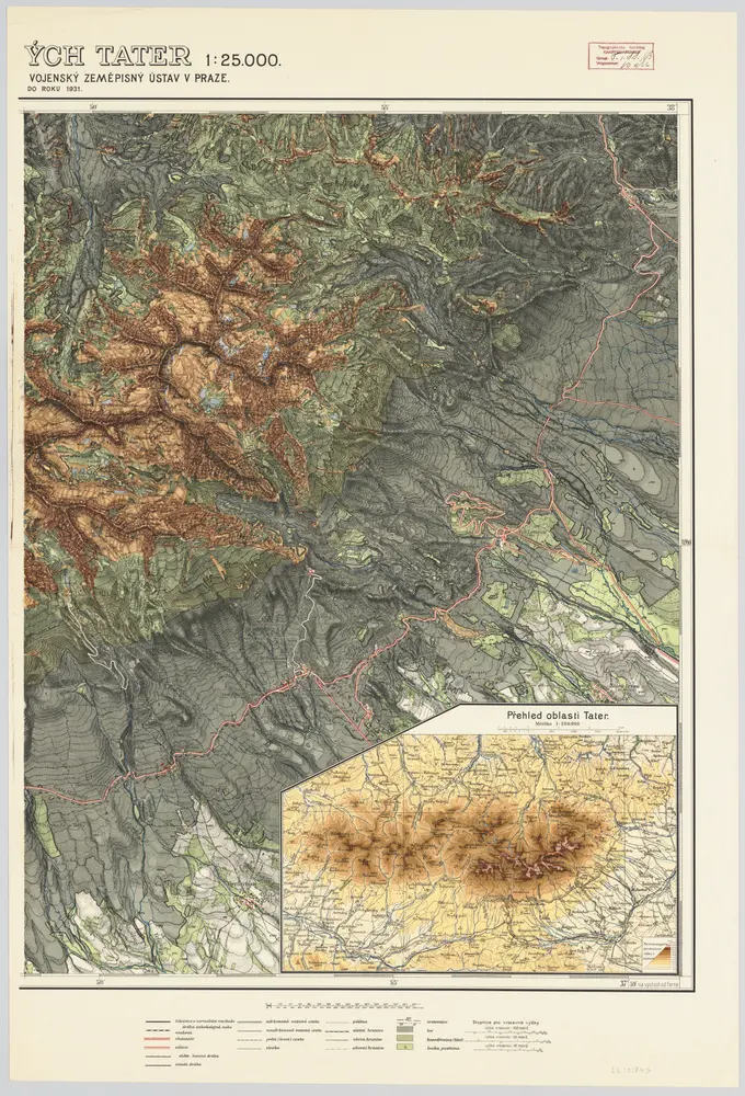
[Rechterblad], uit: Podrobná mapa Vysokých Tater
1931
[Praag : Vojenský Zeméepisný Ústav]
1:25k
n/a
1800
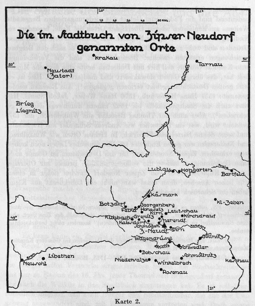
Die im Stadtbuch von Zipser Neudorf genannten Orte
1637
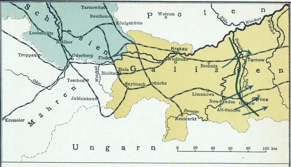
Nr. 13. Der Durchbruch bei Tarnow-Gorlice. (2. Mai 1915.)
1915
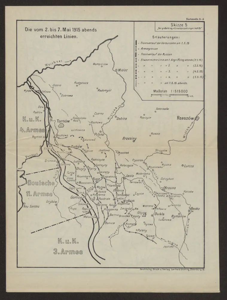
Die vom 2. bis 7. Mai 1915 abends erreichten Linien
1915
Verl. Gerhard Stalling, Oldenburg
1:515k
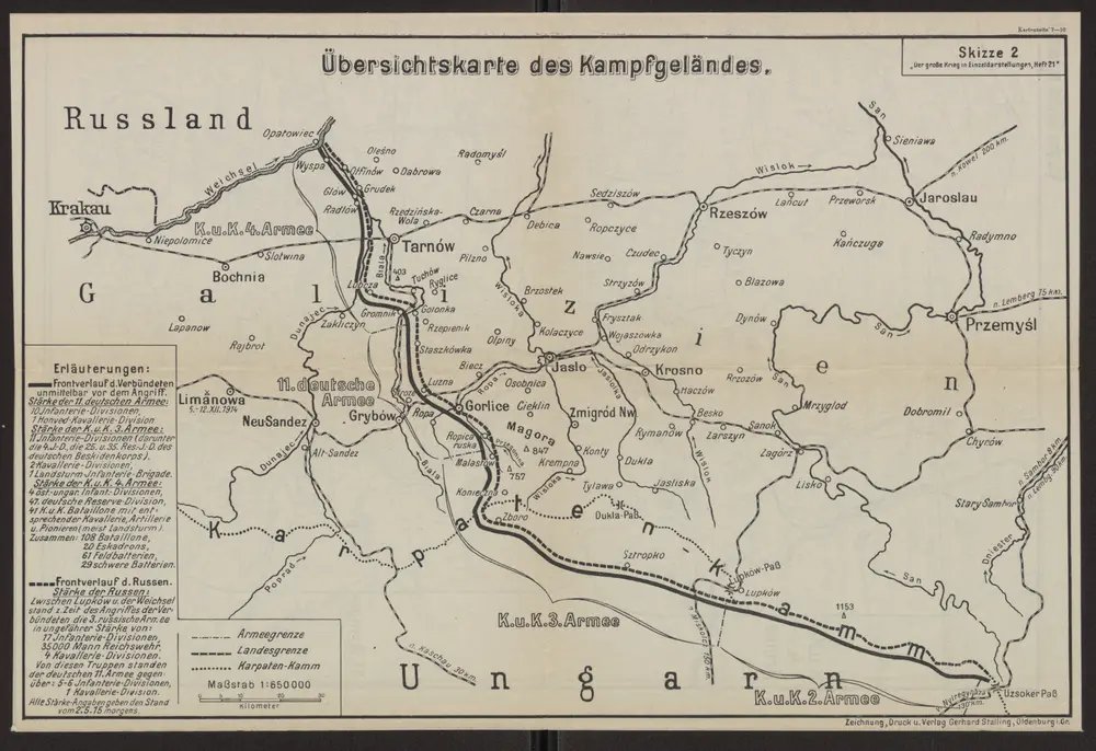
Übersichtskarte des Kampfgeländes
1915
Verl. Gerhard Stalling, Oldenburg
1:650k
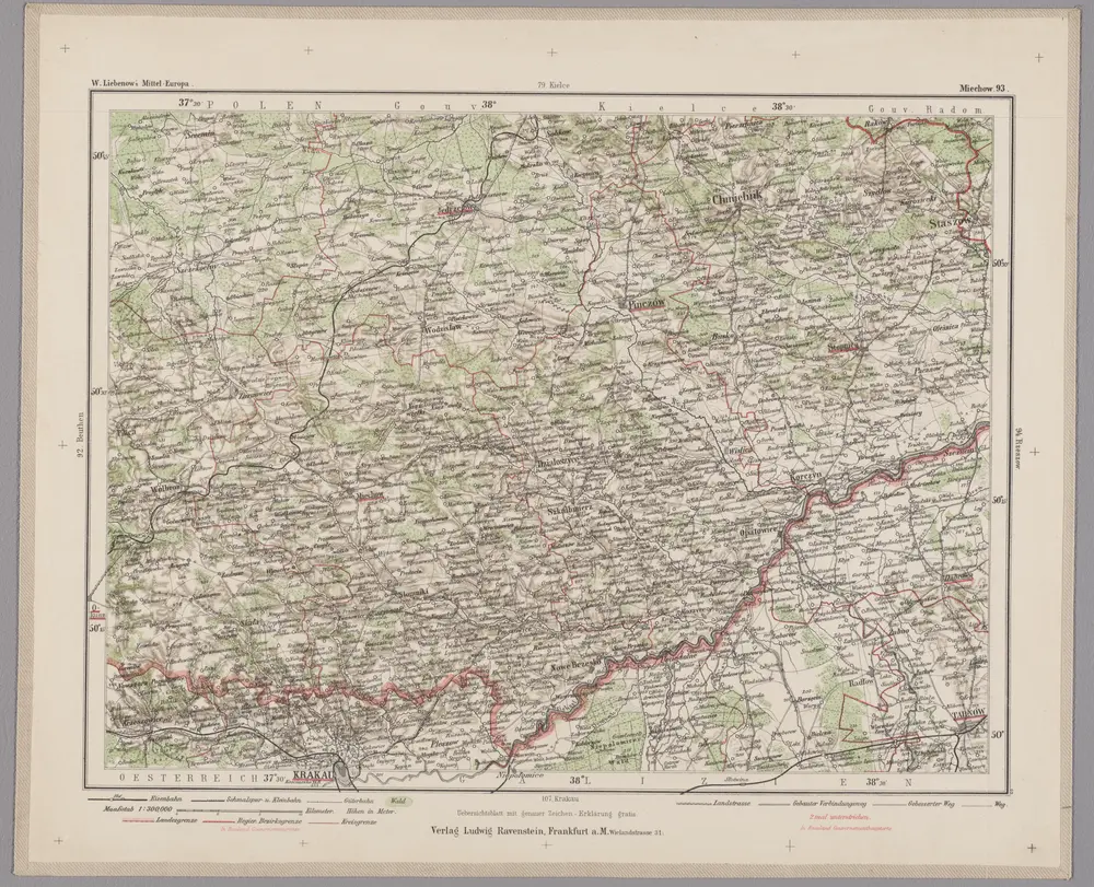
Miechow 93, uit: Special-Karte von Mittel-Europa / nach amtlichen Quellen bearbeitet von W. Liebenow
1899
Johannes Wilhelm Liebenow 1822-1897
1:300k
Carte de la Roumanie et pays limitrophes. Cracovie
1911
France. Service géographique de l'armée
1:500k