编目地图
Kirchen, Klöster und Burgen in spätromanischer Zeit (nach V. Mancl)

完整标题:Kirchen, Klöster und Burgen in spätromanischer Zeit (nach V. Mancl)
描述:1150 - 1250
发布日期:1940
物理尺寸:20 x 30 cm
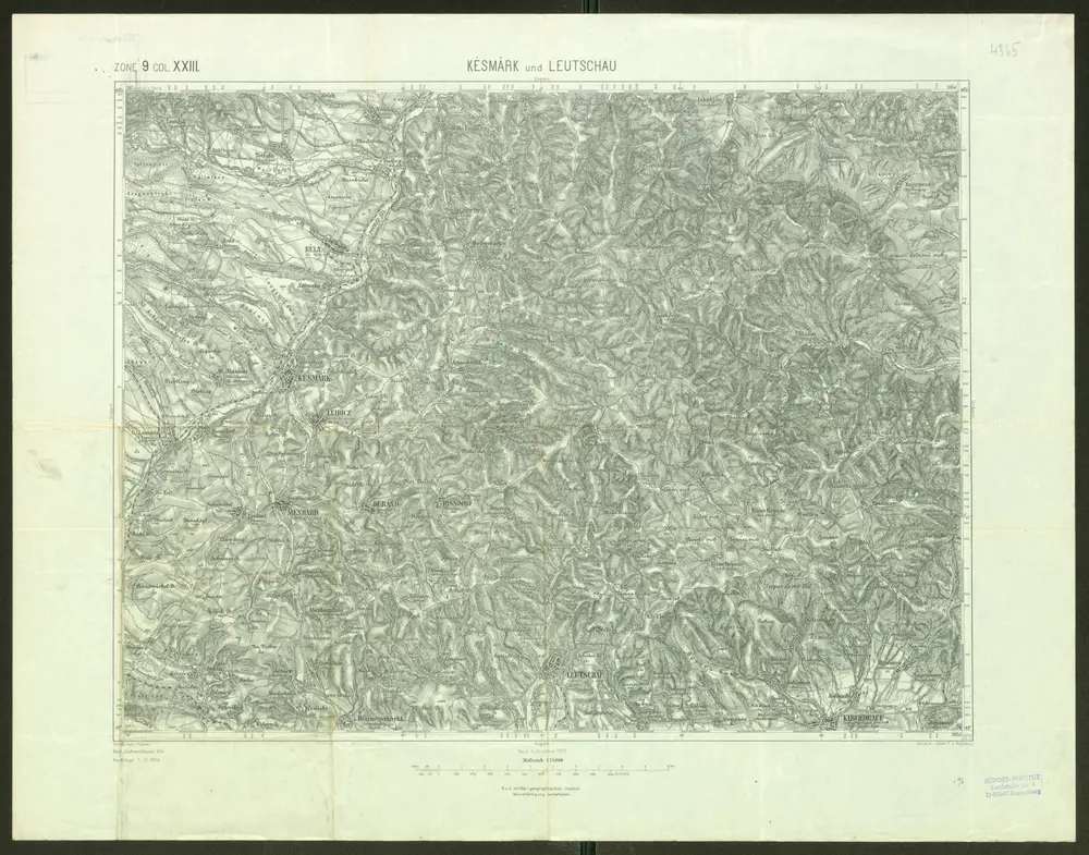
Késmárk und Leutschau
1899
Geripp: Fwkr. Hübner. Terrain: Hptm. E. v. Bogdanyi
1:75k
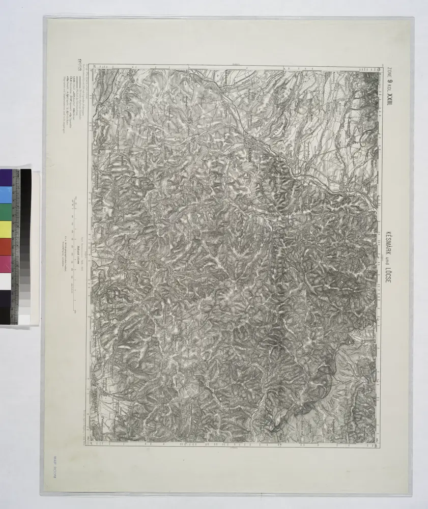
Kesmark und Locse.; Spezialkarte der osterreichisch-ungarischen Monarchie.
1912
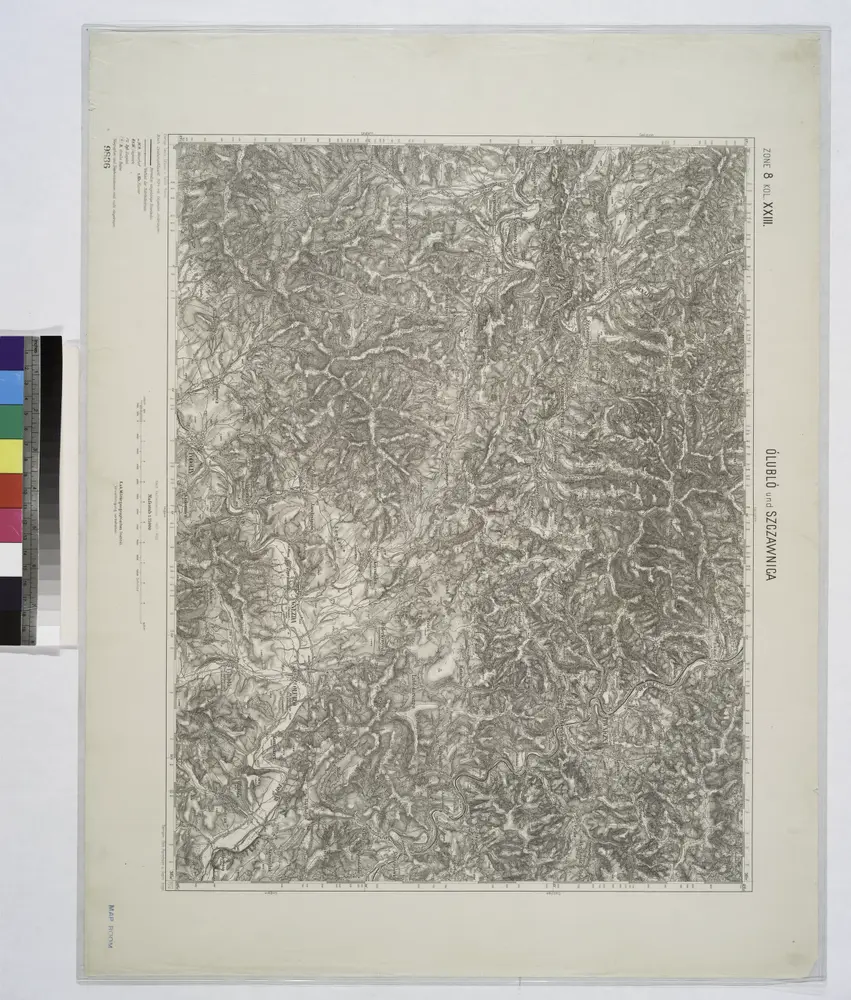
Olublo und Szczawnica.
1914
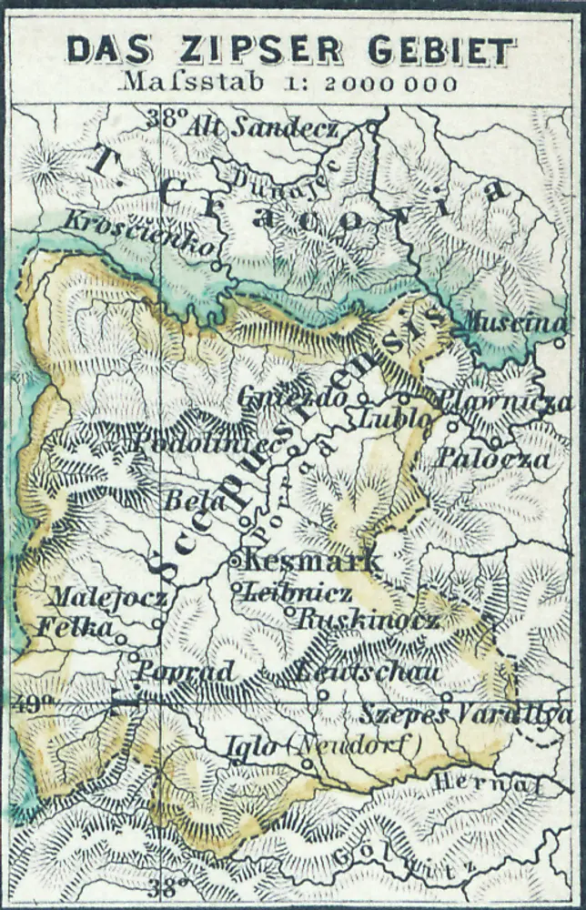
Das Zipser Gebiet
1880
1:2m
Geologische Spezialkarte der im Reichsrate vertretenen Königreiche und Länder der Österreichisch-Ungarischen Monarchie
1912
Uhlig, Victor
1:75k
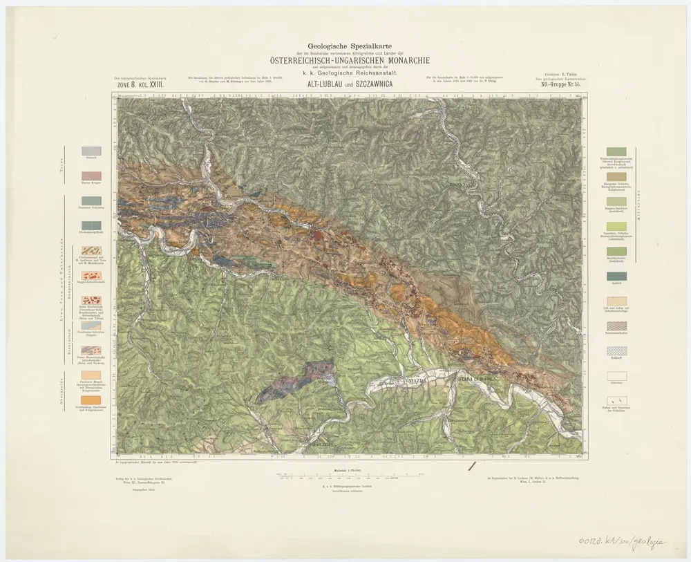
Zone 8, Kol. XXIII, Alt-Lublau und Szgzawnica, uit: Geologische Karte der im Reichsrathe vertretenen Königreiche und Länder der Österreich-Ungarischen Monarchie : auf Grundlage der Specialkarte i.M. 1:75.000 des k.u.k. Militär-geographischen Institutes / neu bearb. und als Kartenwerk von 341 Blattnummern in zwanglosen Lfg. hrsg. durch die k.k. Geologische Reichsanstalt in Wien
1898
Kaiserlich-Königliche Geologische Reichsanstalt, Wenen
1:75k
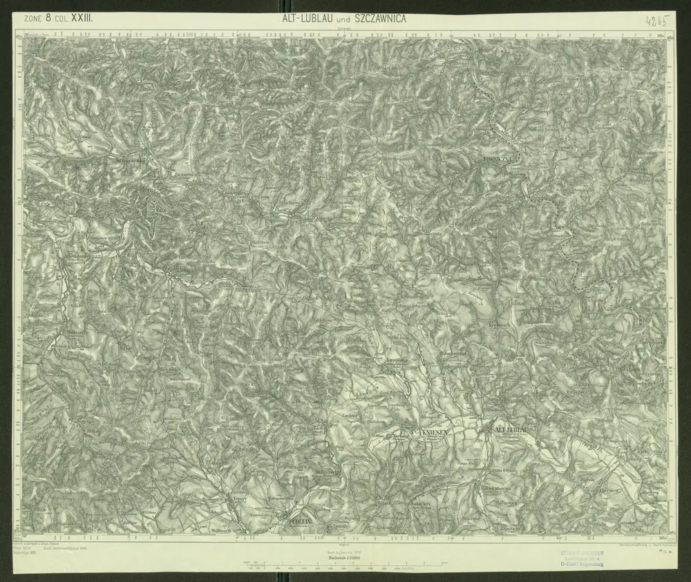
Alt-Lublau und Szczawnica
1895
Schrift und Gerippe v. Lieut. Otawa. Terrainschraffirung v. Oberlt. Heimbach
1:75k
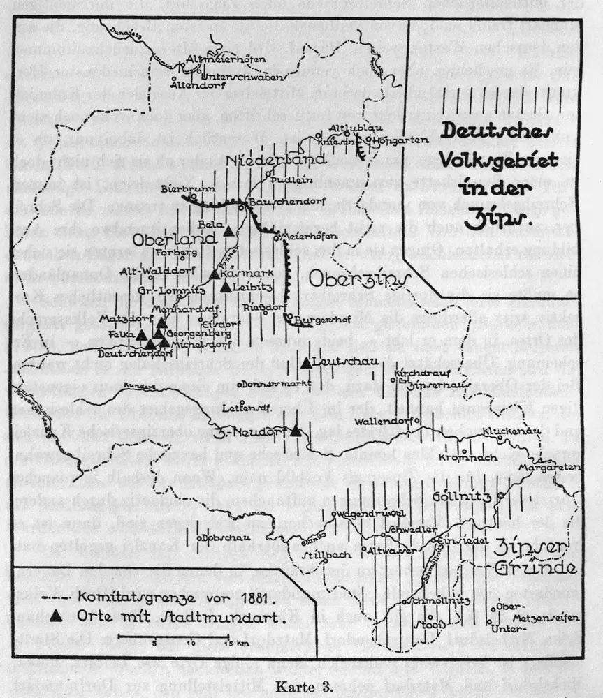
Deutsches Volksgebiet in der Zips
1637
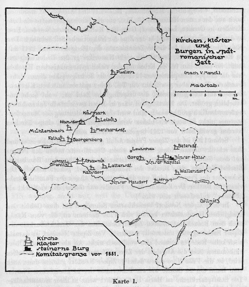
Kirchen, Klöster und Burgen in spätromanischer Zeit (nach V. Mancl)
1250
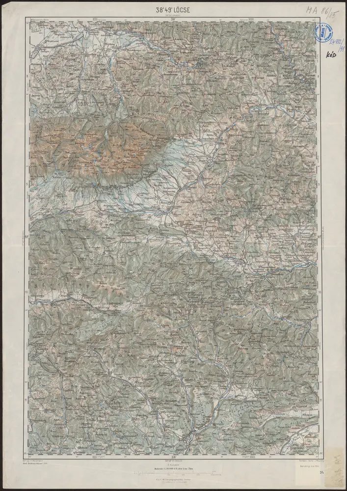
38°49° Löcse / K.u.k. Militärgeographisches Institut
1914
K.u.k. Militärgeographisches Institut