Maps of Dubrovacko-Neretvanska

Maps of Dubrovacko-Neretvanska

$title$

Pianura dei Canali nel Circolo di Ragusa

Dubrovnik, Umland, Kanal
$title$

[Umgebung von Molunat ; Politische Einteilung]

Kroatien Dalmatien Dalmatien Umland
$title$

Ragusa.

from Spezialkarte der osterreichisch-ungarischen Monarchie.
$title$

Übersichtsblatt zum Kriegsspielplan der Umgebung von Cattaro

1 : 12500 Kotor (Černá Hora) K. u. k. militär-geographisches Institut
$title$

Trebinje und Risano.

from Spezialkarte der osterreichisch-ungarischen Monarchie.
$title$

[Umgebung von Dubrovnik]

Kroatien Dalmatien Ragusa (Dalmatien) Umland
$title$

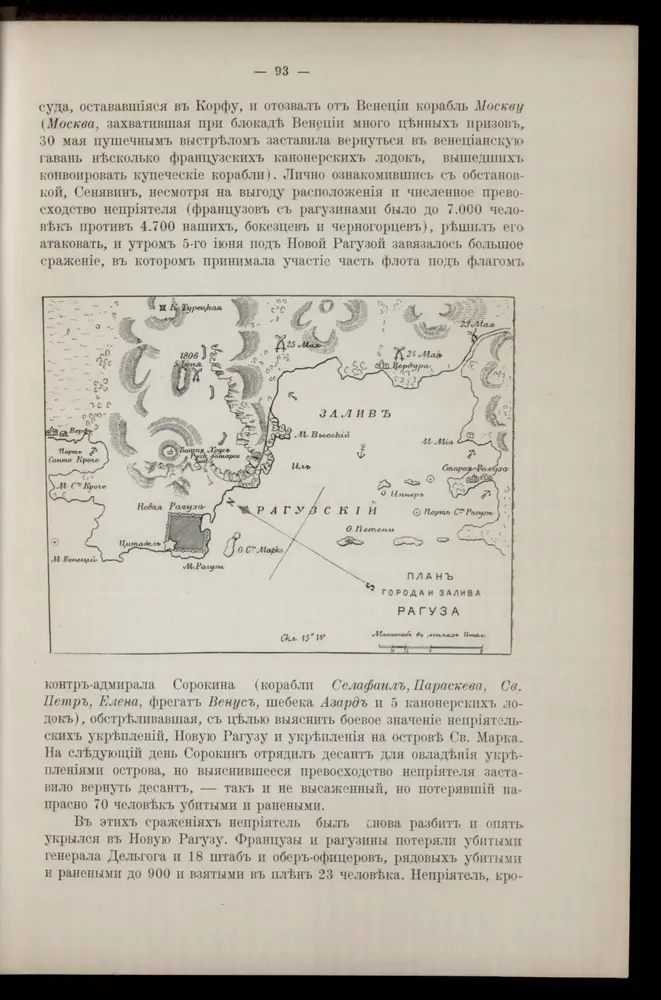
Plan goroda i zaliva Raguza

Kroatien Dubrovnik Seeschlacht
$title$

Dubrovnik - Kotor

1 : 200000 Dubrovník (Chorvatsko : oblast) Kartografska radionica
$title$

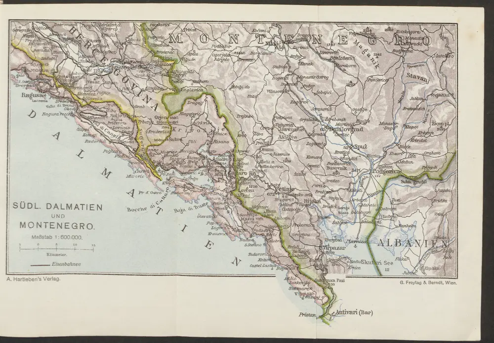
Südl. Dalmatien und Montenegro

1 : 600000 Kroatien Montenegro Dalmatien
$title$

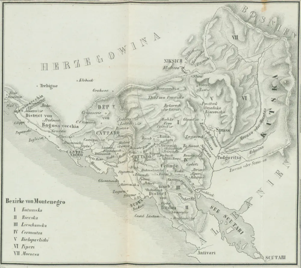
Bezirke von Montengro

Kroatien, Montenegro
$title$

Generalkarte von Bosnien und Herzegovina

$title$

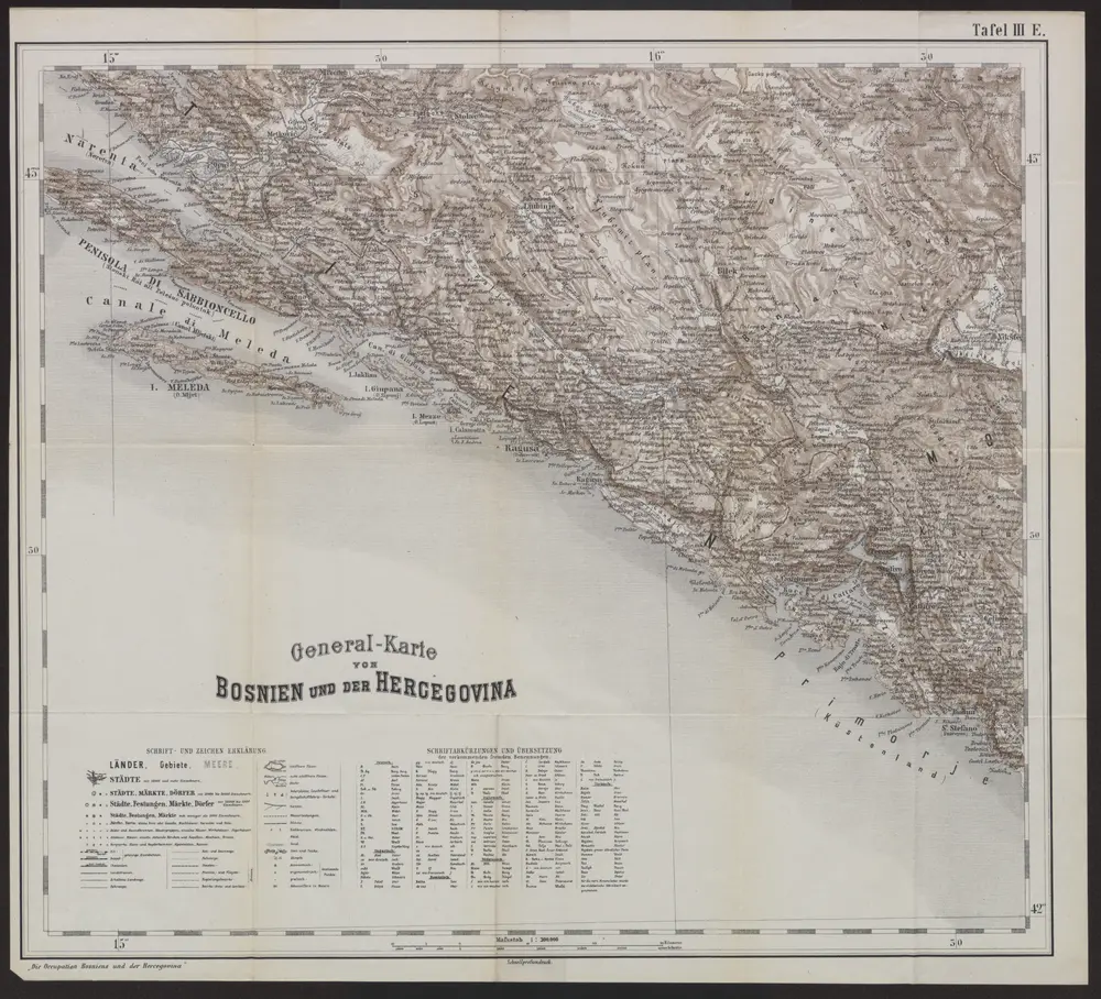
Generalkarte von Bosnien und der Hercegovina

1 : 300000 Bosnien-Herzegowina Montenegro
$title$

Oestlicher Theil von Dalmatien

1 : 445000 Chorvatsko Santini, P. Engelman, J. W. F. A. Schraembl
$title$

Oestlicher Theil von Dalmatien

1 : 450000 Chorvatsko Santini, P. Engelman, J. W. F. A. Schraembl
$title$

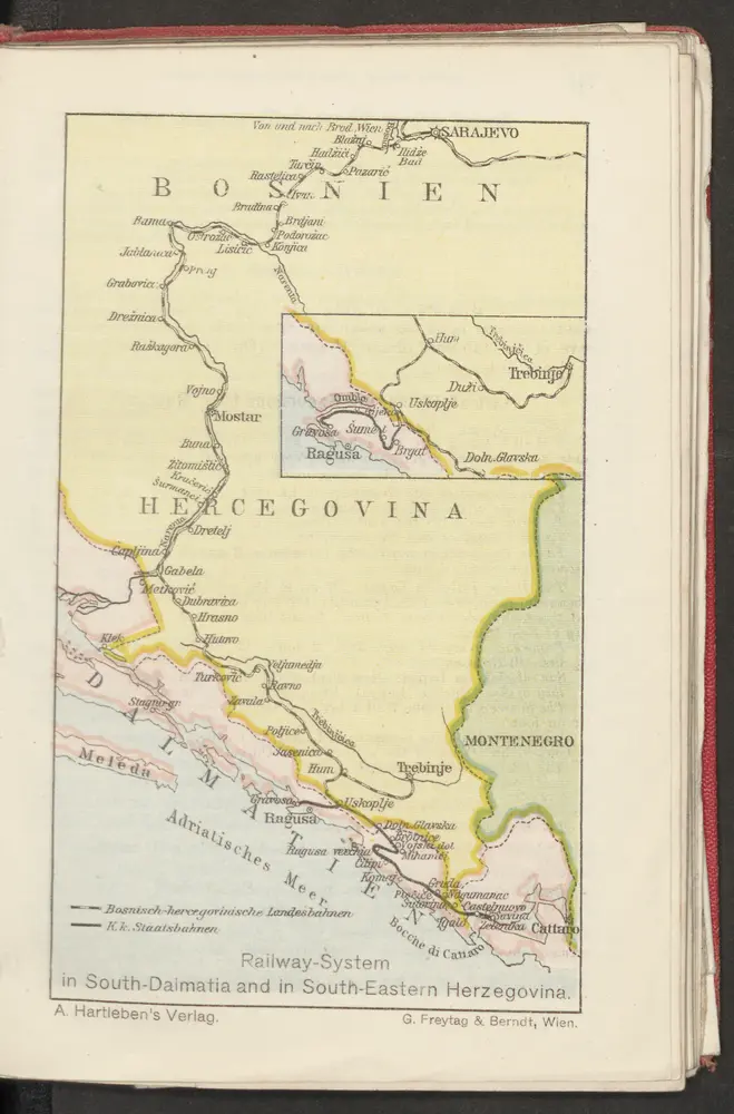
Railway-System in South-Dalmatia and in South-Eastern Herzegovina

Kroatien Dalmatien Herzegowina Bosnien Eisenbahnnetz
$title$

Carte de la partie d'Albanie occupé par le Bacha de Scutari. le District des Montenegrins, et partie des territoires des Rep. de Venise, et de Raguse

1 : 490000 Albánie
$title$

Carte de la partie d'Albanie occupée par le Bacha de Scutari, le district des Montenegrins, et partie des territoires des Rep. de Venise, et de Raguse

1 : 490000 Albánie
$title$

Generalkarte von Zentraleuropa

$title$

Adriatisches Meer, Küsten-Karte

1 : 180000 Jaderské moře (oblast) Oesterreicher, Tobias von Hydrographisches Amt der k. u. k. Kriegs-Marine
$title$

Karta Crnegore

1 : 285000 Albánie Karacsay, Fedor de
$title$

Karta Crnegore

1 : 285000 Albánie Karacsay, Fedor de
$title$

Karta Crnegore

1 : 285000 Albánie Karacsay, Fedor de
$title$

Karta Crnegore

1 : 285000 Albánie Karacsay, Fedor de
$title$

Hercegovina

1 : 400000 Hercegovina Daneš, Jiří Viktor Královská česká společnost nauk
$title$

Mappa swobodné obce Černohorské

Černá Hora Šafárik, Jan
$title$

[Černá hora]

Černá Hora Milutinović Sarajlija, Sima
$title$

Die adriatische Küste von Spalato bis Cattaro

1 : 900000 Kroatien Adriaküste
$title$

Karte des Operations-Gebietes in Süd-Dalmatien (Crivoscie-Bocche di Cattaro) und der Herzegovina, nebst dem angrenzenden Fürstenthum Montenegro

1 : 325000 Dalmácie (Chorvatsko) A. Hartleben's Verlag
$title$

Carta di Montenegro (Crna gora)

1 : 300000 Montenegro Paulini, Giacomo
$title$

Süd-Dalmatien

Dalmatien
© MapTiler © OpenStreetMap contributors
How does it work?
These instructions will show you how to find historical maps online.
Getting started
Type the place name in the search box to find the exact location. You can further adjust the search by zooming in and out.
Zoom
Zoom in and out with the buttons or use your mouse or touchpad natively.
Exact Area tool
Click here and draw a rectangle over the map to precisely define the search area.
Set filters
Narrow your search with advanced settings, such as Years (from/to), Fulltext, Publisher, etc.
Results
See the results of your search on the right side. You can scroll down to find more maps of this location.
?

Download OldMapsOnline Mobile