Maps of Sfintu-Gheorghe

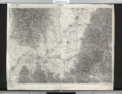
Kovászna
1 : 75000 Covasna
Kovaszna.; Spezialkarte der osterreichisch-ungarischen Monarchie.
from Spezialkarte der osterreichisch-ungarischen Monarchie. Austro-Hungarian Monarchy. Militärgeographisches Institut.,
Lambert-Cholesky sheet 4260 (Cernatul de Jos)
1 : 20000 Romanian military topographic map sheet under Lambert-Cholensky projection Serviciul Geografic al Armatei geo-spatial.org Serviciul Geografic al Armatei
Lambert-Cholesky sheet 4160 (Bodok)
1 : 20000 Romanian military topographic map sheet under Lambert-Cholensky projection Serviciul Geografic al Armatei geo-spatial.org Serviciul Geografic al Armatei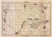
Lambert-Cholesky sheet 4159 (Sîntion Lunca)
1 : 20000 Romanian military topographic map sheet under Lambert-Cholensky projection Direcția Topografică Militară geo-spatial.org Direcția Topografică Militară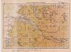
Lambert-Cholesky sheet 4360 (Ghelinţa)
1 : 20000 Romanian military topographic map sheet under Lambert-Cholensky projection Serviciul Geografic al Armatei geo-spatial.org Serviciul Geografic al Armatei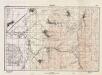
Lambert-Cholesky sheet 4158 (Bicfalău)
1 : 20000 Romanian military topographic map sheet under Lambert-Cholensky projection Direcția Topografică Militară geo-spatial.org Direcția Topografică Militară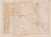
Lambert-Cholesky sheet 4261 (Kezdi-Osorhei)
1 : 20000 Romanian military topographic map sheet under Lambert-Cholensky projection Serviciul Geografic al Armatei geo-spatial.org Serviciul Geografic al Armatei
Kezdi-Vasarhely.
from Spezialkarte der osterreichisch-ungarischen Monarchie.
Magyarbodza.
from Spezialkarte der osterreichisch-ungarischen Monarchie.
Putna-Patak.
from Spezialkarte der osterreichisch-ungarischen Monarchie.
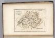
Carte des glücklichen Treffens am Bozaner Pass unter Com.do des F.M.L. Fürsten Hohenlohe den 3ten
1 Karte : Kupferdruck ; 12 x 17 cm [Trattner]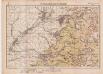
Lambert-Cholesky sheet 4361 (Breţcu)
1 : 20000 Romanian military topographic map sheet under Lambert-Cholensky projection Serviciul Geografic al Armatei geo-spatial.org Serviciul Geografic al Armatei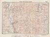
Lambert-Cholesky sheet 4161 (Malnaş)
1 : 20000 Romanian military topographic map sheet under Lambert-Cholensky projection Direcția Topografică Militară geo-spatial.org Direcția Topografică Militară
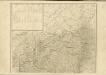
Gebiet um Kronstadt
1 : 600000 Braşov, Kronstadt (Siebenbürgen, Region)
Generalkarte von Zentraleuropa

[Střední Rumunsko]
1 : 420600 Rumunsko Schraembl, Franz Anton F.A. Schraembl
Siebenbürgen
Sedmihradsko (Rumunsko) Kunst- und Industrie Comptoir
Carte de la Roumanie et pays limitrophes. Klausenbourg
1 : 500000 France. Service géographique de l'armée [Paris] : Service géographique de l'armée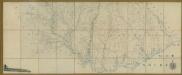
Carte de la Moldavie
1 : 330000 Moldawien, Bessarabien
Generalkarte Von Siebenbürgen. Nach geometrisch gemessenen Karten und andern zuverlaessigen Hilfsmitteln verjüngt, und graduirt von Herrn A. von Wenzely. Herausgegeben von Herrn F. A. Schraembl
1 : 430000 Siebenbürgen Produkt, Straßennetz Wenzely, Anton; Schraembl, Franz Anton
Sheet XV: Karte Des Oesterreichischen Kaiserstaates.
1 : 576000 Scheda, Josef
Übersichtskarte von Mittel - Europa
Switzerland.
1 : 1500000 Carey, Mathew
Switzerland.
1 : 1450000 Carey, Mathew
Switzerland.
1 : 1500000 Carey, Mathew
Switzerland.
1 : 500000 Carey, Mathew
Switzerland.
1 : 500000 Carey, Mathew