Maps of Alba Lulia

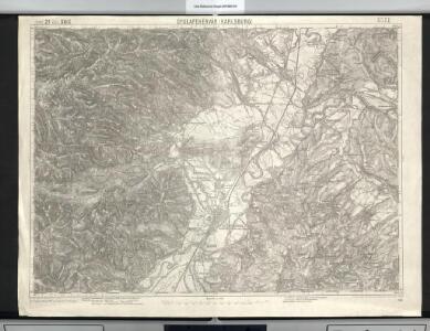
Gyulafehérvár
1 : 75000 Karlsburg
Lambert-Cholesky sheet 2962 (Alba Iulia(de nord))
1 : 20000 Romanian military topographic map sheet under Lambert-Cholensky projection Direcția Topografică Militară geo-spatial.org Direcția Topografică Militară
Lambert-Cholesky sheet 2963 (Cetea)
1 : 20000 Romanian military topographic map sheet under Lambert-Cholensky projection Direcția Topografică Militară geo-spatial.org Direcția Topografică Militară
Lambert-Cholesky sheet 3062 (Henig)
1 : 20000 Romanian military topographic map sheet under Lambert-Cholensky projection Direcția Topografică Militară geo-spatial.org Direcția Topografică Militară
Lambert-Cholesky sheet 2961 (Alba Iulia(de sud))
1 : 20000 Romanian military topographic map sheet under Lambert-Cholensky projection Serviciul Geografic al Armatei geo-spatial.org Serviciul Geografic al Armatei
Lambert-Cholesky sheet 3063 (Teiuş)
1 : 20000 Romanian military topographic map sheet under Lambert-Cholensky projection Direcția Topografică Militară geo-spatial.org Direcția Topografică Militară
Lambert-Cholesky sheet 3061 (Ghirbom)
1 : 20000 Romanian military topographic map sheet under Lambert-Cholensky projection Direcția Topografică Militară geo-spatial.org Direcția Topografică Militară
Lambert-Cholesky sheet 2862 (Meteş)
1 : 20000 Romanian military topographic map sheet under Lambert-Cholensky projection Direcția Topografică Militară geo-spatial.org Direcția Topografică Militară
Lambert-Cholesky sheet 2863 (Întregalde)
1 : 20000 Romanian military topographic map sheet under Lambert-Cholensky projection Direcția Topografică Militară geo-spatial.org Direcția Topografică Militară
Lambert-Cholesky sheet 2861 (Inuri)
1 : 20000 Romanian military topographic map sheet under Lambert-Cholensky projection Serviciul Geografic al Armatei geo-spatial.org Serviciul Geografic al Armatei
Gyulafeherva [Karlsburg].
from Spezialkarte der osterreichisch-ungarischen Monarchie.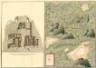
Plan des Bergwergs Szirbund
Mollova mapová sbírka Geyer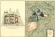
Plan des Bergwergs Rapold
Mollova mapová sbírka Geyer
Nagy-Enyed.
from Spezialkarte der osterreichisch-ungarischen Monarchie.
Szasz-Sebes [Muhlbach].
from Spezialkarte der osterreichisch-ungarischen Monarchie.
Zalatna.
from Spezialkarte der osterreichisch-ungarischen Monarchie.
Transilvania
Mollova mapová sbírka Hoffmann, Johannes Hoffmann, Johann
Vermehrte und Verbesserte Landkarten des Königreichs Ungarn :
1 : 500000 Mollova mapová sbírka Stier, Martin Böner, Johann-Alexander Endter, Martin
Plan von Bergwerg Laposneck
Mollova mapová sbírka Geyer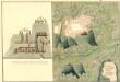
Plan des Bergwergs Weres Patack
Mollova mapová sbírka Geyer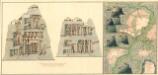
Plan dern Bergwerg bei Carlburg und Vardia
Mollova mapová sbírka Geyer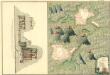
Plan von Bergwerg Pestian und Ivota
Mollova mapová sbírka Geyer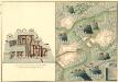
Plan der Bergwerg, Flod, Gilamare und Giogy
Mollova mapová sbírka Geyer
Siebenbürgen
Sedmihradsko (Rumunsko) Kunst- und Industrie Comptoir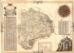
Mapa Particvlaris Transilvaniae
Mollova mapová sbírka Geyer
Transylvaniae Principatus
1 : 720000 Mollova mapová sbírka Seutter, Matthäus Seutter, Matthäus
Nova Transilvaniae Principatus Tabula. Novissima descriptia editia
1 : 730000 Mollova mapová sbírka Ottens, Reinier Ottens, Josua
Principatus Transilvaniae
1 : 720000 Mollova mapová sbírka Homann, Johann Baptist Homann, Johann Baptista
Carte de la Roumanie et pays limitrophes. Klausenbourg
1 : 500000 France. Service géographique de l'armée [Paris] : Service géographique de l'armée