Mappa catalogata
Nagykanizsa
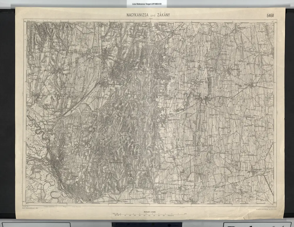

Titolo completo:Nagykanizsa
Dimensione fisica:20 x 30 cm
Scala della mappa:1:75 000
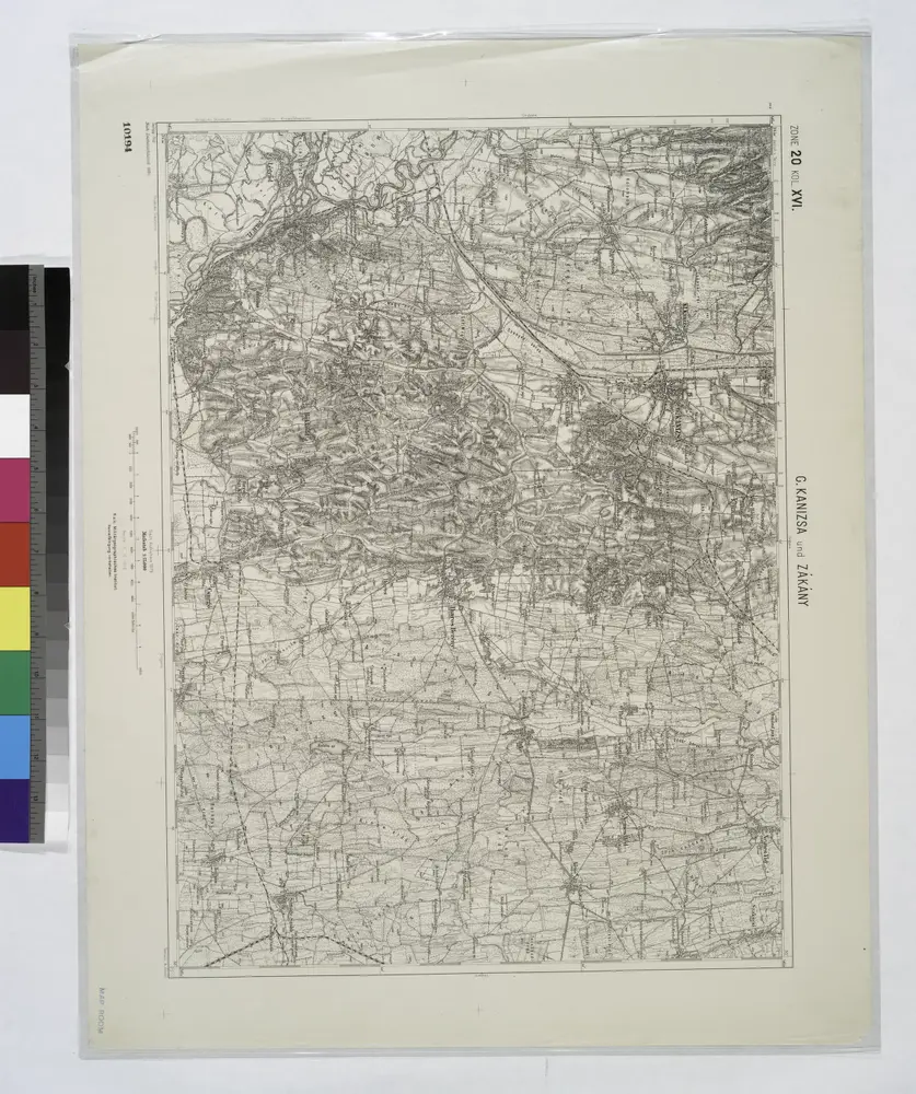
G. Kanizsa und Zakany.
1914
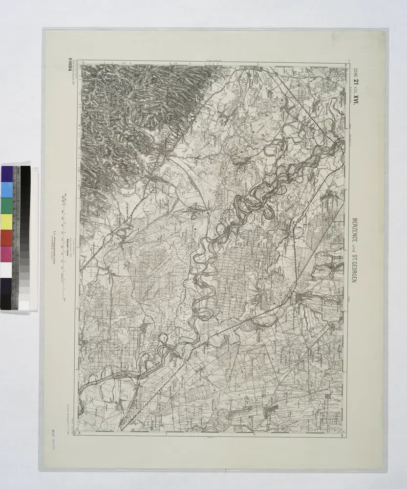
Berzence und St. Georgen.; Spezialkarte der osterreichisch-ungarischen Monarchie.
1910
Comitat Somogy
1870
1:300k
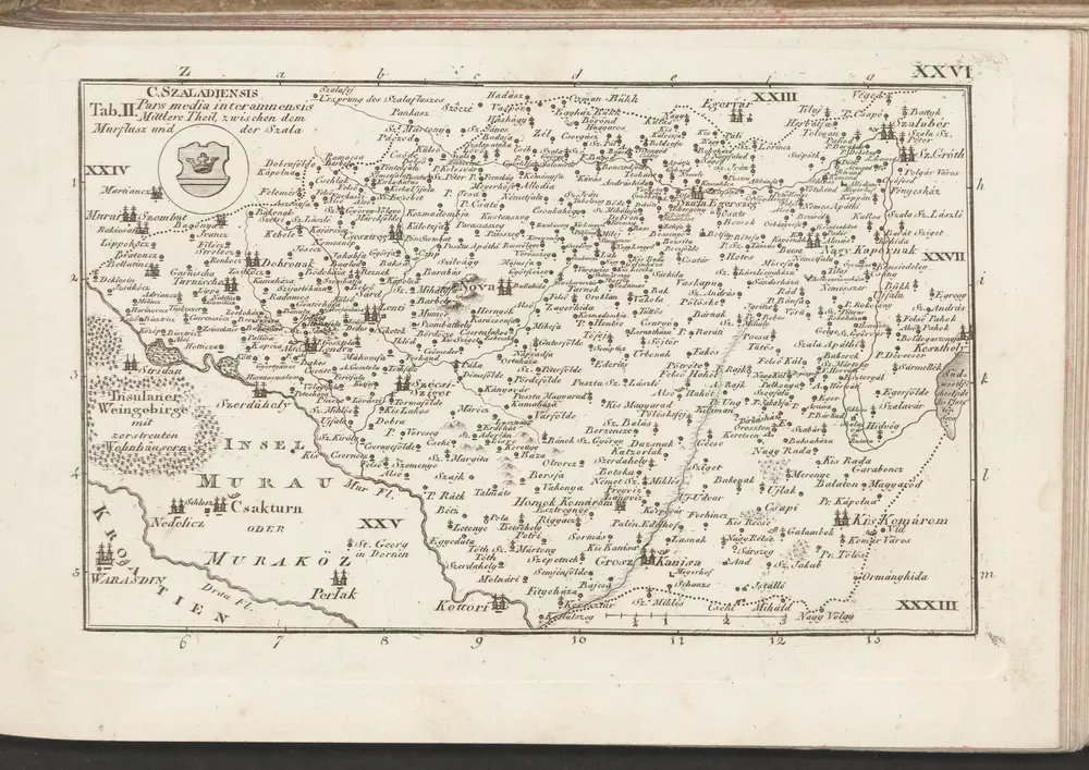
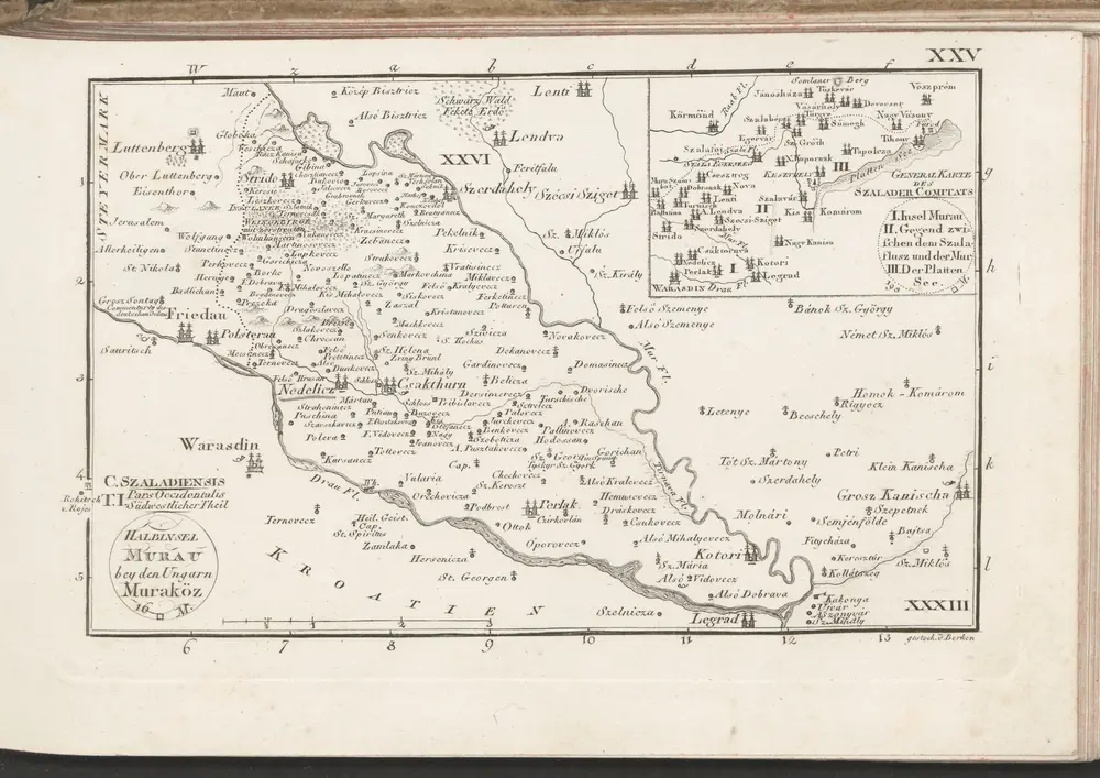
C. Szaladiensis. Tab. II
1804
n/a
1804
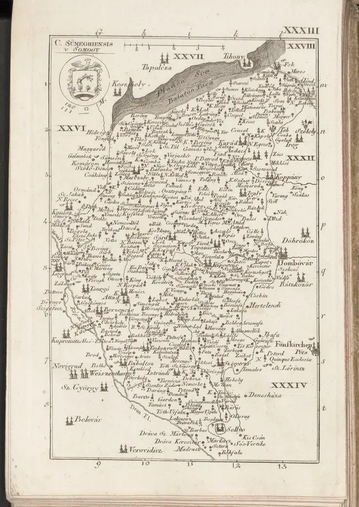
C. Sümeghiensis
1804
n/a
1804
n/a
1804
C. Szaladiensis. Tab. I
1804
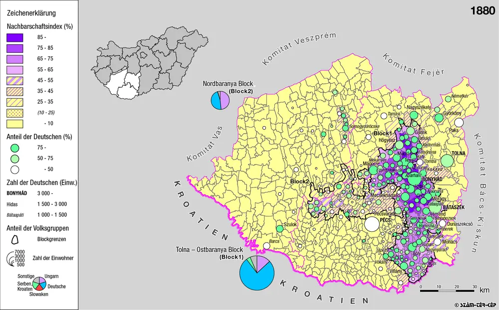
Siedlungsgebiet der Deutschen nach dem Nachbarschaftsindex für Süd-Transdanubien 1880
1880
Bottlik, Zsolt