Mapa catalogado
Sarkad


Título completo:Sarkad
Tamaño físico:20 x 30 cm
Escala del mapa:1:75 000
Lambert-Cholesky sheet 1869 (Sarkad)
1921
Serviciul Geografic al Armatei
1:20k
Lambert-Cholesky sheet 1969 (Ciumeghiul)
1940
Institutul Geografic Militar
1:20k

Sarkad und Kis Jeno.
1914
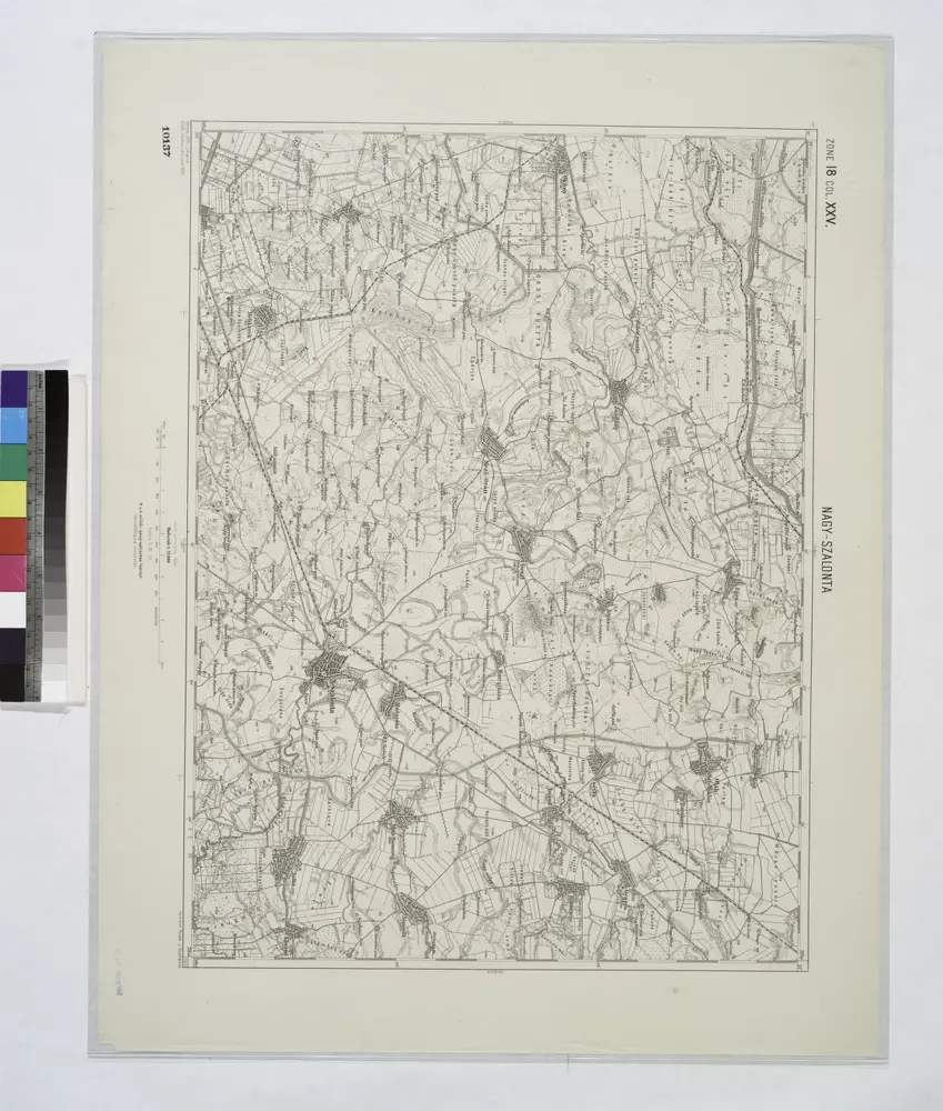
Nagy-Szalonta.
1914
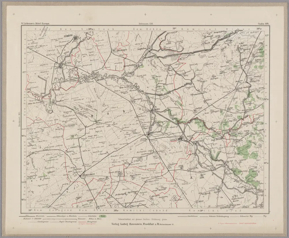
Csaba 164, uit: Special-Karte von Mittel-Europa / nach amtlichen Quellen bearbeitet von W. Liebenow
1899
Johannes Wilhelm Liebenow 1822-1897
1:300k
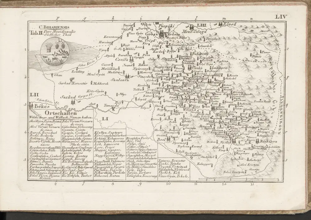
C. Bihariensis. Tab. II
1804
n/a
1804
Lambert-Cholesky sheet 1870 (Sarkad Keresztur)
1958
Direcția Topografică Militară
1:20k
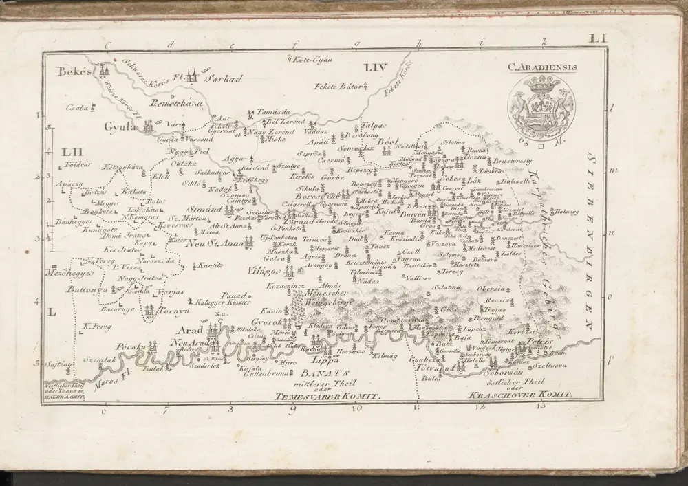
C. Aradiensis
1804
n/a
1804