Maps of Dunapataj

Paks
1 : 75000 Paks, Komitat Tolna
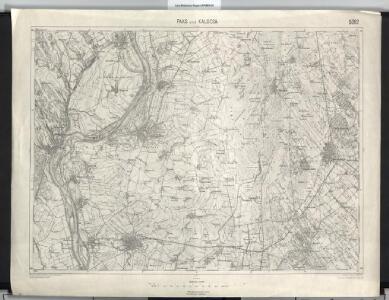
Paks und Kalocsa.
from Spezialkarte der osterreichisch-ungarischen Monarchie.
Mappa Comitatus Solthensis
1 : 170000 Mollova mapová sbírka Mikoviny, Sámuel Schmutzer, Andreas
Kecskemét 163, uit: Special-Karte von Mittel-Europa / nach amtlichen Quellen bearbeitet von W. Liebenow
1 : 300000 titelvariant: W. Liebenow's Mittel-Europa; Annotatie: Titel boven de bladen: W. Liebenow's Mittel-Europa Johannes Wilhelm Liebenow 1822-1897 Frankfurt a. M. : Ludwig Ravenstein
A Dunavölgy Átnézeti Térképe, Carte d ́ensemble del la Vallée du Danube XVI.

A Dunavölgy Átnézeti Térképe, Carte d ́ensemble del la Vallée du Danube XV.

Tolna vármegye térképe
1 : 355000 Kogutowicz, Manó Magyar Földrajzi Intézet
Dunafoldvar und Szabadszallas.
from Spezialkarte der osterreichisch-ungarischen Monarchie.
Hajos.
from Spezialkarte der osterreichisch-ungarischen Monarchie.
Pincehely.
from Spezialkarte der osterreichisch-ungarischen Monarchie.
Plan der Bergwerg fekete Patak und Berznye
Mollova mapová sbírka Geyer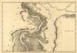
Colotscha - Fulna
Mollova mapová sbírka Marsili, Luigi Ferdinando
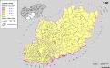
Siedlungsgebiet der Deutschen nach dem Nachbarschaftsindex für das Komitat Bács-Kiskun 1980
Bács-Kiskun Deutsche, Siedlung Bottlik, Zsolt
Kroaten im Komitat Bács-Kiskun 1980
Bács-Kiskun Kroaten, Siedlung Bottlik, Zsolt
Siedlungsgebiet der Deutschen nach dem Nachbarschaftsindex für das Komitat Bács-Kiskun 1880
Bács-Kiskun Deutsche, Siedlung Bottlik, Zsolt
Kroaten im Komitat Bács-Kiskun 1880
Bács-Kiskun Kroaten, Siedlung Bottlik, Zsolt
Siedlungsgebiet der Deutschen nach dem Nachbarschaftsindex für das Komitat Bács-Kiskun 1941
Bács-Kiskun Deutsche, Siedlung Bottlik, Zsolt
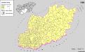
A horvátok aránya és száma Bács-Kiskun megyében 1880-ban
Bács-Kiskun Kroaten, Siedlung Bottlik, Zsolt
Kroaten im Komitat Bács-Kiskun 1941
Bács-Kiskun Kroaten, Siedlung Bottlik, Zsolt
A horvátok aránya és száma Bács-Kiskun megyében 1941-ben
Bács-Kiskun Kroaten, Siedlung Bottlik, Zsolt
A horvátok aránya és száma Bács-Kiskun megyében 1980-ban
Bács-Kiskun Kroaten, Siedlung Bottlik, Zsolt
A németek településterülete a szomszédsági mutató alapján Bács-Kiskun megyében 1980-ban
Bács-Kiskun Deutsche, Siedlung Bottlik, Zsolt
A németek településterülete a szomszédsági mutató alapján Bács-Kiskun megyében 1880-ban
Bács-Kiskun Deutsche, Siedlung Bottlik, Zsolt
A németek településterülete a szomszédsági mutató alapján Bács-Kiskun megyében 1941-ban
Bács-Kiskun Deutsche, Siedlung Bottlik, Zsolt
Pest-Pilis-Solt-Kiskun vármegye
1 : 500000 Budapešť (Maďarsko : oblast) Kogutowicz, Manó Magyar Földrajzi Intézet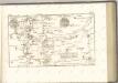
Serben in Süd-Transdanubien und im Komitat Bács-Kiskun 1980
Transdanubien (Süd), Bács-Kiskun, Serben, Siedlung Bottlik, Zsolt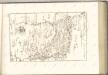

Pesth-Solter, Csongráder, Szolnoker Comitat und das Ober Capitanat von Jazygien und Cumanien
1 : 280000 Budapešť-oblast (Maďarsko)