Maps of Harghita

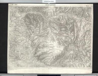
Görgényszentimre
1 : 75000 Judeţ Mureş
Gorgenyszentimre.; Spezialkarte der osterreichisch-ungarischen Monarchie.
from Spezialkarte der osterreichisch-ungarischen Monarchie. Austro-Hungarian Monarchy. Militärgeographisches Institut.,
Lambert-Cholesky sheet 3771 (Lunca Bradului)
1 : 20000 Romanian military topographic map sheet under Lambert-Cholensky projection Direcția Topografică Militară geo-spatial.org Direcția Topografică Militară
Lambert-Cholesky sheet 3770 (Fâncelul de Sus)
1 : 20000 Romanian military topographic map sheet under Lambert-Cholensky projection Direcția Topografică Militară geo-spatial.org Direcția Topografică Militară
Lambert-Cholesky sheet 3671 (Deda)
1 : 20000 Romanian military topographic map sheet under Lambert-Cholensky projection Direcția Topografică Militară geo-spatial.org Direcția Topografică Militară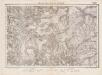
Lambert-Cholesky sheet 3670 (Glăjăria)
1 : 20000 Romanian military topographic map sheet under Lambert-Cholensky projection Institutul Geografic Militar geo-spatial.org Institutul Geografic Militar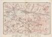
Lambert-Cholesky sheet 3669 (Hodac)
1 : 20000 Romanian military topographic map sheet under Lambert-Cholensky projection Institutul Geografic al Armatei geo-spatial.org Institutul Geografic al Armatei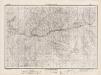
Lambert-Cholesky sheet 3769 (Fâncelul de Jos)
1 : 20000 Romanian military topographic map sheet under Lambert-Cholensky projection Institutul Geografic al Armatei geo-spatial.org Institutul Geografic al Armatei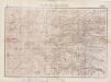
Lambert-Cholesky sheet 3870 (Subcetate)
1 : 20000 Romanian military topographic map sheet under Lambert-Cholensky projection Serviciul Geografic al Armatei geo-spatial.org Serviciul Geografic al Armatei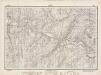
Lambert-Cholesky sheet 3871 (Topliţa)
1 : 20000 Romanian military topographic map sheet under Lambert-Cholensky projection Direcția Topografică Militară geo-spatial.org Direcția Topografică Militară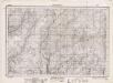
Lambert-Cholesky sheet 3772 (Bâtca Bradului)
1 : 20000 Romanian military topographic map sheet under Lambert-Cholensky projection Direcția Topografică Militară geo-spatial.org Direcția Topografică Militară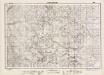
Lambert-Cholesky sheet 3869 (Poiana Draguşa)
1 : 20000 Romanian military topographic map sheet under Lambert-Cholensky projection Direcția Topografică Militară geo-spatial.org Direcția Topografică Militară
Lambert-Cholesky sheet 3672 (Poiana Culmilor)
1 : 20000 Romanian military topographic map sheet under Lambert-Cholensky projection Direcția Topografică Militară geo-spatial.org Direcția Topografică Militară

Szovata.
from Spezialkarte der osterreichisch-ungarischen Monarchie.
Lambert-Cholesky sheet 3872 (Bâtca Mogoşului)
1 : 20000 Romanian military topographic map sheet under Lambert-Cholensky projection Serviciul Geografic al Armatei geo-spatial.org Serviciul Geografic al Armatei
Wurzland
Mollova mapová sbírka Hoffmann, Johannes Hoffmann, Johann
[Střední Rumunsko]
1 : 420600 Rumunsko Schraembl, Franz Anton F.A. Schraembl
Siebenbürgen
Sedmihradsko (Rumunsko) Kipferling, Karl Joseph im Verlage des Kunst und Industrie Comptoir's
Carte de la Moldavie
1 : 330000 Moldawien, Bessarabien
Kolozsvár (Klausenburg), Máramaros-Sziget, Tölgyes
1 : 750000 Cluj-Napoca (Rumunsko) Erben, F. K. u. k. Militärgeographisches Institut
Kolozsvár (Klausenburg), Máramaros-Sziget, Tölgyes
1 : 750000 Cluj-Napoca (Rumunsko) Erben, F. K. u. k. Militärgeographisches Institut
Klausenburg, Máramaros-Sziget, Tölgyes
1 : 750000 K. u. k. militär-geographisches Institut
Klausenburg, Máramaros-Sziget, Tölgyes
1 : 750000 Cluj-Napoca (Rumunsko) K. k. militär-geographisches Institut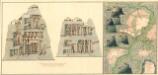
Plan dern Bergwerg bei Carlburg und Vardia
Mollova mapová sbírka Geyer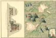
Plan von Bergwerg Pestian und Ivota
Mollova mapová sbírka Geyer
Plan der Bergwerg, Flod, Gilamare und Giogy
Mollova mapová sbírka Geyer
Siebenbürgen
Sedmihradsko (Rumunsko) Kunst- und Industrie Comptoir
Carte de la Roumanie et pays limitrophes. Klausenbourg
1 : 500000 France. Service géographique de l'armée [Paris] : Service géographique de l'armée