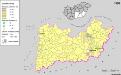
Maps of Sarkadi járás

Nagy-Szalonta
1 : 75000 Salonta, Judeţ Bihor
Lambert-Cholesky sheet 1971 (Mezeghian )
1 : 20000 Romanian military topographic map sheet under Lambert-Cholensky projection Serviciul Geografic al Armatei geo-spatial.org Serviciul Geografic al Armatei
Lambert-Cholesky sheet 1970 (Solonţa Mare)
1 : 20000 Romanian military topographic map sheet under Lambert-Cholensky projection Serviciul Geografic al Armatei geo-spatial.org Serviciul Geografic al Armatei
Lambert-Cholesky sheet 1870 (Sarkad Keresztur)
1 : 20000 Romanian military topographic map sheet under Lambert-Cholensky projection Direcția Topografică Militară geo-spatial.org Direcția Topografică Militară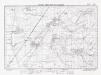
Lambert-Cholesky sheet 2071 (Cefa)
1 : 20000 Romanian military topographic map sheet under Lambert-Cholensky projection Direcția Topografică Militară geo-spatial.org Direcția Topografică Militară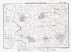
Lambert-Cholesky sheet 2070 (Tulca)
1 : 20000 Romanian military topographic map sheet under Lambert-Cholensky projection Direcția Topografică Militară geo-spatial.org Direcția Topografică Militară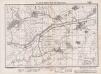
Lambert-Cholesky sheet 1972 (Kumadi)
1 : 20000 Romanian military topographic map sheet under Lambert-Cholensky projection Institutul Geografic Militar geo-spatial.org Institutul Geografic Militar
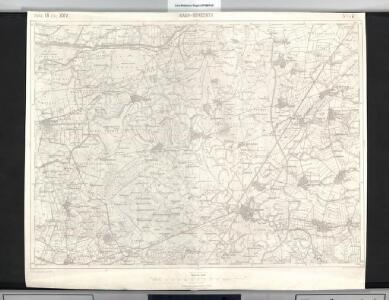
Nagy-Szalonta.
from Spezialkarte der osterreichisch-ungarischen Monarchie.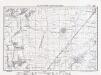
Lambert-Cholesky sheet 2072 (Leş)
1 : 20000 Romanian military topographic map sheet under Lambert-Cholensky projection Direcția Topografică Militară geo-spatial.org Direcția Topografică Militară
Csaba 164, uit: Special-Karte von Mittel-Europa / nach amtlichen Quellen bearbeitet von W. Liebenow
1 : 300000 titelvariant: W. Liebenow's Mittel-Europa; Annotatie: Titel boven de bladen: W. Liebenow's Mittel-Europa Johannes Wilhelm Liebenow 1822-1897 Frankfurt a. M. : Ludwig Ravenstein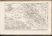
C. Bihariensis. Tab. II
Ungarn Rumänien Komitat Bihar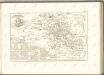

Berettyo-Ujfalu und Koros-Tarjan.
from Spezialkarte der osterreichisch-ungarischen Monarchie.
Sarkad und Kis Jeno.
from Spezialkarte der osterreichisch-ungarischen Monarchie.
Tenke und Kardo.
from Spezialkarte der osterreichisch-ungarischen Monarchie.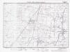
Lambert-Cholesky sheet 1969 (Ciumeghiul)
1 : 20000 Romanian military topographic map sheet under Lambert-Cholensky projection Institutul Geografic Militar geo-spatial.org Institutul Geografic Militar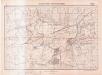
Lambert-Cholesky sheet 2069 (Talpoş)
1 : 20000 Romanian military topographic map sheet under Lambert-Cholensky projection Serviciul Geografic al Armatei geo-spatial.org Serviciul Geografic al Armatei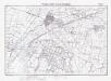
Lambert-Cholesky sheet 1869 (Sarkad)
1 : 20000 Romanian military topographic map sheet under Lambert-Cholensky projection Serviciul Geografic al Armatei geo-spatial.org Serviciul Geografic al Armatei
Süd-Biharer Comitat
1 : 290000 Bihor (Rumunsko)
Süd-Biharer Comitat
1 : 288000 Bihor (Rumunsko : judet)
Süd-Biharer Comitat
1 : 288000 Bihor (Rumunsko)
Das Oesterreichische-Kaiserthum
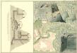
Plan des Bergwergs zu Lupkovo
Mollova mapová sbírka Geyer
Partis Hungariae Inter Tibiscum et Nigrum Chrysum Nova et Accurata Descriptio
1 : 530000 Mollova mapová sbírka Valk, Gerhard Schenk, Peter I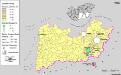
Siedlungsgebiet der Slowaken nach dem Nachbarschaftsindex für die Südliche Tiefebene 1880
Ungarn (Süd) Slowaken, Siedlung Bottlik, Zsolt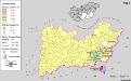
Siedlungsgebiet der Slowaken nach dem Nachbarschaftsindex für die Südliche Tiefebene 1941
Ungarn (Süd) Slowaken, Siedlung Bottlik, Zsolt
A szlovákok településterülete a szomszédsági mutató alapján Dél-Alföldön 1880-ban
Ungarn (Süd) Slowaken, Siedlung Bottlik, Zsolt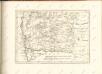

Szeged és Debrecen
1 : 750000 Debrecín (Maďarsko : oblast) M. Kir. Állami Térképészet