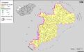
Maps of Pápai járás

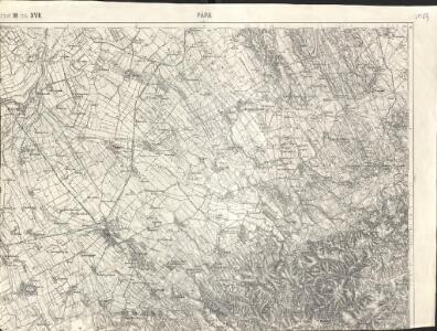
Pápa
1 : 75000 Pápa (Ungarn)
Papa.
from Spezialkarte der osterreichisch-ungarischen Monarchie.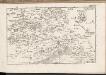
C. Veszprim
Ungarn Komitat Veszprém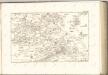

Übersichtskarte zu den Operationen vor u. nach der Schlacht bei Raab

Veszprémer Comitat
1 : 280000 Veszprém (Maďarsko : oblast)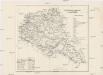
Veszprémer Comitat
1 : 280000 Veszprém-oblast (Maďarsko)
Steinamanger 161, uit: Special-Karte von Mittel-Europa / nach amtlichen Quellen bearbeitet von W. Liebenow
1 : 300000 titelvariant: W. Liebenow's Mittel-Europa; Annotatie: Titel boven de bladen: W. Liebenow's Mittel-Europa Johannes Wilhelm Liebenow 1822-1897 Frankfurt a. M. : Ludwig Ravenstein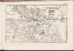
C. Jauriniensis
Ungarn Komitat Raab
Veszprém vármegye térképe
1 : 400000 Veszprém (Maďarsko : oblast) Kogutowicz, Manó Magyar Földrajzi Intézet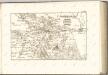

Einnahme von Raab am 28ten Juni 1849.
Györ-oblast (Maďarsko) Mortier, Pieter Jan Jiří
Raab.
from Spezialkarte der osterreichisch-ungarischen Monarchie.
Györ vármegye
1 : 240000 Györ-oblast (Maďarsko) Király, Georg
Devecser und Varoslod.
from Spezialkarte der osterreichisch-ungarischen Monarchie.
Moor und Zircz.
from Spezialkarte der osterreichisch-ungarischen Monarchie.
Sarvar, Kis-Cell und Beled.
from Spezialkarte der osterreichisch-ungarischen Monarchie.
Bez titulu: Západní Maďarsko
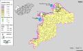
Siedlungsgebiet der Deutschen nach dem Nachbarschaftsindex für Westungarn 1941
Ungarn, Transdanubien, Deutsche, Siedlung Bottlik, Zsolt
Siedlungsgebiet der Deutschen nach dem Nachbarschaftsindex für Westungarn 1980
Ungarn, Transdanubien, Deutsche, Siedlung Bottlik, Zsolt
Siedlungsgebiet der Deutschen nach dem Nachbarschaftsindex für Westungarn 1880
Ungarn, Transdanubien, Deutsche, Siedlung Bottlik, Zsolt
Kroaten in West-Ungarn 1941
Transdanubien Kroaten, Siedlung Bottlik, Zsolt
Kroaten in West-Ungarn 1880
Transdanubien Kroaten, Siedlung Bottlik, Zsolt
A horvátok aránya és száma Nyugat-Magyarországon 1980-ban
Transdanubien Kroaten, Siedlung Bottlik, Zsolt
Kroaten in West-Ungarn 1980
Transdanubien Kroaten, Siedlung Bottlik, Zsolt
A horvátok aránya és száma Nyugat-Magyarországon 1941-ben
Transdanubien Kroaten, Siedlung Bottlik, Zsolt
A horvátok aránya és száma Nyugat-Magyarországon 1880-ban
Transdanubien Kroaten, Siedlung Bottlik, Zsolt
A németek településterülete a szomszédsági mutató alapján Nyugat-Magyarországon 1941-ban
Ungarn, Transdanubien, Deutsche, Siedlung Bottlik, Zsolt
A németek településterülete a szomszédsági mutató alapján Nyugat-Magyarországon 1880-ban
Ungarn, Transdanubien, Deutsche, Siedlung Bottlik, Zsolt