Maps of China
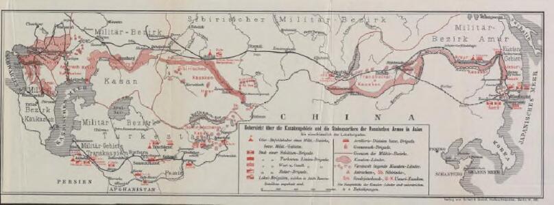
Uebersicht über die Kasakengebiete und die Stabsquartiere der russischen Armee in Asien
Russland / Asiatischer Teil Militär Kosaken
Ostasien
Carte d'actualité Édé. n12, Europe - Asie - Afrique - Océanie
1 : 17000000 Lille : Imprimerie industrielle
Tartary.
1 : 13000000 Thomson, John
Tartary.
1 : 22809600 Lucas, Fielding Jr.
Carte Generale de l'Empire Chinois.
1 : 19000000 Vivien de St Martin, L.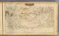
Central Asia.
1 : 14000000 Arrowsmith, Aaron; Lewis, Samuel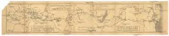
Rozložení armádního intendanstva v lednu 1919 před přemístěním na východ
1 : 7530000 Rusko
Chaines de montagnes et volcans de l'Asie-centrale (enfoneement du sol dans l'ouest)
Asie střední Humboldt, Alexander von Berthe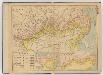
中俄交界詳圖 .
1 : 14400000 中俄交界詳圖 宣统元年至二年[1909-1910],武昌:武昌亞新地學社出版 该图集以1幅总图15幅详图(分图)的形式,详细绘制了清末中俄边界线以及清代中俄边界的变化,空间上东起乌苏里江、图们江,向西延黑龙江、蒙古、新疆直到帕米尔地区。详图中详细标注了边界上各界牌所在位置及名称。 该图未标注成图时间,根据图上内容推测应为宣统元年至二年。详图第十幅中,吉林宁古塔标注了绥芬府,而绥芬府是宣统元年[1909]四月升绥芬厅而置,次年四月又改为宁安府,因此该图应成图于宣统元年或二年。图上其他标注也符合这一时间限定,如总图中已绘制了京张铁路,而京张铁路通车时间是1909年,表明该图应在1909年或之后;北京处则标注为“順天京師”,而顺天府于民国二年被废,京师改为京兆地方,表明该图应在1913年之前。因此,该图成图时间应在宣统元年至二年之间,其中,又以宣统二年上半年的可能性最大。 1集16图,彩印,中文,图幅为36.5 x 47.6 cm,总图比例尺1:14400000,详图比例尺1:1500000,以穿过北京的116°经线为中央经线,总图经纬度范围约为E50°-145°; N40°-60°。 Harvard-Yenching | Offsite Storage C (HD) | G2306.F2 H93 1930Z;Hollis Number:012092643 武昌:武昌亞新地學社
A New Description of Tartarie / by Robt. Morden
1 : 43000000 1 Karte : Kupferdruck ; 11 x 13 cm Morden, Robert [Printed for Robert Morden and Thomas Cockerill]
Thibet, Mongolia, and Mandchouria.
1 : 19008000 Tallis, J. & F.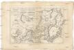
Tartarie, Chinoise, roy de Corée et isles du Japon
1 : 12640000 Japonsko Bonne, Rigobert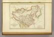
L'Empire Chinois et du Japon.
1 : 23600000 Malte-Brun, Conrad, 1775-1826
Siberia, Chinese Tartary.
1 : 11000000 Society for the Diffusion of Useful Knowledge (Great Britain)
Russia in Asia 3, Chinese Empire.
1 : 10454400 Letts, Son & Co.
Russia in Asia 1.
1 : 10454400 Letts, Son & Co.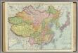
East Asia.
1 : 8997000 Rand McNally and Company
The Chinese Empire compiled from native and foreign authorities
1 : 9700000 The Chinese Empire Compiled from Native and Foreign Authorities 1882年,S. Wells Williams卫三畏 (1812-1884)绘制,Jacob Wells修订,G. Stern刻版,New York: Charles Scribner's Sons出版。 该图详细刻画了清末中国疆域、行政区划及边疆地区。卫三畏曾在1847年左右曾出版了一幅题为Map of the Chinese empire, compiled from native & foreign authorities的彩色中国地图,现藏于国会图书馆,1953年又出版了一幅题为Map of the Chinese Empire : compiled from native & foreign authorities的黑白中国地图(仅部分着黄色),而1882年的这版中国地图,是在前两版的基础上,根据新调查的数据进行修订而成。卫三畏是清末最为杰出的汉学家,对中国有着持续深入的研究,这幅地图可以代表19世纪末西方对中国疆域和政区认识的最高水平,尤其是对内陆边疆和海疆的认识。 附插图2幅:Map of the City of Canton & Adjacent Islands,描绘珠三角地形与广州城市格局;Harbor & Island of Amoy,描绘厦门岛及周边海湾。 Map of the city of Canton & adjacent islands, Harbor & island of Amoy 1图,黑白印刷,英文,图幅49 x 54 cm,比例尺约为1:9,700,000,经纬度约为E65°-140°; N18°-55°。 Harvard-Yenching | Offsite Storage (HD)|MLC-C|HY53A6,Hollis Number:008375431 S. Wells Williams New York: Charles Scribner's Sons
W. Siberia, Tartary, Khiva, Bokhara &c.
1 : 10060000 Society for the Diffusion of Useful Knowledge (Great Britain)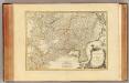
Tartarie Chinoise.
1 : 10400000 Bonne, Rigobert, 1727-1794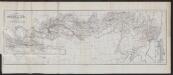
Karte der Reichsgrenze zwischen Russland und China
1 : 8500000 Russland China Grenze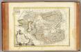
Tartarie Independante.
1 : 10400000 Bonne, Rigobert, 1727-1794
Sbírka map a diagramů použitých na mírových konferencích v Paříži v letech 1919 - 1920
La Tartaria chinese
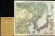
New war map of East Asia

Der westliche Theil von Mittel-Asien oder Turan mit einen Theile der angrenzenden Laender
1 : 5700000 Asie střední Weiland, Karl Ferdinand Geograph. Institut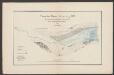
Septima Asie Tabula [Karte], in: [Clavdii Ptholomei Cosmographi ...], S. 320.
1 Karte aus Atlas Nicolaus Germanus [und Ptolemaeus, Claudius]
Central Asia.
1 : 4979779 Johnston, W. & A.K.