Gecatalogiseerde kaart
Ungarn: Comitate: Beregh, Marmarozs, Ugocsa, Közep Szolnok, Kraszna, District Kövár. Siebenbürgen: Innerer Szolnok, Doboka, Clausenburg, Torda, Aranyoser Stuhl, Marozser Stuhl, Udvarhlyer Stuhl, Csiker Stuhl, und Bistriczer District

Volledige titel:Ungarn: Comitate: Beregh, Marmarozs, Ugocsa, Közep Szolnok, Kraszna, District Kövár. Siebenbürgen: Innerer Szolnok, Doboka, Clausenburg, Torda, Aranyoser Stuhl, Marozser Stuhl, Udvarhlyer Stuhl, Csiker Stuhl, und Bistriczer District
Jaar illustratie:1833 - 1838
Pubdatum:1838
Fysieke grootte:20 x 30 cm
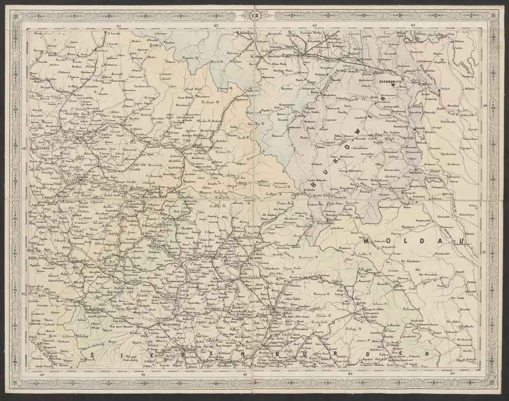
Strassen- und Eisenbahnkarte des oesterreichischen Kaiserthumes
1866
Schaller, G.
1:864k
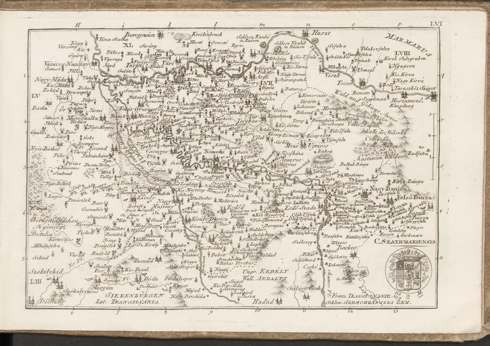
C. Szathmariensis
1804
Ungarn: Comitate: Beregh, Marmarozs, Ugocsa, Közep Szolnok, Kraszna, District Kövár. Siebenbürgen: Innerer Szolnok, Doboka, Clausenburg, Torda, Aranyoser Stuhl, Marozser Stuhl, Udvarhlyer Stuhl, Csiker Stuhl, und Bistriczer District
1838
n/a
1804
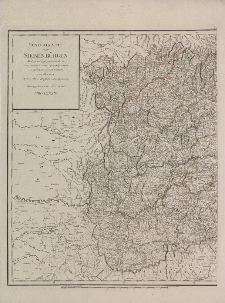
Generalkarte Von Siebenbürgen. Nach geometrisch gemessenen Karten und andern zuverlaessigen Hilfsmitteln verjüngt, und graduirt von Herrn A. von Wenzely. Herausgegeben von Herrn F. A. Schraembl
1789
Wenzely, Anton; Schraembl, Franz Anton
1:430k
Szathmárer Comitat
1870
1:300k
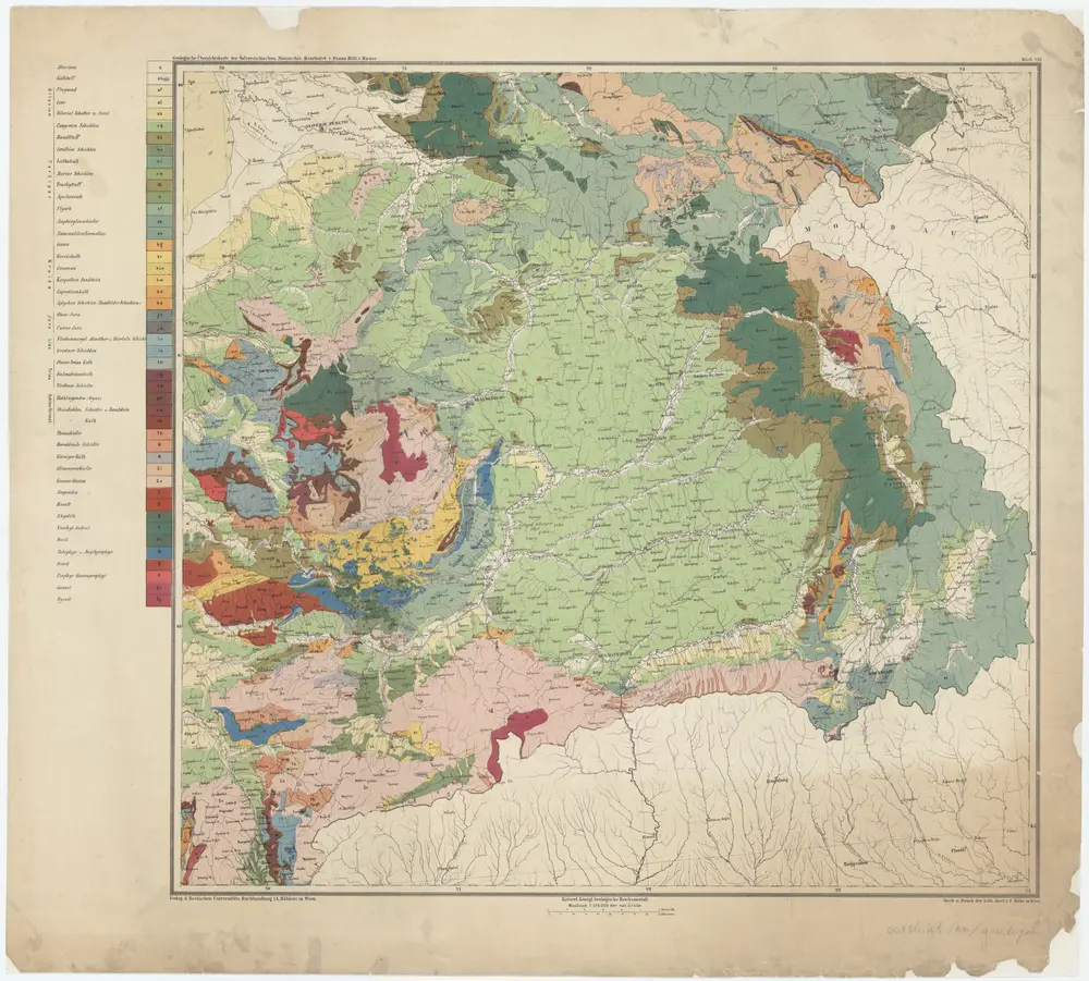
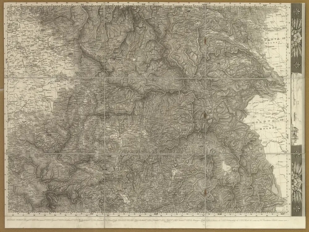
Blatt VIII, uit: Geologische Übersichts-Karte der Österreichisch-Ungarischen Monarchie / nach den Aufnahmen der K.K. Geologischen Reichsanstalt bearb. von Franz Ritter von Hauer ; gezeichn. von Eduard Jahn
1867
Hauer, Franz Ritter von; Jahn, Eduard; Kaiserlich-Königliche Geologische Reichsanstalt, Wenen
1:576k
n/a
1800
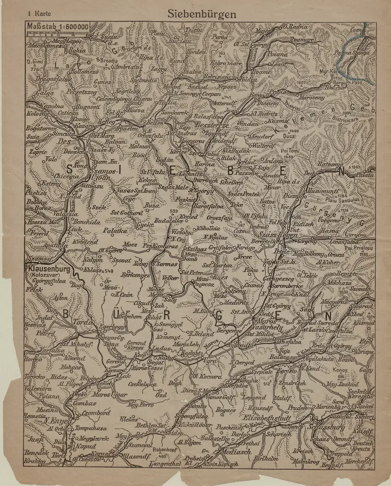
Siebenbürgen
1916
1:600k
Kolozsvár (Klausenburg), Máramaros-Sziget, Tölgyes
1918
K. u. k. Militärgeographisches Institut
1:750k
Kolozsvár (Klausenburg), Máramaros-Sziget, Tölgyes
1916
K. u. k. Militärgeographisches Institut
1:750k
Klausenburg, Máramaros-Sziget, Tölgyes
1892
K. u. k. militär-geographisches Institut
1:750k