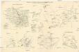
Maps of Germany

[Einwanderung in Reval 1710-1786)
Reval Einwanderung Gebauer, Victor
[Einwanderung in Reval 1639-1710)
Reval Einwanderung Essen, Nicolai v. ; Eichhorn, Nicolai
[Nord- und Istsee]
Atlas der Hydrographie Berghaus, Hermann Justus Perthes
Téatre De La Guerre Des Couronnes du Nord. [Karte], in: Atlas nouveau, contenant toutes les parties du monde [...], Bd. 1, S. 67.
1 Karte aus Atlas Sanson, Nicolas Jaillot, Alexis Hubert und Mortier, Pieter
[Centralis Europae]
Evropa střední Schedel, Hartmann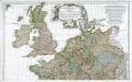
Prémière partie de la carte d'Europe contenant la France, l'Alemagne, l'Italie, l'Espagne & les isles britanniq.s, 1
1 Blatt : 53 x 84 cm s.n.
Tabula Europae IIII. [Karte], in: Claud. Ptolemaeus. Geographia lat. cum mappis [...], S. 263.
1 Karte aus Atlas Münster, Sebastian [und Ptolemaeus, Claudius]
Porostní mapa revíru Srbice
1 : 2880
Tabula Europae IIII. [Karte], in: Geographia universalis vetus et nova complectens Claudii Ptolemaei Alexandrini enarrationis libros VIII, S. 231.
1 Karte aus Atlas Münster, Sebastian [und Ptolemaeus, Claudius]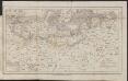
Map of the Post-Route to & from St. Petersburgh
1 : 24000000 Osteuropa Deutschland Polen Russland Reiseweg Postroute
Carte des états slaves rendus indépendants par Samo, et groupés autour de lui (an 625 à 650), en face du royaume réduit des Avars, enserré à l’est par les Khazars et les Bulgares, et au sud et à l’ouest par les Slaves que l’empereur Héraclius avait établis au sud du Danube
Ostmitteleuropa Tschechische Republik Slawen Awaren Samo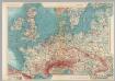
Western Europe. Pergamon World Atlas.
1 : 5000000 Polish Army Topography Service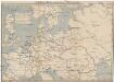
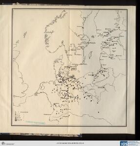
Schiffbare Wasserstrassen in Mitteleuropa
1 : 15000 Evropa střední Oelwein, A.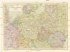
Střední Evropa
1 : 3000000 Evropa střední Kuchař, Karel Janka, Jaromír V. Neubert a synové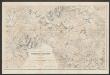
Quarta Europe Tabula [Karte], in: [Clavdii Ptholomei Cosmographi ...], S. 260.
1 Karte aus Atlas Nicolaus Germanus [und Ptolemaeus, Claudius]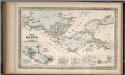
The Baltic Sea.
Mitchell, Samuel Augustus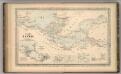
The Baltic Sea.
Mitchell, Samuel Augustus
Part of North of Europe.
1 : 3800000 Melish, John
Nord- und Ostseeherrschaft I: Reich Knuts des Großen
1 : 12000000 Nordeuropa Knud II., Danmark, Konge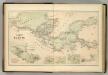
Chart of the Baltic.
Hughes, William
The countries of northern Europe
Skizzen zu den größeren Manövern der fremden Armeen 1906
Francie Streffleur, Valentin Ritter von L. W. Seidel & Sohn
Quarta Europae Tabula. [Magna Germania] [Karte], in: Claudii Ptolemei viri Alexandrini mathematice discipline philosophi doctissimi geographie opus [...], S. 160.
1 Karte aus Atlas Waldseemüller, Martin [und Ptolemaeus, Claudius] Übelin, Georg
Nord- und Ostseeherrschaft III
1 : 10000000 Ostseeraum, Deutscher Orden, Deutsche Hanse
Germany.
from A system of geography, or, A new & accurate description of the earth in all its empires, kingdoms and states : illustrated with history and topography, and maps of every country : fairly engraven on copper, according to the latest discoveries and corrections / by Herman Moll.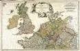
Erster Theil der Karte von Europa, welcher Frankreich, Deutschland, Italien Spanien, England, Scotland und Ireland enthælt, 1
1 Blatt : 53 x 83 cm F.A. Schrämbl
Conspectus Generalis omnium earum partium quae unquam ad Imperium Francicum vel Franco-Romanum demum Romano-Germanicum diversis temporum periodis pertinuerunt.
1 : 11000000 Mollova mapová sbírka Homann, Johann Baptist Homann, Johann Baptista - dědici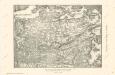
Die Ältesten Karten von Deutschland

Composite: Central Europe.
1 : 2000000 John Bartholomew and Son