Maps of West Bosnia

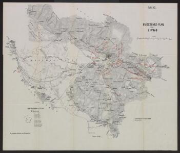
Umgebungs-Plan von Livno
1 : 40000 Bosnien-Herzegowina Livno Umland
Gefecht bei Livno
Bosnien-Herzegowina Livno Gefecht
Livno.
from Spezialkarte der osterreichisch-ungarischen Monarchie.
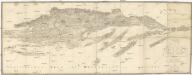
Umgebungen von Sinj
Kroatien Dalmatien Sinj Umland
Zupanjac und Cista.
from Spezialkarte der osterreichisch-ungarischen Monarchie.
Gubin und Vrlika.; Spezialkarte der osterreichisch-ungarischen Monarchie.
from Spezialkarte der osterreichisch-ungarischen Monarchie. Austro-Hungarian Monarchy. Militärgeographisches Institut.,
Generalkarte von Zentraleuropa

[Generalkarte von Bosnien und der Hercegovina]
1 : 300000 Bosnien-Herzegowina Herzegowina
Střední Dalmacie
1 : 750000 Dalmácie střední (Chorvatsko) Machát, František c. a k. voj. zeměpisný ústav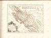
Der Noerdliche Theil Des Königreichs Dalmatien
1 : 1000000 Dalmatien
Vermehrte und Verbesserte Landkarten des Königreichs Ungarn :
1 : 500000 Mollova mapová sbírka Stier, Martin Böner, Johann-Alexander Endter, Martin
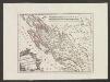
Reg. Bosniae
1 : 875000 Mollova mapová sbírka Bruggen, Johann van der Brugge, Johannes van der
Reg. Bosniae
1 : 875000 Mollova mapová sbírka Pfeffel, Johann Andreas Pfeffel, Johann Andreas I.
Dalmatien und seine Hinterländer
1 : 1700000 Kroatien Dalmatien Bosnien Herzegowina
Zagreb, Brod, Osijek, Glina, Knin, Sarajevo
1 : 750000 Glina (Chorvatsko) Cronenberg, E. K. u. k. Militärgeographisches Institut
Agram, Brod, Esseg, Glina, Knin, Sarajevo
1 : 750000 Glina (Chorvatsko) K. u. k. Militärgeographisches Institut
Sheet XVIII: Karte Des Oesterreichischen Kaiserstaates.
1 : 576000 Scheda, Josef
Dalmatien und Montenegro
Kroatien, Montenegro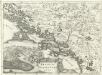
Regnum Dalmatiae
1 : 1200000 Mollova mapová sbírka Bruggen, Johann van der Brugge, Johannes van der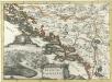
Regnum Dalmatiae
1 : 1200000 Mollova mapová sbírka Bruggen, Johann van der Brugge, Johannes van der
XVIII, uit: General-Karte des oesterreichischen Kaiserstaates mit einem grossen Theile der angrenzenden Länder / durch Josef Scheda ... bearb. und hrsg
1 : 576000 Annotatie geografische gegevens: Maatstokken: oesterreichische Meilen, geografische oder deutsche Meilen, preussische Meilen, türkische Berri, französische Lieues, russische Werste; Maatstok per blad: wiener Klafter, öster. Meilen; Blad XIX: statistische en taalkundige informatie; Blad XIX: legenda [Wien : K.K. Militärisch-Geografisches Institut]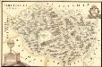
Mapa Particvlaris Regni Bosniae
Mollova mapová sbírka Geyer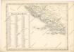
Strassen und Eisenbahnkarte des oesterreichischen Kaiserthumes

Königreich Dalmatien
1 : 1000000 Dalmácie (Chorvatsko)
Das Königreich Bosnia
1 : 1570000 Bosna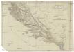
Oestreichisch Dalmatien und Albanien
1 : 930000 Albánie Mollo, Tranquillo Tranquillo Mollo
Oestreichisch Dalmatien und Albanien
1 : 930000 Albánie Mollo, Tranquillo Tranquillo Mollo
Strassen- und Eisenbahnkarte des oesterreichischen Kaiserthumes
1 : 864000 Blatt 14 Schaller, G. K.K. Militärisch-Geografisches Institut, Karten-Evidenthaltungs-Abteilung