Project
Community
News
My maps
Mappa catalogata
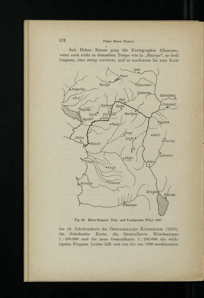
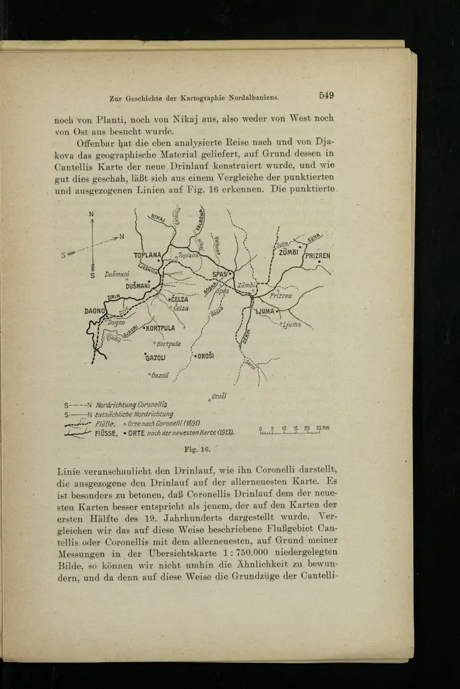
Drin- und Vardarreise
View on external website
Titolo completo:
Drin- und Vardarreise
Anno di illustrazione:
1916
Data di pubblicazione:
1916
Dimensione fisica:
20 x 30 cm
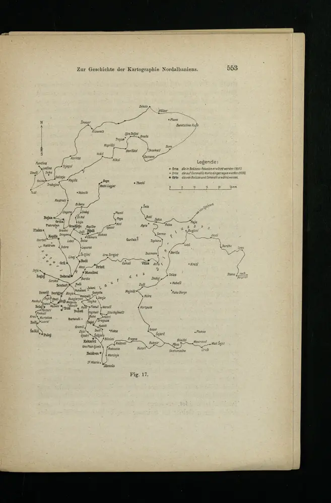
[Nordalbanien]
1916
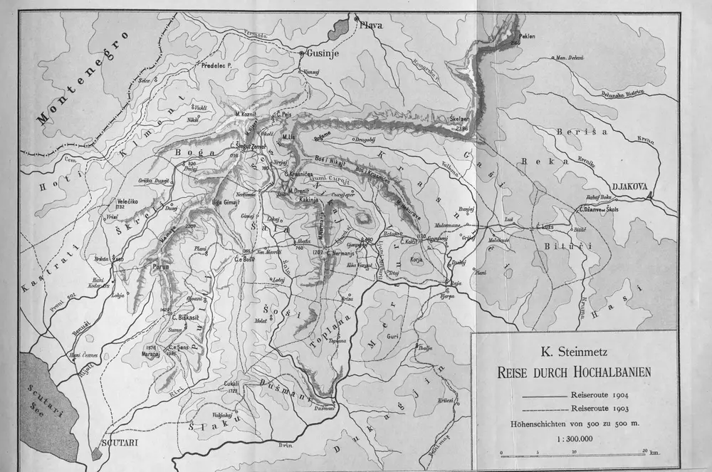
Reise durch Hochalbanien
1905
1:300k
Drin- und Vardarreise
1916
[Nordalbanien]
1916
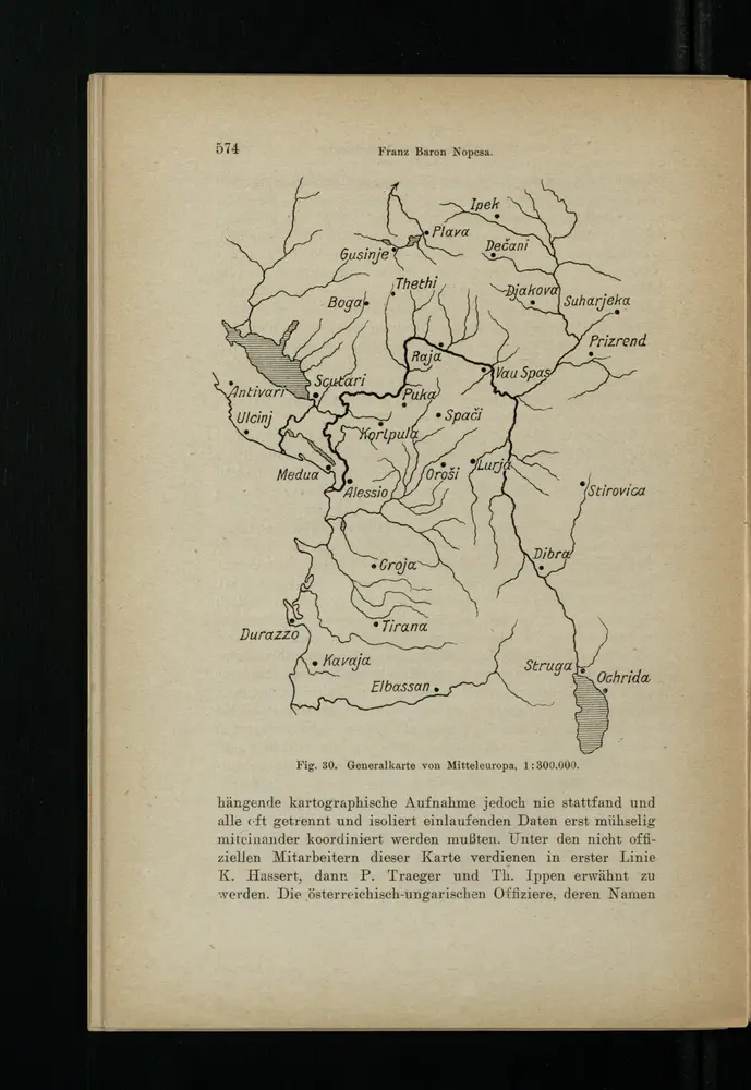
Generalkarte von Mitteleuropa
1916
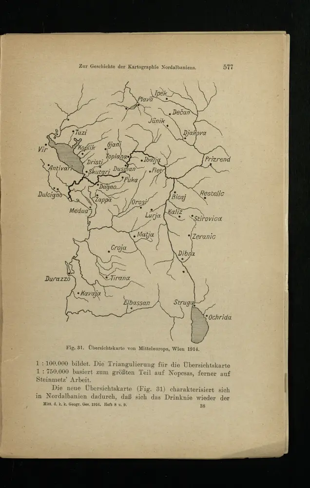
Übersichtskarte von Mitteleuropa
1916
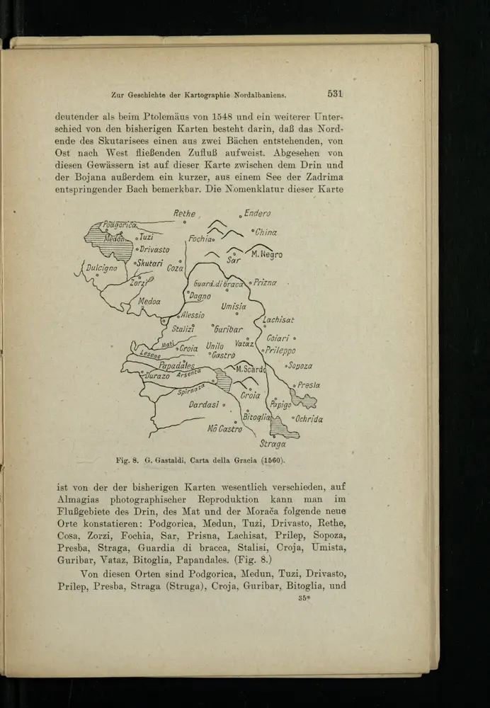
Carta della Gracia
1916
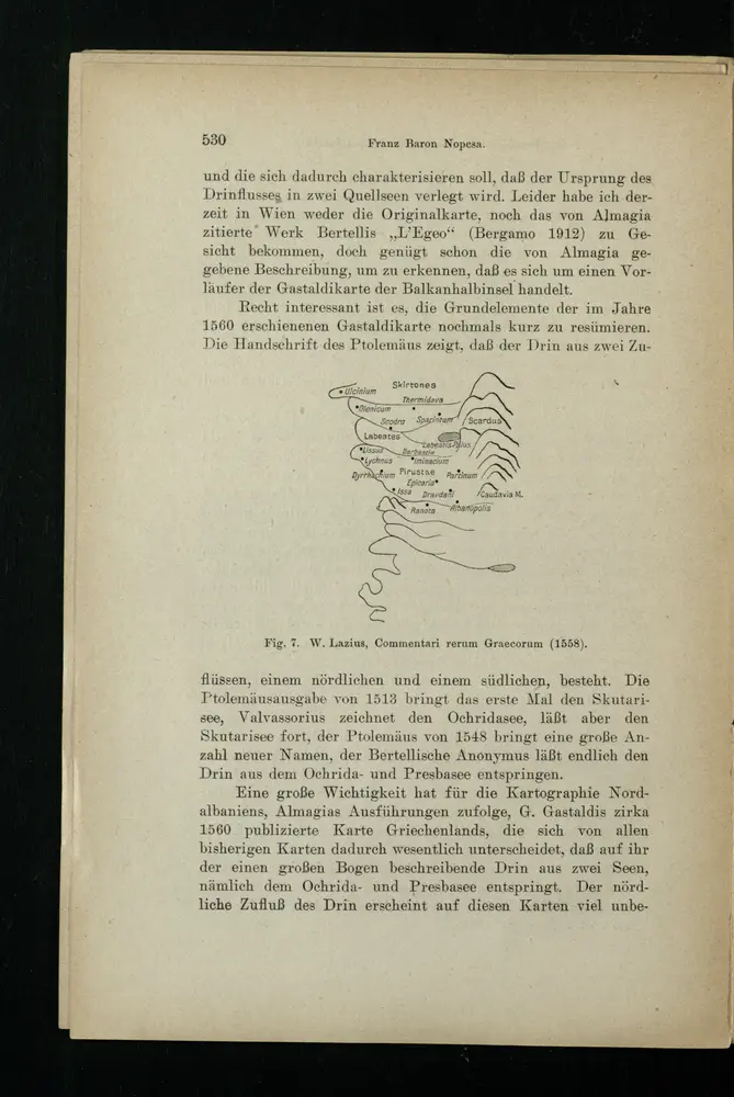
Commentari rerum Graecorum
1916
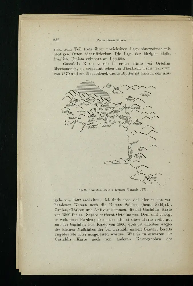
Isole e fortesse Venezia
1916
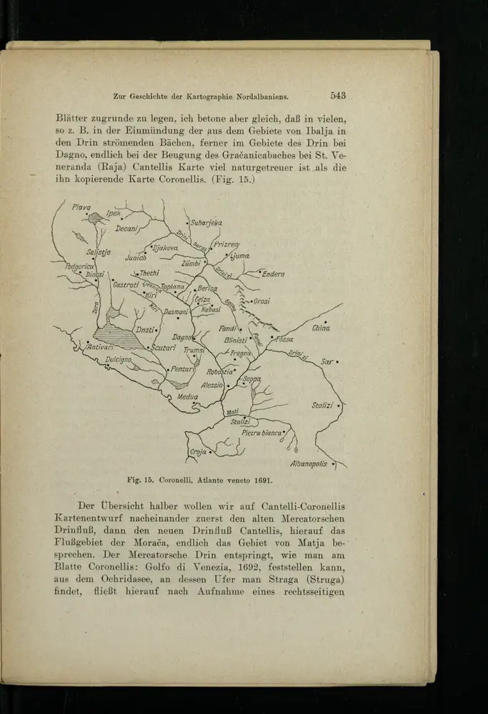
Atlante veneto
1916
La storia