Cataloged map


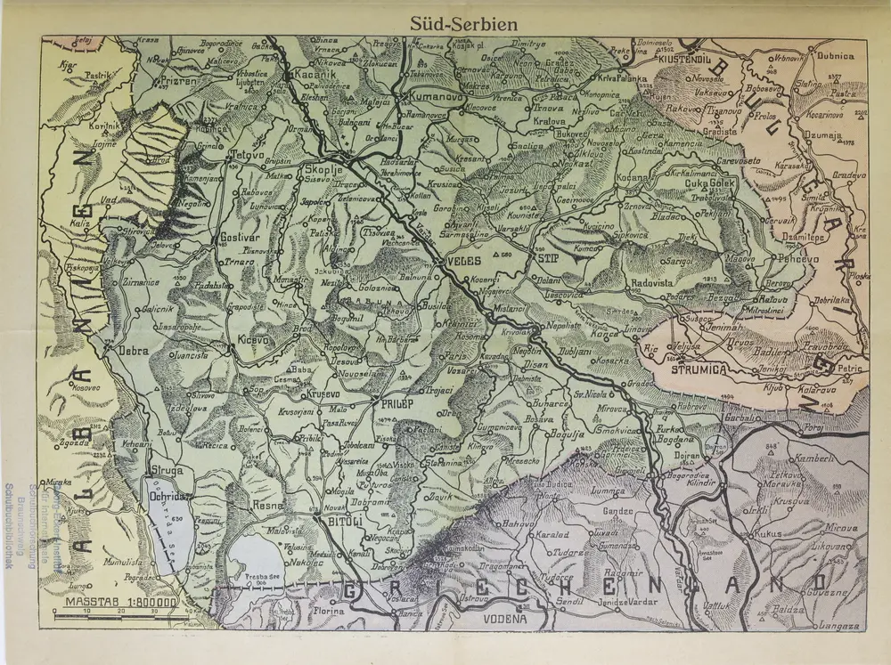
Süd-Serbien
1916
1:800k
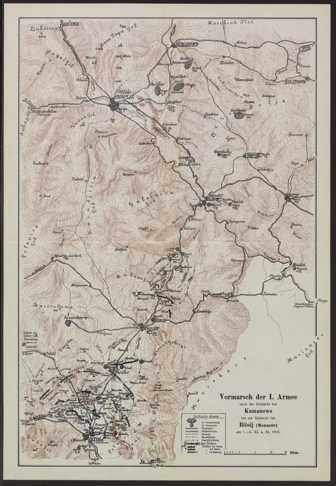
Vormarsch der 1. Armee nach der Schlacht bei Kumanowo bis zur Schlacht bei Bitolj (Monastir)
1912
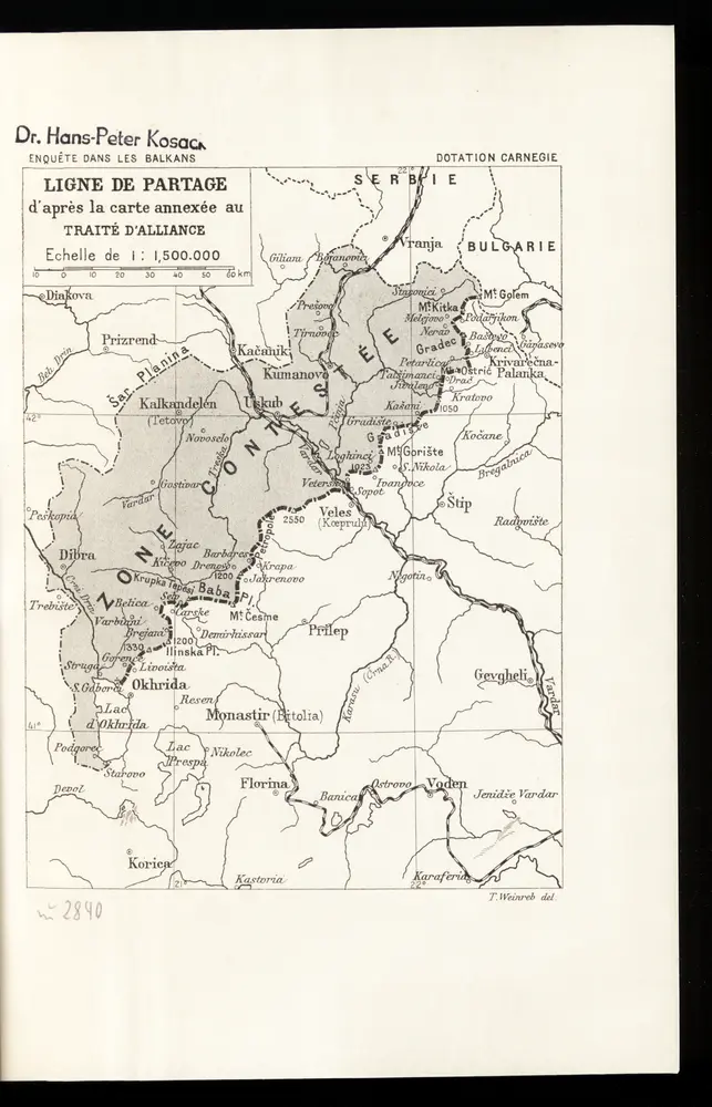
Ligne de partage d'après la carte annexée au Traité d'Alliance
1912
Th. Weinreb del.
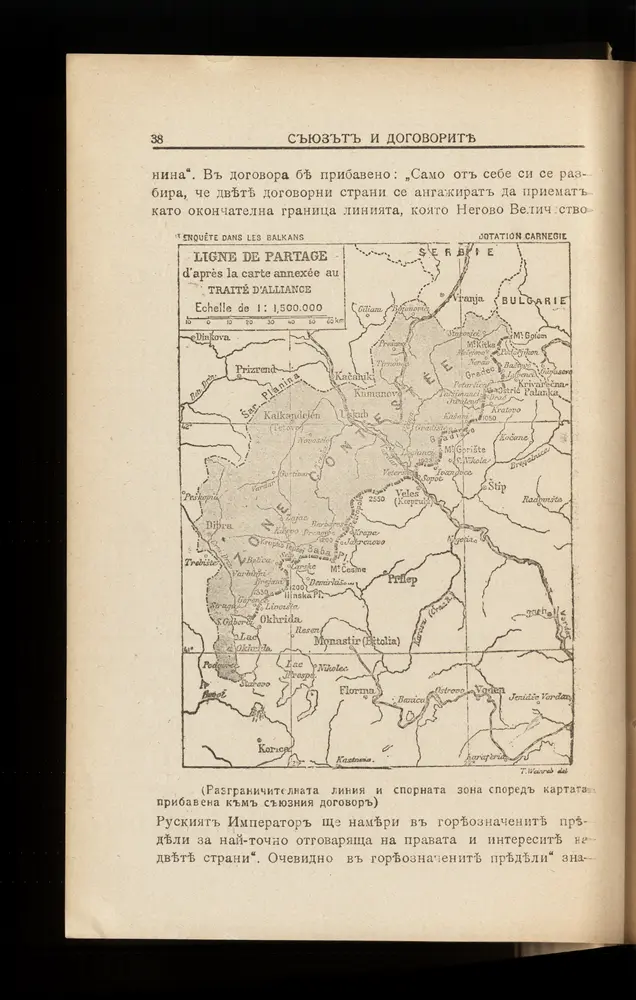
Ligne de partage d'après la carte annexée au traité d'alliance
1913
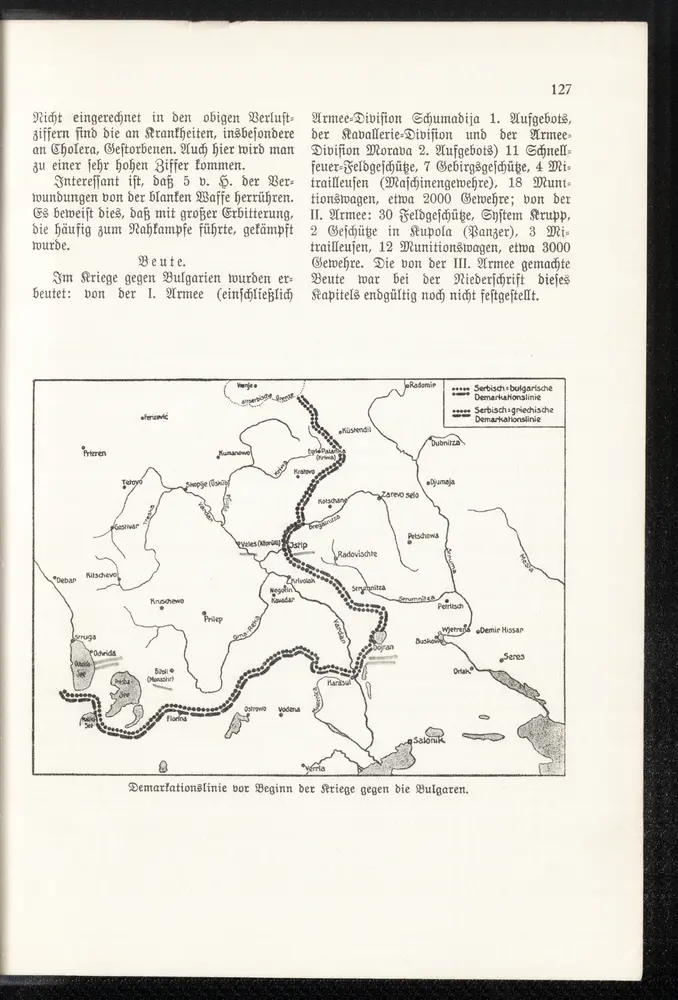
Demarkationslinie vor Beginn der Kriege gegen die Bulgaren
1913
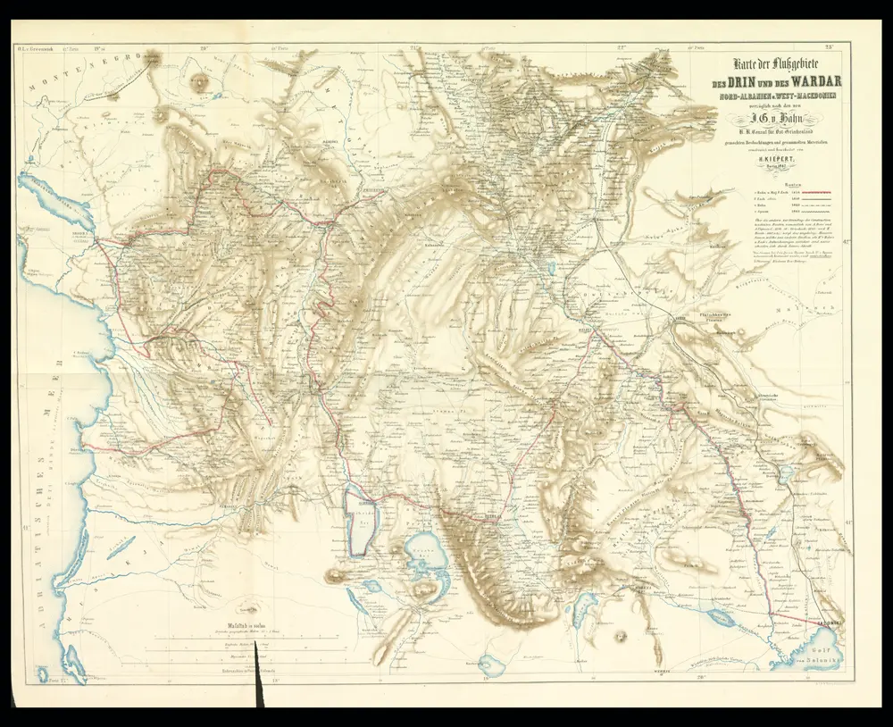
Karte der Flußgebiete des Drin und des Wardar
1867
Hahn, Johann Georg von
1:500k
[Mazedonien]
1915
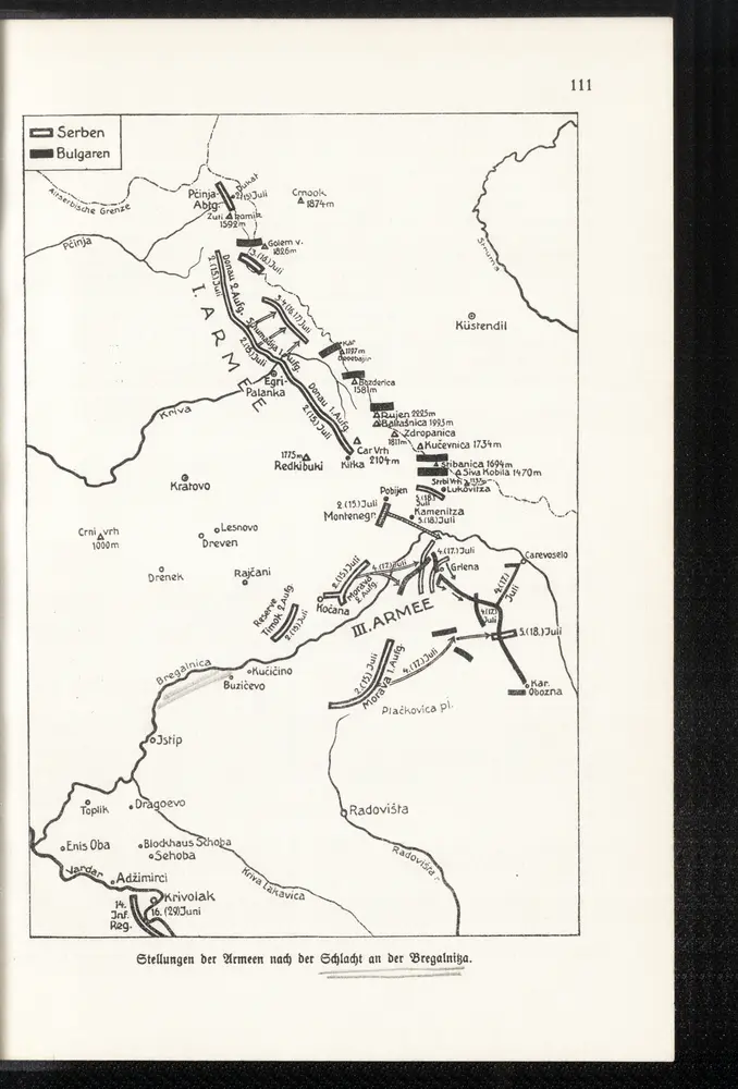
Stellungen der Armeen nach der Schlacht an der Bregalnica
1913
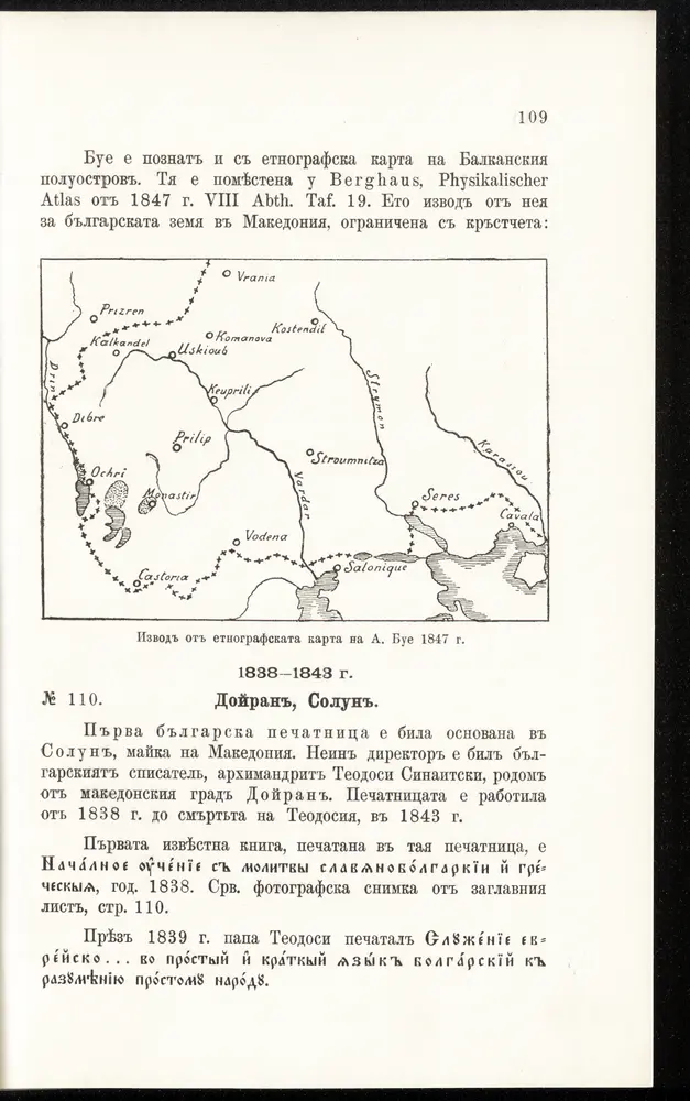
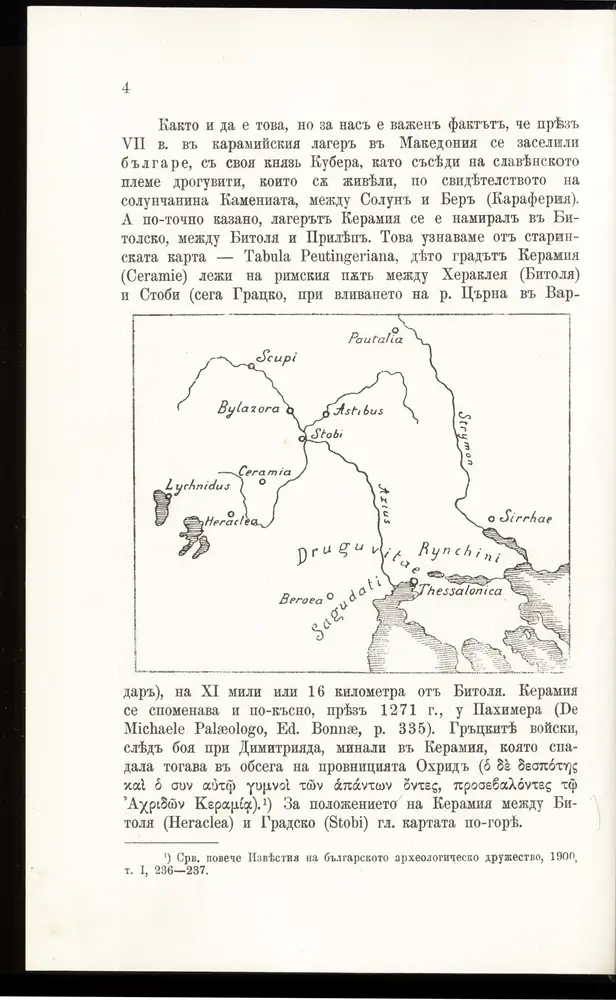
[Bălgarska zemja v Makedonija]
1915
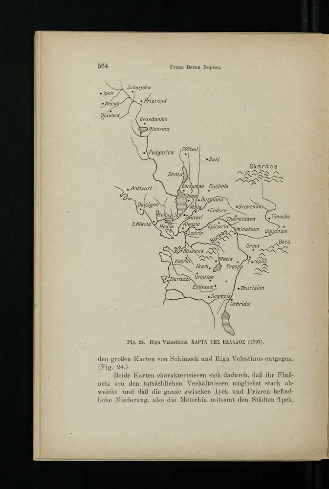
Charta tēs Ellados
1916