Cataloged map
Übersichtskarte

Full title:Übersichtskarte
Depicted:1913
Pubdate:1913
Physical Size:20 x 30 cm
Map scale:1:400 000
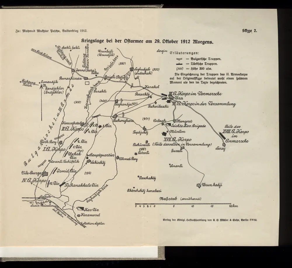
Kriegslage bei der Ostarmee am 29. Oktober 1912 Morgens
1912
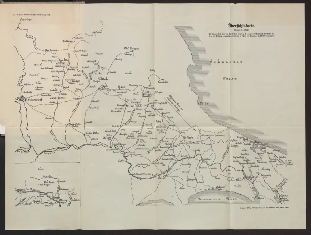
Übersichtskarte
1913
1:400k
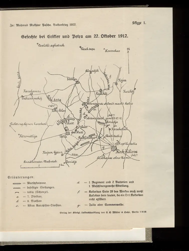
Gefechte bei Erikler und Petra am 22. Oktober 1912
1912
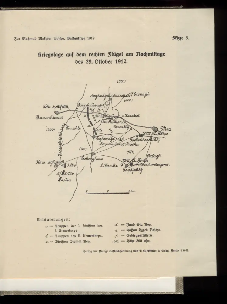
Kriegslage auf dem rechten Flügel am Nachmittage des 29. Oktober 1912
1912
[Romanien]
2013
Konstantinopel, Šumla, Adrianopel, Dimotika
1918
K. u. k. Militärgeographisches Institut
1:750k
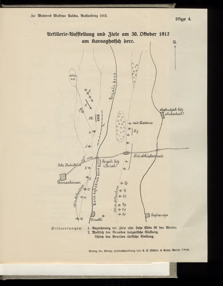
Artillerie-Aufstellung und Ziele am 30. Oktober 1912 am Karaaghatsch dere
1912
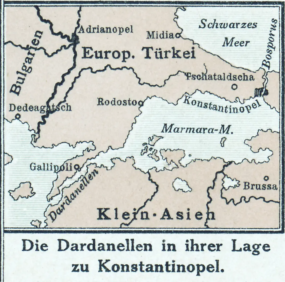
Die Dardanellen in ihrer Lage zu Konstantinopel
1916
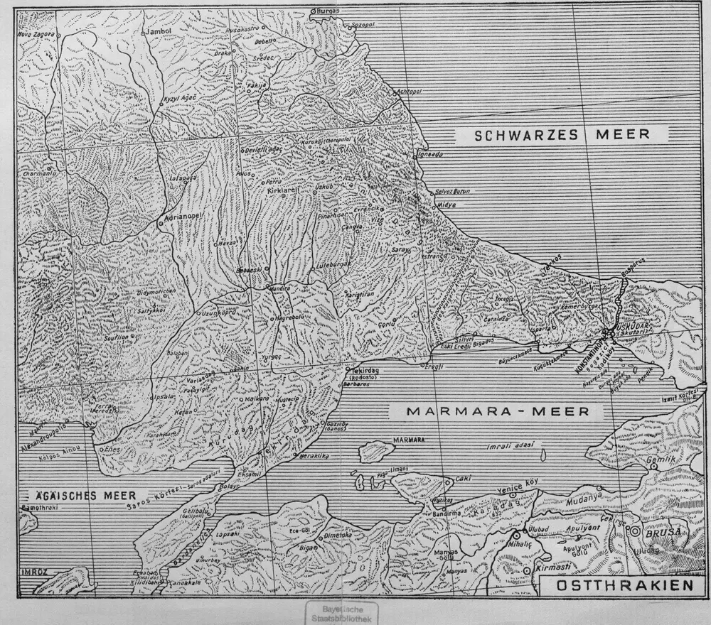
Ostthrakien
1944
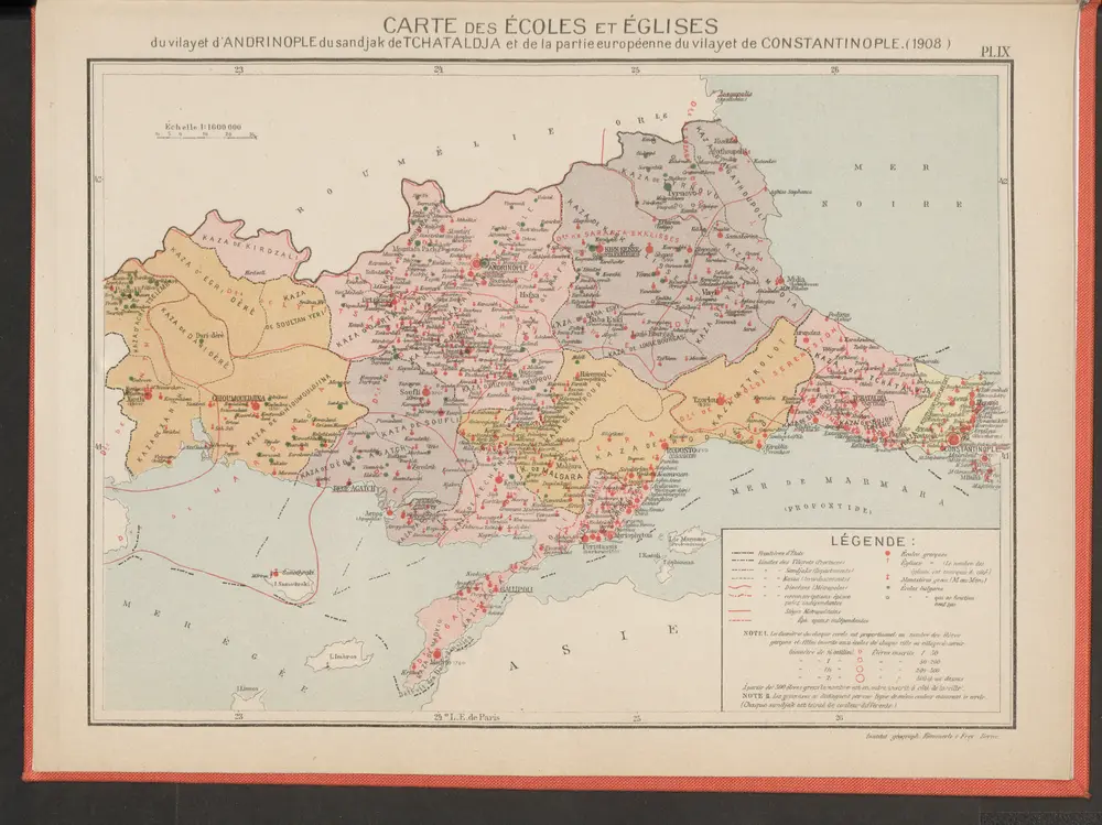
Carte des écoles et églises du vilayet d'Andrinople du sandjak de Tchataldja et de la partie européenne du vilayet de Constantinople (1908)
1908
Kümmerly & Frey