Maps of England
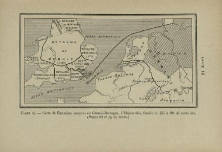
Carte de l’invasion saxonne en Grande-Bretagne. L’Heptarchie, fondée de 455 à 584 de notre ère
Großbritannien Angelsachsen Völkerwanderungszeit
Letecká navigační mapa
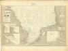
Museumskart 217-7: Kart over Nordsjøen
1 : 500000 S. A. Aarnes Den Geografiske Opmaaling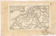
Soubor map

Bez titulu: Severozápadní Evropa
A new map of the Netherlands or Low Countries, shewing their principal divisions, cities, towns, rivers &c.
from A new sett of maps both of antient and present geography : wherein not only the latitude and longitude of many places are corrected according to the latest observations, but also the most remarkable differences of antient and present geography may be quickly discern'd by a bare inspection or comparing of correspondent maps, which seems to be the most natural and easy method to lead young students (for whose use the work is principally intended) unto a competent knowledge of the geographical science : together with a geographical treatise particularly adapted to the use and design of these maps / by Edward Wells, M.A. and student of Christ-Church, Oxon.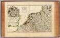
L'Alemagne 1.
1 : 1800000 Rizzi Zannoni, Giovanni Antonio Bartolomeo, 1736-1814
Nouvelle Carte du Royaume des Pays - Bas et Pays Limithropes...

Nouvelle carte geographique des postes des Pais Bas, de la Westphalie, & des provinces limitrophes
1 : 1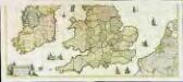
Nova totius Angliæ, Scotiæ, et Hiberniæ, tabula, 2
2 Blätter : 43 x 103 cm Danckerts
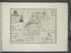
Tabula generalis totius Belgii
1 : 1000000 Belgie Homann, Johann Baptist á Iohanne Baptista Homanno
TABULA GENERALIS TOTIUS BELGII qua PROVINCIAE XVII. INFER. GERMANIAE olim sub S.R.I. CIRCULO BURGUNDIAE
1 : 1100000 Belgie Homann, Johann Baptist â Iohanne Baptista Homanno
Tabula generalis totius Belgii
1 : 1000000 Belgie Homann, Johann Baptist á Iohanne Baptista Homanno
Tabula generalis totius Belgii
1 : 1000000 Belgie Homann, Johann Baptist â Iohanne Baptista Homanno
D.O.M. Carte Generale Des Dixsept Provinces des Pays-Bas avec les Frontieres de France, d'Allemagne et Partie de l'Angleterre Nouvellement dreßée sur plusieur Momoires tirés sur les Lieux pendant les Guerres
1 : 750000 Mollova mapová sbírka Sengre, Henri Misson, François Maximilien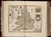
Anglia Regnum / [Joannes Janssonius]
1 : 1800000 Annotatie: Oorspr. verschenen in: Gerardi Mercatoris et I. Hondii Appendix Atlas ... - Amsterdam : bey Johan Jansson, 1636; Origineel is Blad 23 in atlas factice Janssonius, Joannes (jr.) (1588-1664) Amstelodami : apud Ioannem Ianssonium
Le royaume d'Angleterre
1 Karte : Kupferdruck ; 39 x 49 cm Sanson; Fortin chéz Fortin ing.r mécanicien du roy pour les globes rue de la Harpe près la rue du Foin
A new and very accurate map of South Britain or England and Wales
1 Karte : Kupferdruck ; 33 x 40 cm Bowen; Kitchin s.n.
Le royaume d'Angleterre
1 Karte : Kupferdruck ; 38 x 49 cm Sanson chez l'autheur
Anglia Regnum
1 : 1700000 Annotatie: Oorspr. verschenen in: Gerardi Mercatoris et I. Hondii Newer Atlas oder Grosses Weltbuch ... - Amsterdam : bey Johan Jansson, 1636 Amstelodami : apud Ioannem Ianssonium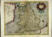
Anglia regnum
1 Karte : Kupferdruck ; 34 x 44 cm Mercator; Hondius Henricus Hondius
Anglia regnum
1 Karte : Kupferdruck ; 34 x 45 cm Mercator; Hondius Jodocus Hondius
Anglia regnum [Karte], in: Gerardi Mercatoris Atlas, sive, Cosmographicae meditationes de fabrica mundi et fabricati figura, S. 109.
1 Karte aus Atlas Mercator, Gerhard Montanus, Petrus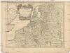
Les dix-sept provinces des Pays-Bas
1 : 1240000 Belgie Sanson, Guillaume Cordier, Louis chez H. Iaillot
Belgii Veteris Typus [...] [Karte], in: Gerardi Mercatoris et I. Hondii Newer Atlas, oder, Grosses Weltbuch, Bd. 1, S. 361.
1 Karte aus Atlas Mercator, Gerhard und Hondius, Jodocus Jansson, Jan
France.
1 : 2070000 Rand McNally and Company
I, uit: General-Karte von Mittel-Europa in 12 Blättern, im Masse 1:1.200.000 / entworfen, bearb. und hrsg. von Josef Schlacher
1 : 1200000 Annotatie: Blad 6 ontbreekt; Annotatie geografische gegevens: 21 maatstokken op blad 9; Legenda op blad 9 Wien : K.K. Militär Geografisches Institut
Charte von dem Schiefer Gebirge des nordwestlichen Deutschlands Belgiens und des nordöstlichen Frankreichs
1 : 1150000 Ardeny Raumer, Carl von Guimpel, F.