Maps of Germany
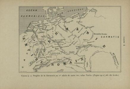
Peuples de la Germanie au 1er siècle de notre ère, selon Tacite
Mitteleuropa Germanien ethnische Gruppe Germanen Tacitus
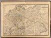
Carte Generale D'Allemagne.
1 : 4600000 Vivien de St Martin, L.
Deutschlands geschichtlich geographischer Zeitraum von 158 v. Chr. bis 260 n. Chr
Evropa střední Ehrenkreutz, I. V.
Atlas für Industrie- und Handelsgeographie: Für commercielle und technische Lehranstalten, für Kaufleute und Industrielle
Allemagne.
1 : 3300000 Lapie, M. (Pierre), 1779-1850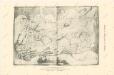
Die Ältesten Karten von Deutschland
Composite: Allemagne.
1 : 2000000 Andriveau-Goujon, J.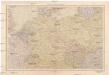
Střední Evropa
1 : 4500000 Evropa střední V. Neubert a synové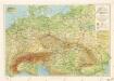
Příruční mapa střední Evropy

Közép-Európa
1 : 5000000 Evropa střední Állami kiadóhivatal
Societas Iesu Germana
1 : 2600000 Mollova mapová sbírka Seutter, Matthäus Seutter, Matthäus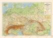
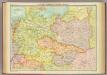
Grossdeutsches Reich und angrenzende Gebiete

Karte des Deutschen Reichs
Schmidt, Johann Marius Friedrich; Jäck Schropp
Übersichtskarte der Verbreitung der Deutschen in Europa
Evropa Kiepert, Heinrich Haas, František Dietrich Reimer

Geologische Übersichtskarte von Mittel-Europa
Evropa střední F. Tempsky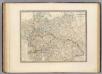
L'Allemagne, l'Europe centrale.
1 : 3460000 Andriveau-Goujon, J.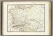
Germanie Ancienne.
1 : 3300000 Lapie, M. (Pierre), 1779-1850
Große Sprachenkarte von Mitteleuropa
1 : 2000000 Lange, Friedrich Reimer
Sbírka map a diagramů použitých na mírových konferencích v Paříži v letech 1919 - 1920

Gnesen 50, uit: Special-Karte von Mittel-Europa / nach amtlichen Quellen bearbeitet von W. Liebenow
1 : 300000 titelvariant: W. Liebenow's Mittel-Europa; Annotatie: Titel boven de bladen: W. Liebenow's Mittel-Europa Johannes Wilhelm Liebenow 1822-1897 Frankfurt a. M. : Ludwig Ravenstein
Eisenbahn-Übersichtskarte von Mittel-Europa
Evropa R. v. Waldheim
Geogr.-physik.-statist. Karte von Deutschland mit Einschluss von ganz Oesterreich, Belgien, den Niederlanden, der Schweiz, Italien und einem Theile von Frankreich, England, Russland und der Türkei
1 : 4000000 Evropa střední Haurand, Theodor C. W.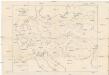
Karte der floss- und schiffbaren Flüsse von Mittel-Europa
1 : 3000000 Evropa střední Jelussig, Othmar Kiepert, Heinrich
Geogr.-physik.-statist. Karte von Deutschland mit Einschluss von ganz Oesterreich, Belgien, den Niederlanden, der Schweiz, Italien und einem Theile von Frankreich, England, Russland und der Türkei
1 : 4110000 Evropa střední a východní Haurand Theobald Grieben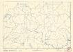
Soubor němých map pro střední školy
Central European states - political.
1 : 3000000 John Bartholomew and Son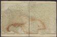
Géographie. croquis n3, Europe centrale
1 : 2500000 Molard, Jules, Commandant [Paris] : Service Géographique de l'Armée
Europe Centrale.
1 : 4100000 Montemont, A.