Maps of Carpathian Mountains
Übersichtskarte der Verbreitung der deutschen Ansiedlung und des deutschen Rechts in Ungarn, Siebenbürgen, Kroatien und Slavonien bis 1763 und in der Walachei und Moldau bis 1774
Ungarn Rumänien Deutsche Ostsiedlung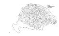
Die Wahlbezirke nach 1878
Ungarn Wahlbezirk
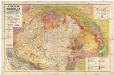
Obščaja karta Vengrii i Transil'vanii
1 : 2700000 Maďarsko Beketov, V.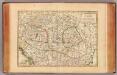
Hongrie, Transilvanie, Esclavonie, Croatie.
1 : 2650000 Janvier, Jean
Ungarn mit seinen Nebenländern und Galizien
1 : 1600000 Dalmácie (Chorvatsko)
Karta teatra vojny v Vengrīi
Ungarn
Tabula generalis regni Hungariae, Croatiae et Slavoniae nec non magni principatus Tranylvaniae
1 : 1400000 Chorvatsko Lipský, Ján Festetis, Georgio
Tabula generalis regni Hungariae, Croatiae et Slavoniae, nec non magni principatus Transylvaniae
1 : 1400000 Chorvatsko Lipský, Ján Festetis de Tolna, Georgio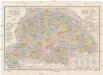
Orts- und Strassenkarte des Königreiches Ungarn
1 : 1296000 Chorvatsko Steinhauser, Anton Artaria
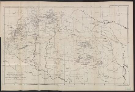
Uibersichts Karte des Kriegsschauplatzes von Ungarn und Siebenbürgen
1 : 1500000 Evropa střední a východní
Südöstliches Central-Europa
Ungarn
Hongrie. Coal Resources of the World.
1 : 1724100 de Pann, Charles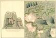
Plan der Bergstadt Terestian
Mollova mapová sbírka Geyer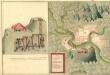
Plan des Gold und Silber Berg Adamos
Mollova mapová sbírka Geyer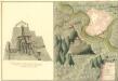
Plan der Bergstat Bogan
Mollova mapová sbírka Geyer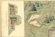
Plan der Bergstadt Abrugbania
Mollova mapová sbírka Geyer
Plaan des Haupt Bergwerg Maidanpeg
Mollova mapová sbírka Geyer
Königreich Hungarn
1 : 1321000 Bukovina (Rumunsko a Ukrajina) Mollo, Tranquillo T. Mollo
Königreich Hungarn
1 : 1321000 Bukovina (Rumunsko a Ukrajina) Mollo, Tranquillo T. Mollo
Uibersichts Karte des Kriegsschauplatzes von Ungarn und Siebenbürgen
1 : 1470000 Maďarsko
Länder der Ungarischen Krone: Ungarn, Siebenbürgen, Slavonien und ein Theil von Kroatien
Handatlas über alle Theile der Erde und über das Weltgebäude Stieler, Adolf Justus Perthes
Magyarország hegy- és vizrajzi térképe
1 : 3500000 Karpaty (pohoří : oblast) Homolka, Josef Posner Károly Lajos és Fia
Donautiefland
Ungarn, Siebenbürgen
Hungary, Transylvania.
1 : 4000000 Bowen, Frances
Allgemeine Postkarte von Ungarn Kroatien, Sklavonien und Siebenbürgen zur Uebersicht
Chorvatsko Benedict, Anton im von Reillyschen Landkarten und Kunstwerke Verschleiss Komptoir
[Ungarn, Siebenbürgen, Woivodina und Slavonien]
Hand-Atlas über alle Theile der Erde und über das Weltgebäude Stieler, Adolf Justus Perthes
Charte von den Kaiserlich Oesterreichischen Ungarischen Ländern
1 : 1200000 entworfen u. gezeichnet von F. W. Streit Weimar : Verlag des Geograph. Instituts
Mappa Potamologica In Qua Fluvii Ac Fluvioli Nominatiores Fere Omnes Qui in Monarchia Hungariae ad Danubium Sive Immediate Sive Mediate Confluunt; Lacus Item Ac Paludes Idea Generali Repraesentantur
1 : 2400000 Mollova mapová sbírka Marsili, Luigi Ferdinando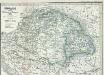
Ungarn seit der Schlacht bei Mohacs 1526
1 : 3700000 Ungarn