Gecatalogiseerde kaart
Kolonie założone za panowania Fryderyka Wielkiego w Prusach Królewskich i w obwodzie nadnoteckim

Volledige titel:Kolonie założone za panowania Fryderyka Wielkiego w Prusach Królewskich i w obwodzie nadnoteckim
Jaar illustratie:1915
Pubdatum:1915
Uitgever:Litogr. Drukerni i Księgarni św. Wojciecha w Poznaniu
Fysieke grootte:20 x 30 cm
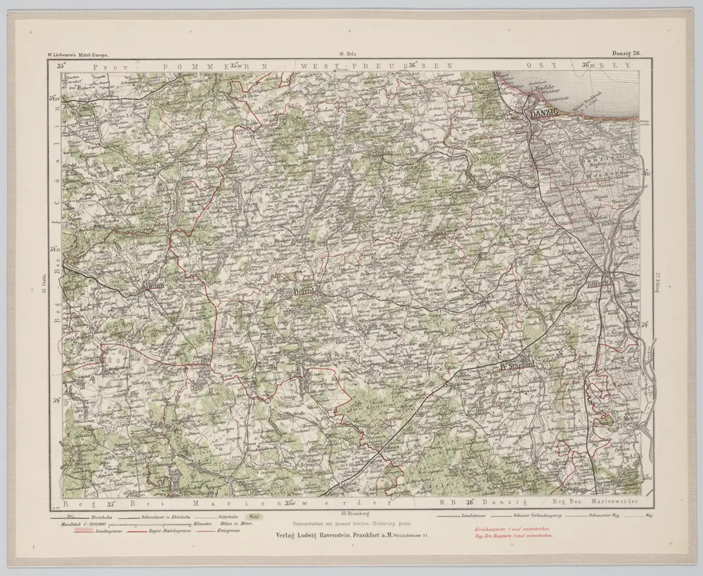
Danzig 26, uit: Special-Karte von Mittel-Europa / nach amtlichen Quellen bearbeitet von W. Liebenow
1899
Johannes Wilhelm Liebenow 1822-1897
1:300k
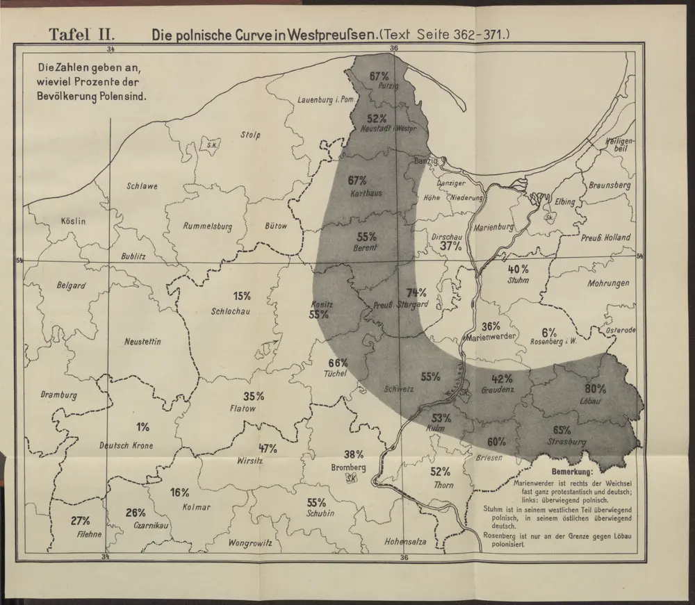
Die polnische Curve in Westpreußen
1910
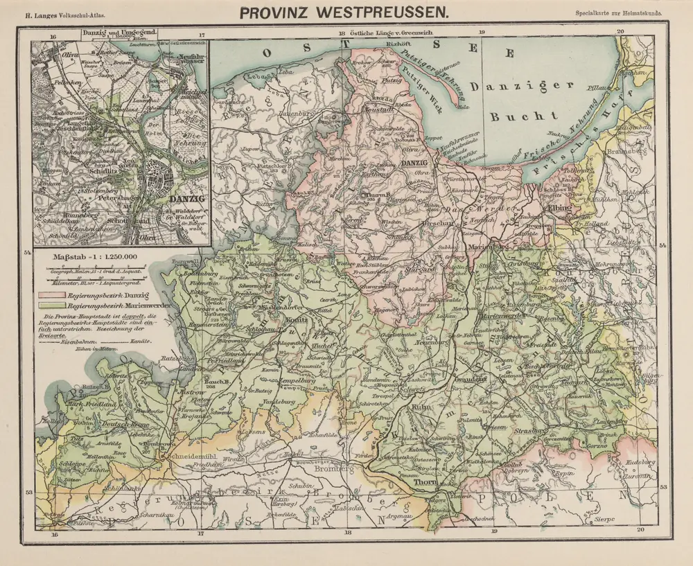
Provinz Westpreussen
1886
1:1m
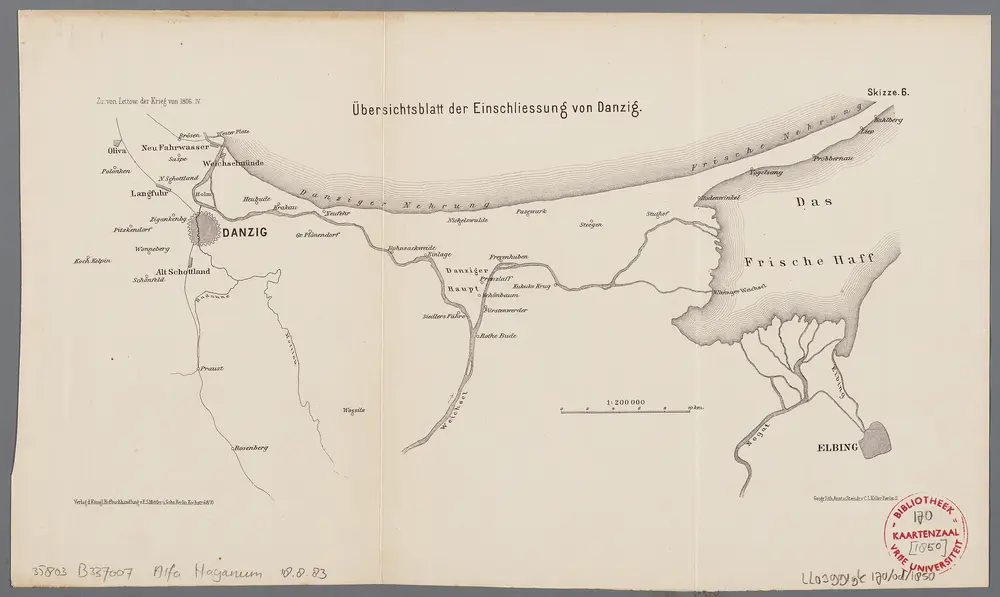
Übersichtsblatt der Einschliessung von Danzig
1896
Berlin : Mittler
1:200k
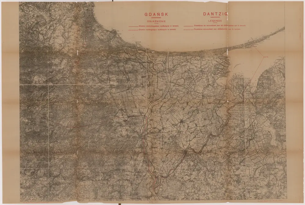
Gdańsk
1919
Wierzbicki, B.
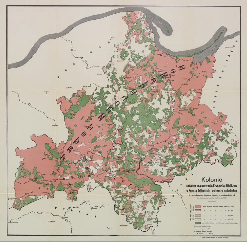
Kolonie założone za panowania Fryderyka Wielkiego w Prusach Królewskich i w obwodzie nadnoteckim
1915
Litogr. Drukerni i Księgarni św. Wojciecha w Poznaniu
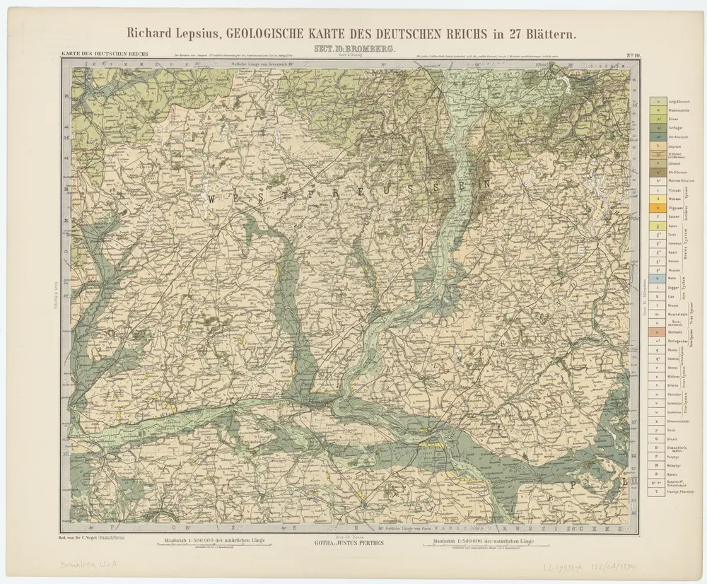
Sect. 10: Bromberg, uit: Geologische Karte des Deutschen Reichs in 27 Blaettern / [von] Richard Lepsius ; Red. von C. Vogel
1894
Carl Vogel 1828-1897
1:500k
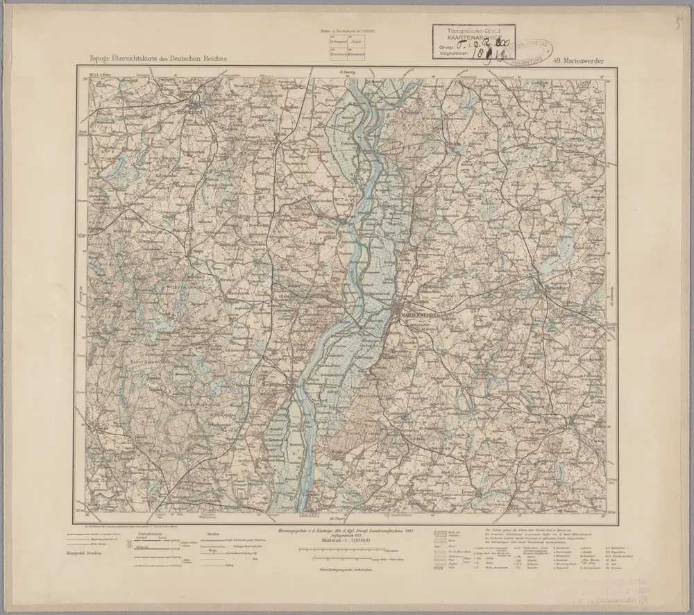
49. Marienwerder, uit: Topographische Uebersichtskarte des Deutschen Reiches / herausgegeben v. d. Kartogr. Abt. d. Königl. Preuß. Landesaufnahme
1899
Königlich Preußische Landesaufnahme. Kartographische Abtheilung
1:200k
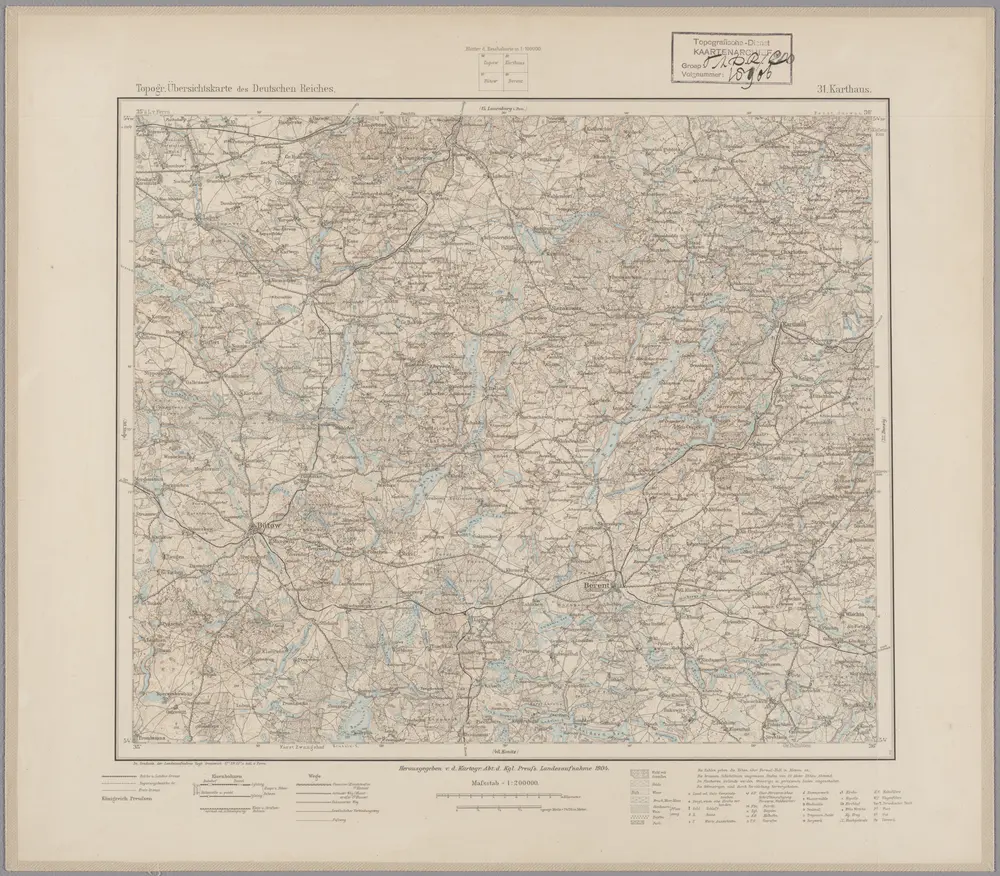
31. Karthaus, uit: Topographische Uebersichtskarte des Deutschen Reiches / herausgegeben v. d. Kartogr. Abt. d. Königl. Preuß. Landesaufnahme
1899
Königlich Preußische Landesaufnahme. Kartographische Abtheilung
1:200k
Danzig, Colberg, Thorn
1918
K. u. k. Militärgeographisches Institut
1:750k