Carte cataloguée
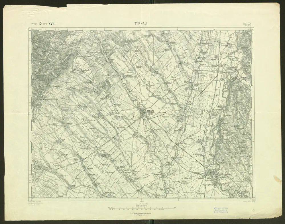
Tyrnau

Titre complet:Tyrnau
Année de l'image:1899
Date de publication:1899
Taille physique:20 x 30 cm
Échelle de la carte:1:75 000
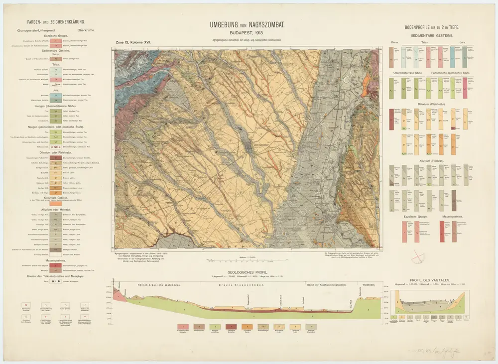
Zone 12, Kolonne XVII, Umgebung von Nagyszombat, uit: [Geologische Specialkarte der im Reichsrathe vertretenen Königreiche und Länder der österreichisch-ungarischen Monarchie] / geologische Aufnahmen der königl. ung. Geologischen Anstalt
1889
Königliche Ungarische Geologische Reichsanstalt; Königliche Ungarische Geologische Anstalt
1:75k
Tyrnau
1899
Geripp: Assist. Scherling. Terrain: Offizial Pflügl
1:75k
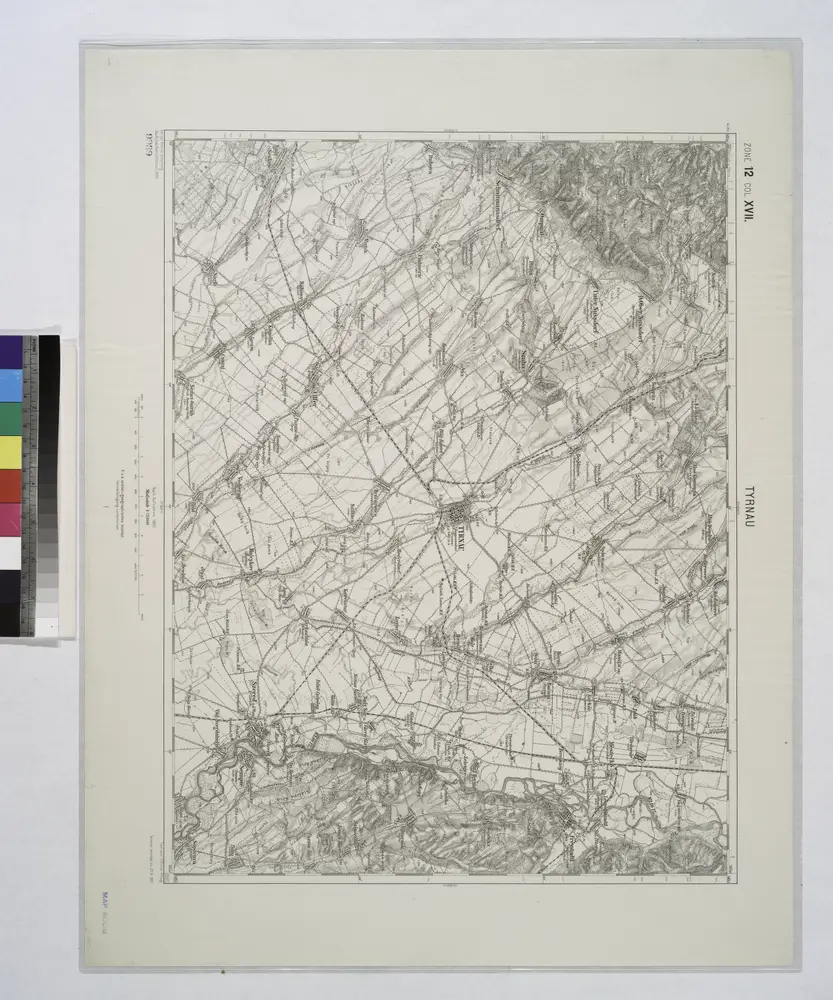
Tyrnau.
1914
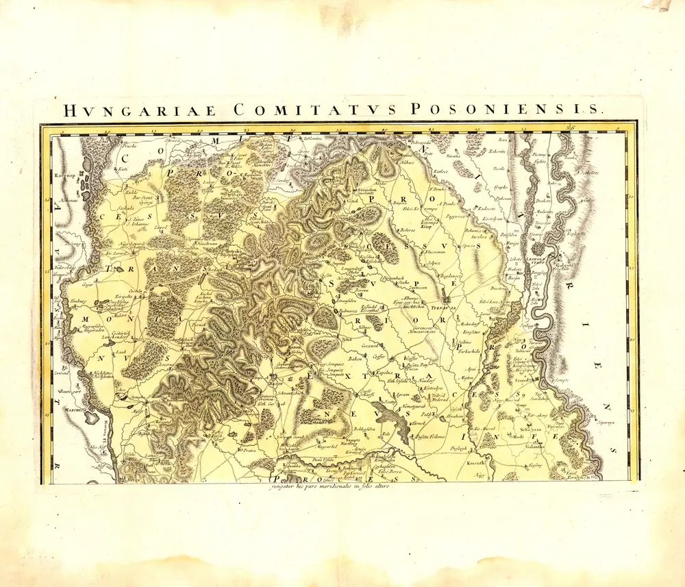
Comitatvs Posoniensis germanis Presbvrg dicti delineatio gegraphica
1757
Mikoviny, Sámuel
n/a
1804
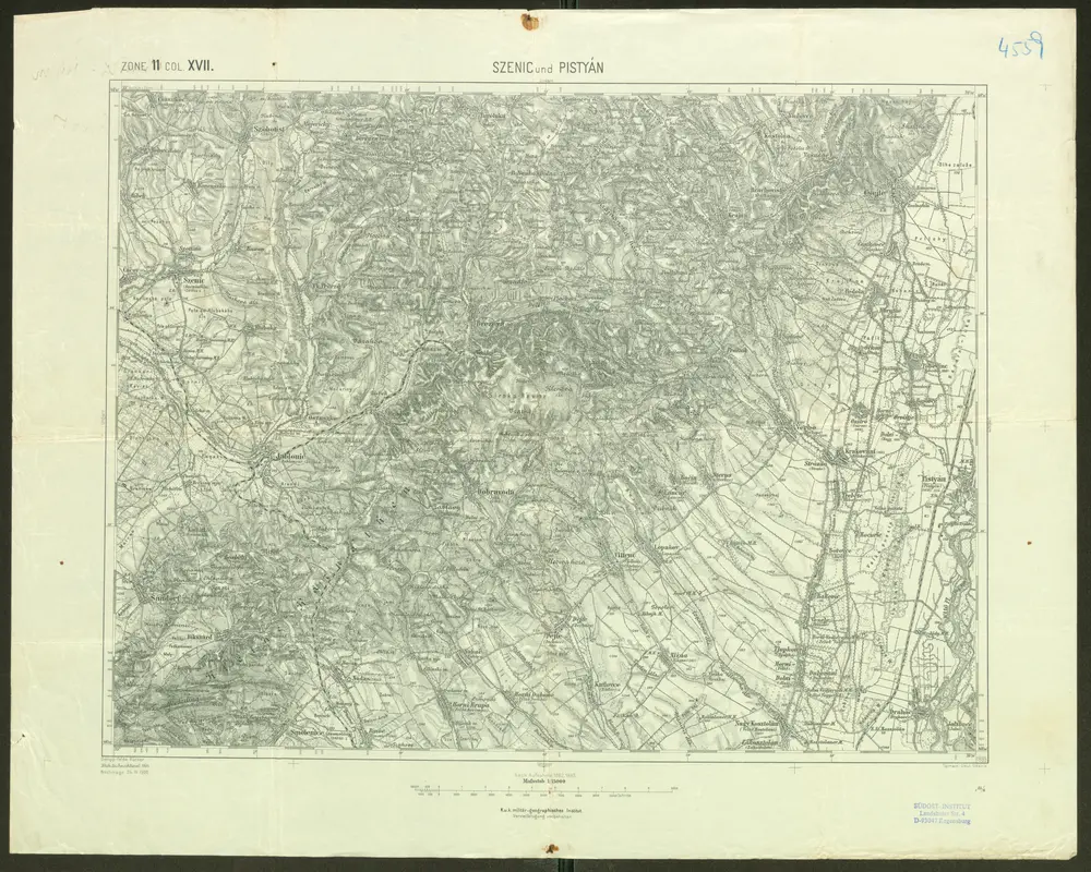
Szenic und Pistyán
1900
Geripp: Feldw. Rücker. Terrain: Lieut. Udalrik
1:75k
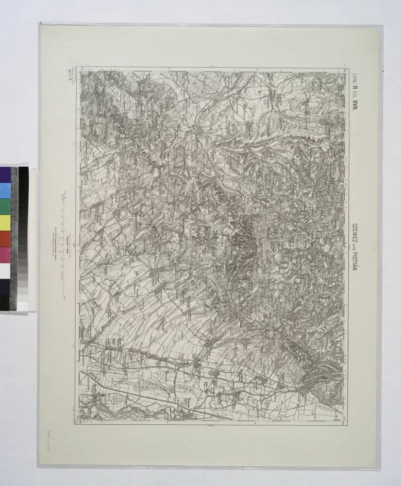
Szencz und Pistyan (Ungarn).
1914
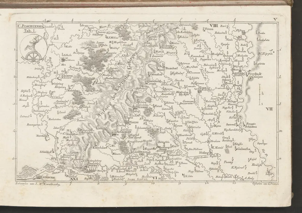
C. Posoniensis. Tab. I
1804
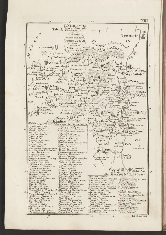
C. Nitriensis. Tab. II
1804
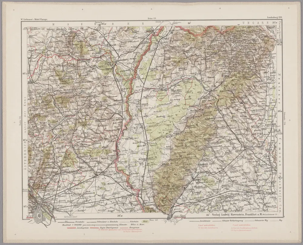
Lundenburg 133, uit: Special-Karte von Mittel-Europa / nach amtlichen Quellen bearbeitet von W. Liebenow
1899
Johannes Wilhelm Liebenow 1822-1897
1:300k