Cataloged map
Asiatisches Rusland
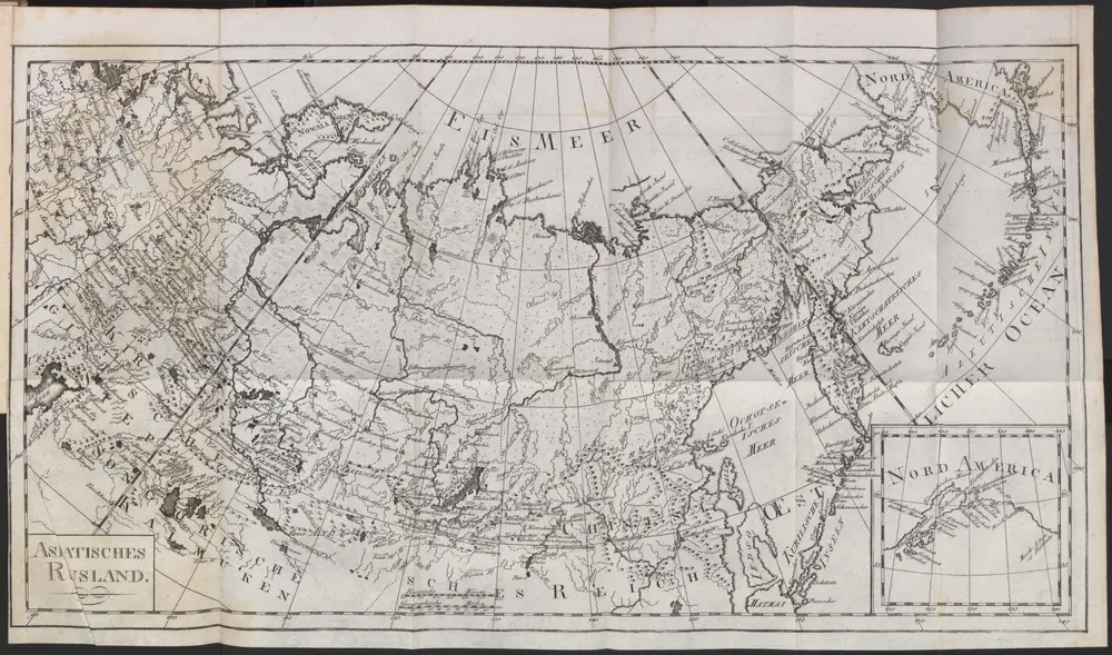

Full title:Asiatisches Rusland
Depicted:1797
Pubdate:1797
Physical Size:20 x 30 cm
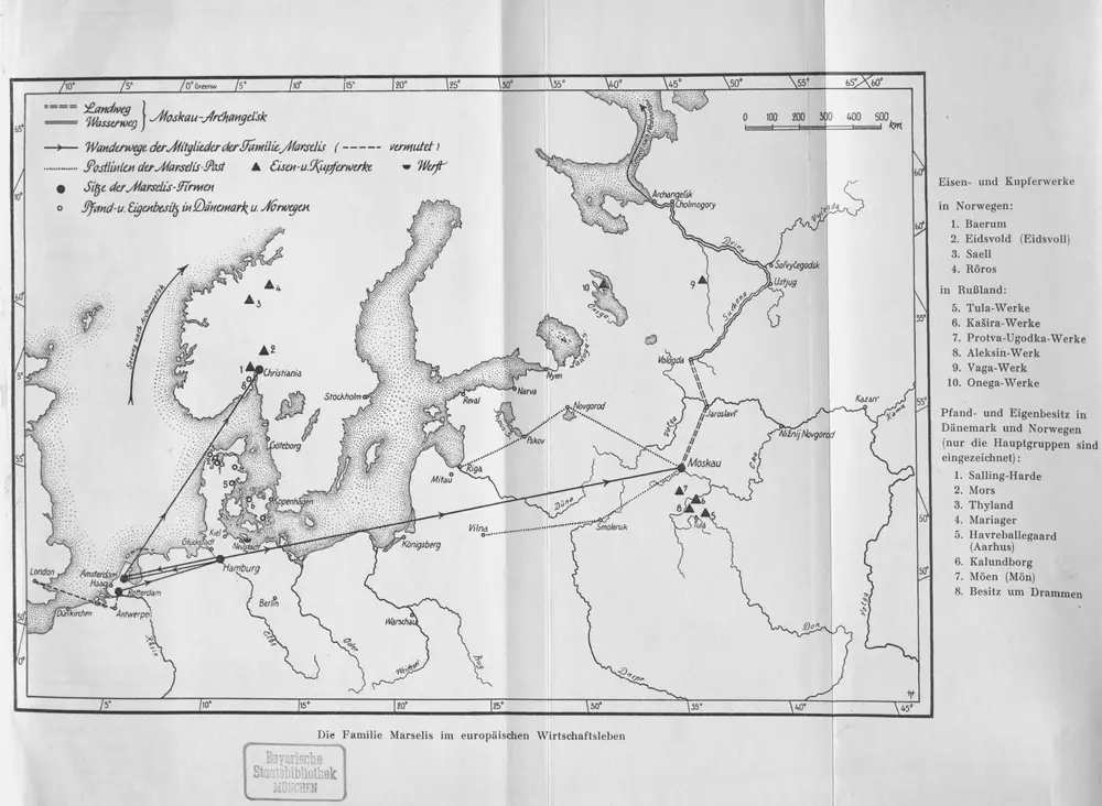
Die Familie Marselis im europäischen Wirtschaftsleben
1957
Russia in Europe / Engd. by J. Moffat, Edinr.
1818
Moffat, John
1:5m
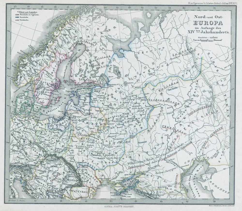
Nord- und Ost-Europa im Anfange des XIVten Jahrhunderts
1300
1:14m
Russia or Moscovy in Europe / T. Kitchin sculp.
1780
Kitchin, Thomas
1:20m
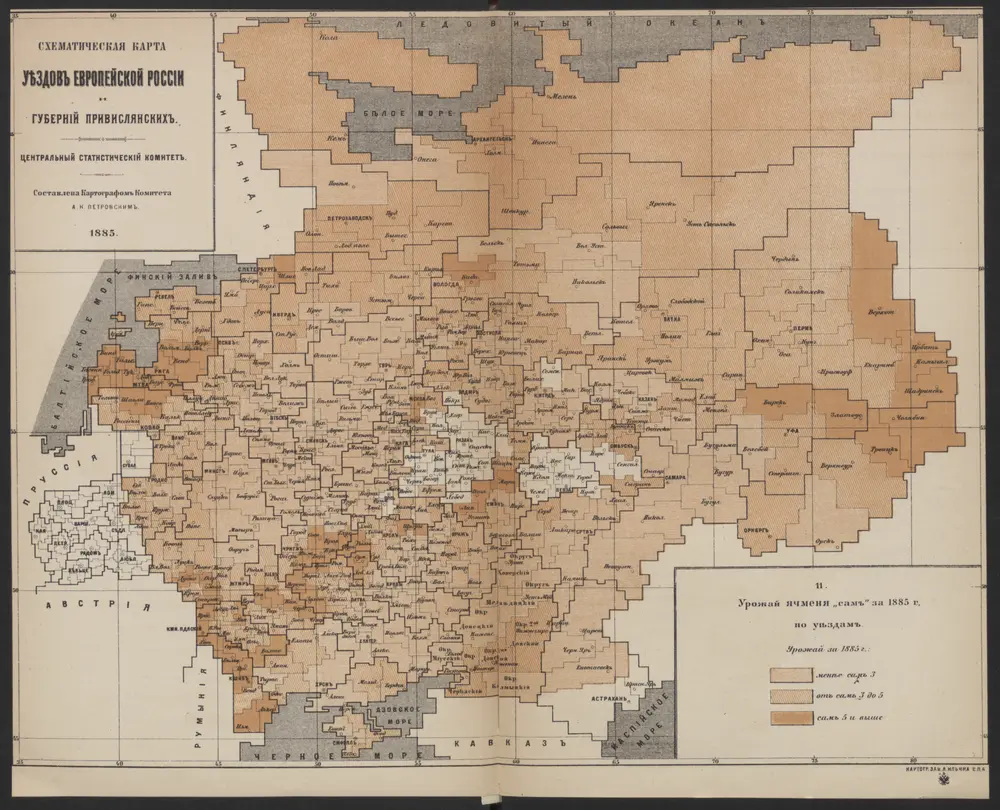
Schematičeskaja karta uězdov evropejskoj Rossīi. Urožaja jačmenja "sam " za 1885 g.
1885
Petrovskij, A.N.
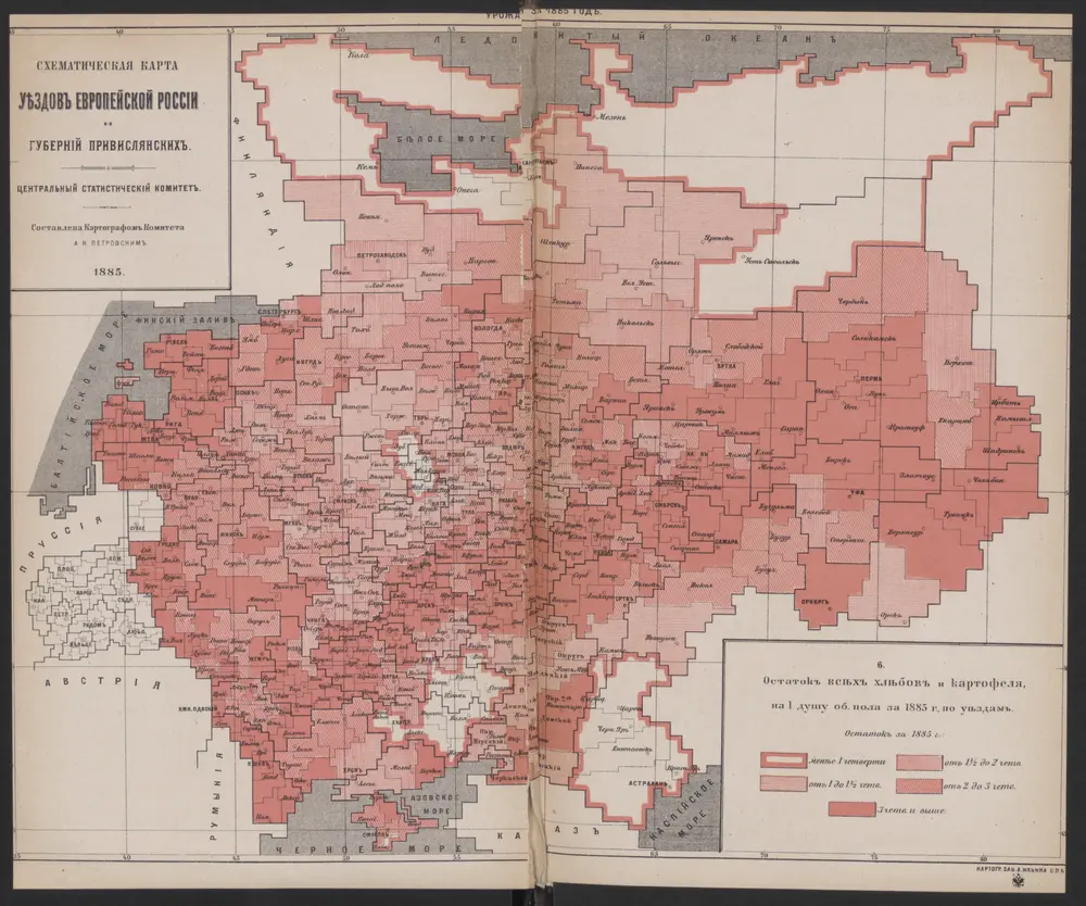
Schematičeskaja karta uězdov evropejskoj Rossīi. Ostatok vsěch chlěbov i kartofelja
1885
Petrovskij, A.N.
Rvssia cum confinijs
1630
Mercator; Hondius
Russia cum confiniis
1630
Mercator, Gerhard
1:23m
Russia cum confiniis
1626
Mercator, Gerhard
1:20m
Russia cum confinijs / per Gerardum Mercatorem
1609
Mercator, Gerhard
1:10m
Russia cum confinijs / per Gerardum Mercatorem
1609
Mercator, Gerhard
1:10m