Maps of Metropolitan France
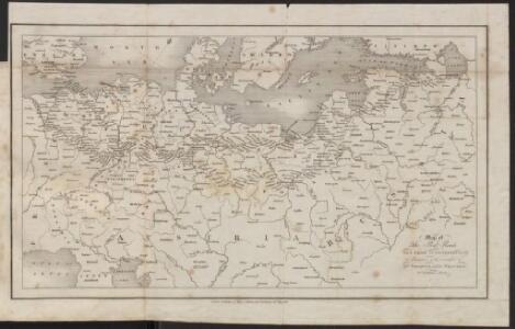
Map of the Post-Route to & from St. Petersburgh
1 : 24000000 Osteuropa Deutschland Polen Russland Reiseweg Postroute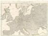
Wege-Karte durch den grösten und wichtigsten Theil Europa's
Evropa Schmidt, Johann Marius Friedrich Kliewer, Heinrich Simon Schropp et Comp.
Bez titulu: Povětrnostní mapa Střední Evropy
Die Karte von Europa...
Die Karte von Europa...

Carte des états slaves rendus indépendants par Samo, et groupés autour de lui (an 625 à 650), en face du royaume réduit des Avars, enserré à l’est par les Khazars et les Bulgares, et au sud et à l’ouest par les Slaves que l’empereur Héraclius avait établis au sud du Danube
Ostmitteleuropa Tschechische Republik Slawen Awaren Samo
29. Mitteleuropa im Jahre 1650
Mitteleuropa
Part of Europe.
1 : 7200000 Cornell, S. S. (Sarah S.)
Vorstellvng der Sonnen- oder Erd Finsternis den 25 Jul. 1748
1 Karte : Kupferdruck ; 23 x 33 cm, Bildgrösse 48 x 56 cm Lowitz; Dorn Homännische Erben
Vorstellvng der Sonnen- oder Erd Finsternis den 25 Jul. 1748
1 Karte : Kupferdruck ; 23 x 33 cm, Bildgrösse 48 x 56 cm Lowitz; Dorn Homännische Erben
Schiffbare Wasserstrassen in Mitteleuropa
1 : 15000 Evropa střední Oelwein, A.
Carte genérale et itineraire de l'Europe
1 : 2300000 Evropa Traux, Maximilian de Schwarzenberg, Karel Filip Artaria
30. Mitteleuropa nach Beendigung des nordischen Krieges im Jahre 1721
Mitteleuropa, Ostmitteleuropa, Nordischer Krieg <1700-1721>
Polen, Litthauen und das Gebiet des deutsche Ordens in den Jahren 1386 - 1480
1 : 6000000 Polen-Litauen, Preußen (Ordensstaat)
Evropa
1 : 5000000 Evropa V. Neubert
Octava Europe Tabula. [Sarmatia Europe] [Karte], in: Claudii Ptolemei viri Alexandrini mathematice discipline philosophi doctissimi geographie opus [...], S. 172.
1 Karte aus Atlas Waldseemüller, Martin [und Ptolemaeus, Claudius] Übelin, Georg
Strassenkarte des Bezirkes Joslowitz

Carte des chemins de fer de l'Europe, uit: Carte des chemins de fer de la Belgique
1 : 370000 [Bruxelles : Ministère des Chemins de Fer, Postes et Télégraphes]
[Evropa - politická mapa]
1 : 3000000 Evropa Paulík, Antonín Klus, František
Nová mapa vysílacích stanic Evropy
Evropa Hlaváček, Josef Orbis
La Germanie à l’époque des invasions des Cimbres et des Teutons à travers l’Europe
Mitteleuropa Germanien Kimbern Teutonen Augustus
Compagnie Internationale des Wagons-lits et des Grands Express européens
1 : 4500000 Evropa L. Hermann
32. Mitteleuropa nach dem Reichsdeputationshauptschluss im Jahre 1803
Mitteleuropa Reichsdeputationshauptschluss
Evropa
Evropa
1 : 5000000 Evropa
Porostní mapa revíru Srbice
1 : 2880
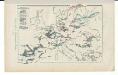
Kriegszusammenhänge III (1700 - 1721)
1 : 20000000 Europa Nordischer Krieg <1700-1721>, Türkenkriege
Carte Routiere et Postale de la France
Germany.
from A new sett of maps both of antient and present geography : wherein not only the latitude and longitude of many places are corrected according to the latest observations, but also the most remarkable differences of antient and present geography may be quickly discern'd by a bare inspection or comparing of correspondent maps, which seems to be the most natural and easy method to lead young students (for whose use the work is principally intended) unto a competent knowledge of the geographical science : together with a geographical treatise particularly adapted to the use and design of these maps / by Edward Wells, M.A. and student of Christ-Church, Oxon.