编目地图
Der Südliche Theil Des Koenigreichs Albanien mit der Landschaft Thessalien
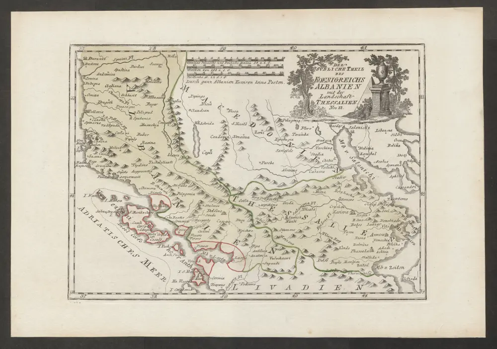

完整标题:Der Südliche Theil Des Koenigreichs Albanien mit der Landschaft Thessalien
物理尺寸:20 x 30 cm
地图比例尺:1:1 300 000
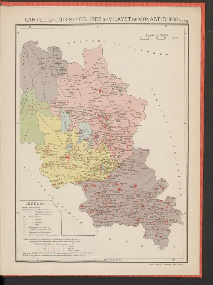
Carte des écoles et églises du vilayet de Monastir (1908)
1908
Kümmerly & Frey
Elbasan, Argyrokastron, Joannina, Corfu, Philiataes
1918
K. u. k. Militärgeographisches Institut
1:750k
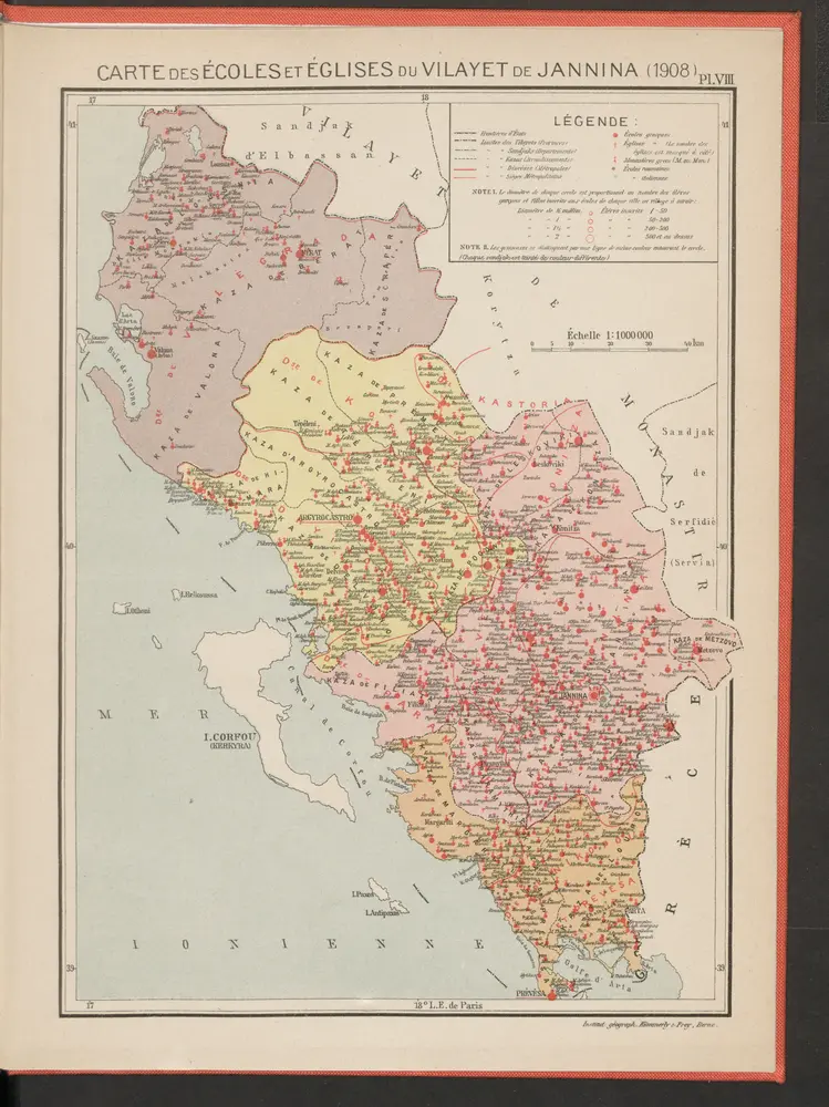
Carte des écoles et églises du vilayet de Jannina (1908)
1908
Kümmerly & Frey
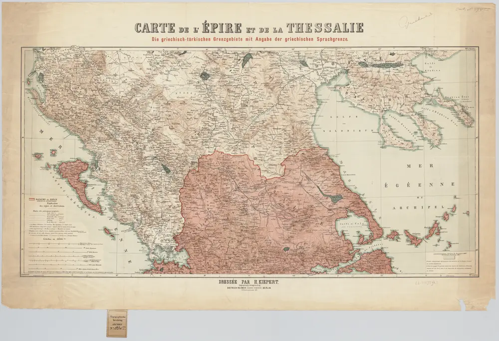
Carte de l'Épire et de la Thessalie : die griechisch-türkischen Grenzgebiete mit Angabe der griechischen Sprachgrenze / dressée par H. Kiepert
1897
Johann Samuel Heinrich Kiepert 1818-1899
1:500k
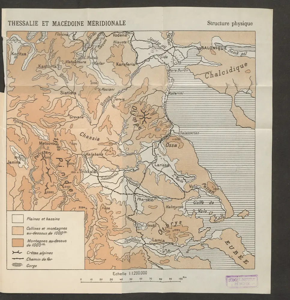
Thessalie et Macédoine méridionale
1915
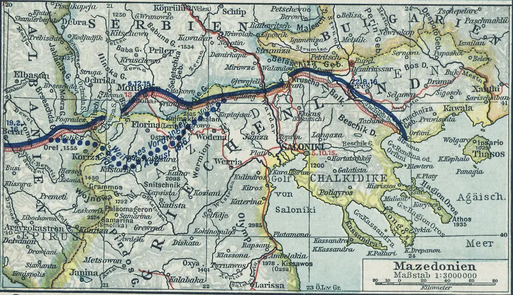
Mazedonien
1916
1:3m
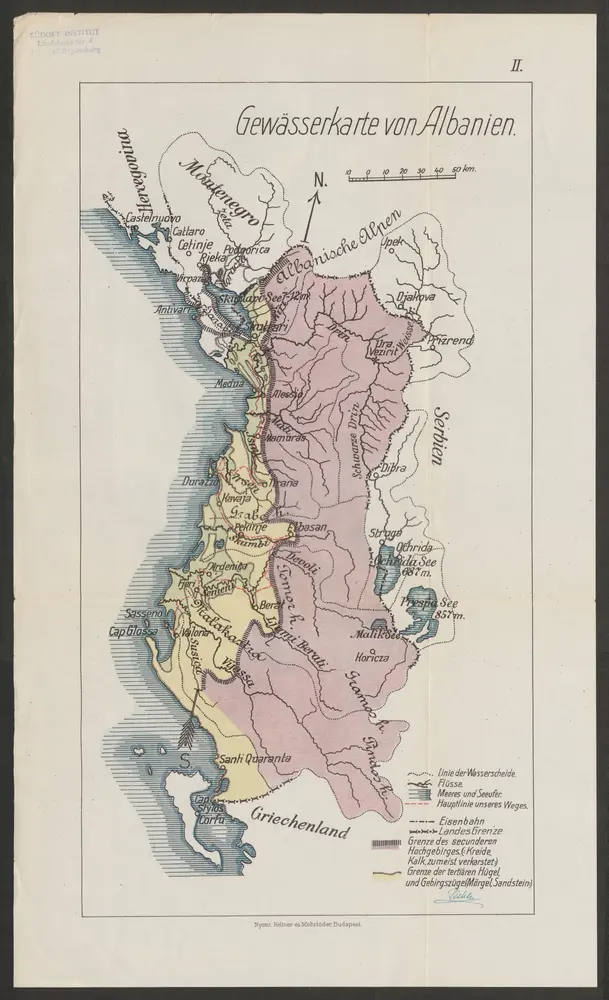
Gewässerkarte von Albanien
1914
Péch, Béla
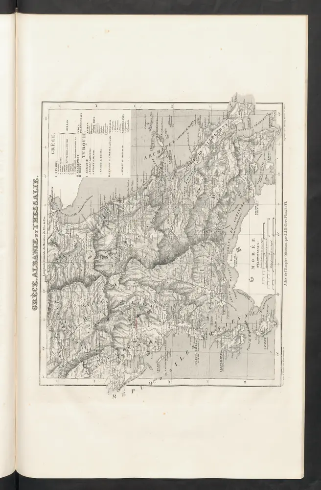
Grèce, Albanie et Thessalie
1844
Hellert, J.J.
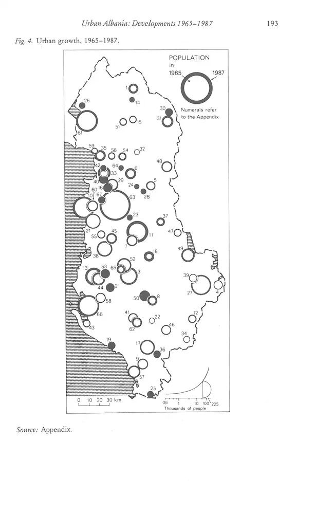
Urban Growth, 1965-1987
1987
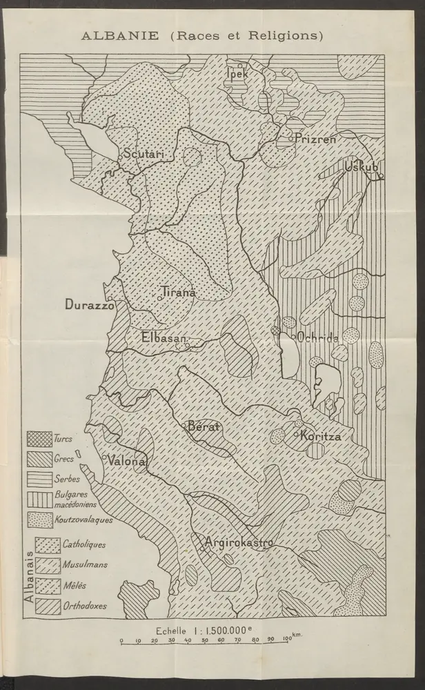
Albanie (Races et Religions)
1915