Maps of Burkina Faso

Maps of Burkina Faso

$title$

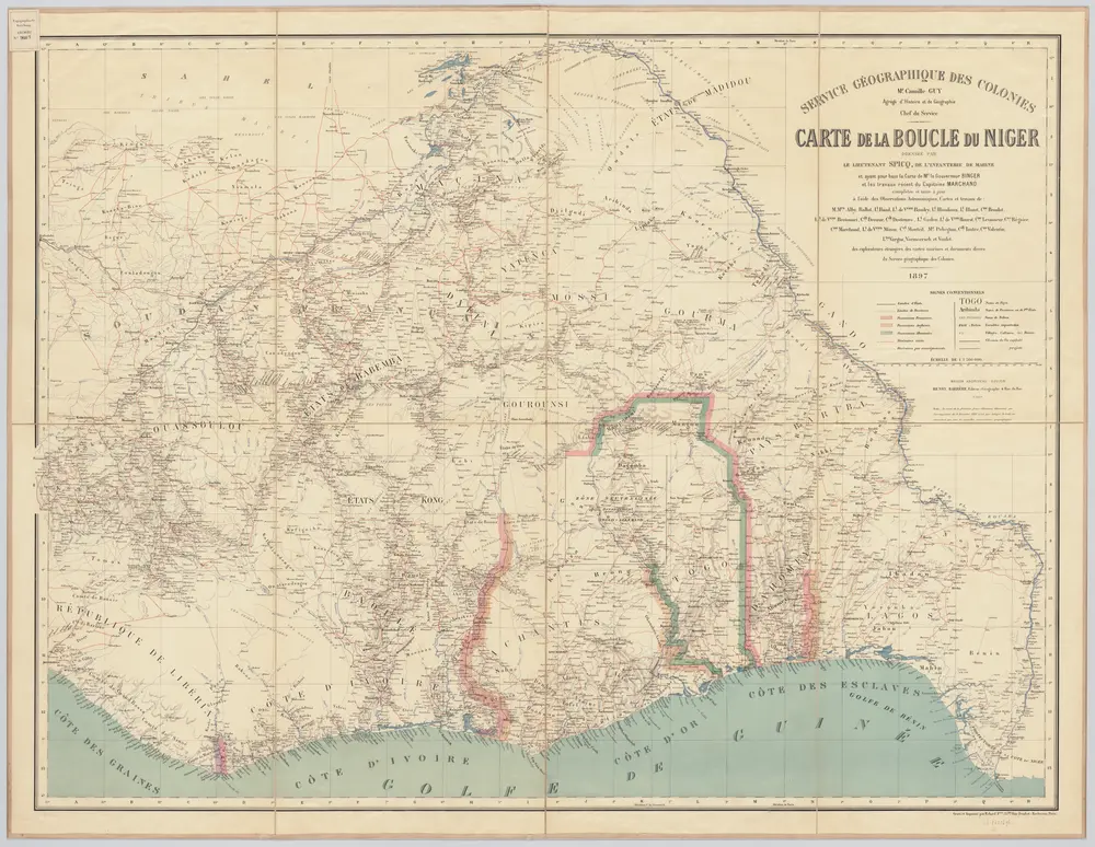
Carte de la boucle du Niger / dressée par Spicq ; Service Géographique des Colonies

1 : 1500000 Annotatie: Met Index alfabetique (76 p.) Henri Eugène Spicq; Service Géographique des Colonies Paris : Maison Andriveau-Goujon, Henri Barrère
$title$

Senegambien, Goldkuste, Kapland.

1 : 8000000 Andree, Richard
$title$

Western Africa.

1 : 3300000 Pinkerton, John, 1758-1826
$title$

West Africa I.

1 : 5600000 Society for the Diffusion of Useful Knowledge (Great Britain)
$title$

West-Africa, Senegambien, Ober-Guinea.

1 : 6000000 Radefeld, Carl Christian Franz, 1788-1874
$title$

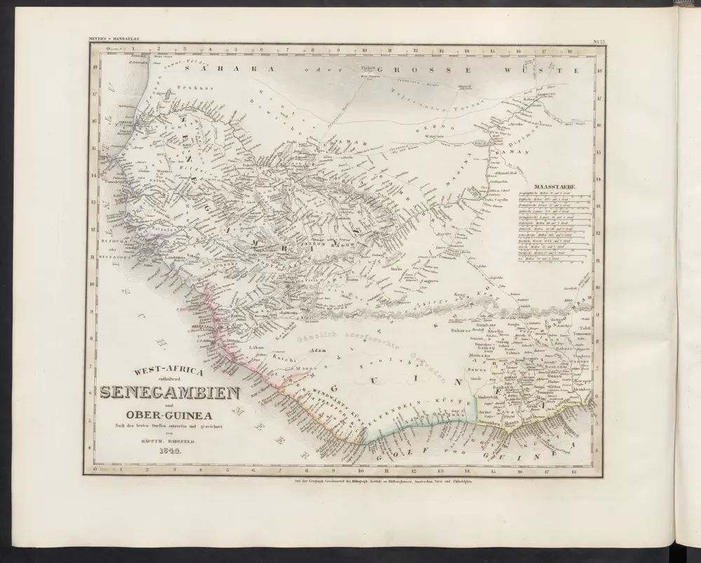
West-Africa enthaltend Senegambien und Ober-Guinea

Grosser Hand-Atlas über alle Theile der Erde in 170 Karten Meyer, J. Verlag des Bibliographischen Instituts
$title$

166. West Africa, South. The World Atlas.

1 : 3750000 USSR (Union of Soviet Socialist Republics).
$title$

Carte de l'Afrique occidentale française. Bingerville, Porto-Novo

1 : 2000000 France. Service géographique des colonies [Paris] : Service géographique des colonies
$title$

The West Coast of Africa.

1 : 3400000 Arrowsmith, John
$title$

Carte des possessions anglaises et françaises sur le Golfe de Guinée

1 : 4600000 Paris : impr. de F. Menetrier
$title$

Odumase und Aussenstationen

$title$

Carte de l'Afrique occidentale française. Tombouctou

1 : 2000000 France. Service géographique des colonies [Paris] : Service géographique des colonies
$title$

Carte de l'Afrique occidentale française. Tombouctou

1 : 2000000 France. Service géographique des colonies [Paris] : Service géographique des colonies
$title$

Mission du Commandant Decoeur entre le Dahomey et le Niger

1 : 100000 Decoeur [Paris] :
$title$

Togo

$title$

Partie, la Guinee. Afrique 27.

1 : 1641836 Vandermaelen, Philippe, 1795-1869
$title$

Carte géologique de l'Afrique occidentale française au 1 000 000e

1 : 1000000 Francouzská západní Afrika Hubert, Henry Émile Larose
$title$

Carte administrative de la Côte d'Ivoire. Répartition des cercles au 1er janvier 1909

1 : 2000000 Afrique occidentale française. Service géographique
$title$

The Gold Coast with Togoland under British Mandate

Huppenbauer
$title$

Die Goldküste und Togo. Uebersichtskarte mit den Missionsstationen der Basler- und der Norddeutschen Missionsgesellschaft

$title$

Die Goldküste und Togo.

$title$

Bambara. Afrique 20.

1 : 1641836 Vandermaelen, Philippe, 1795-1869
$title$

Eastern District of the Gold Coast. The Head-Stations and the Out-Stations of the Basel Mission are underlined

$title$

Die Missionen auf der Gold-Küste und Sklaven-Küste

$title$

Partie, la Guinee. Afrique 28.

1 : 1641836 Vandermaelen, Philippe, 1795-1869
$title$

Carte géologique de l'Afrique occidentale française au 1 000 000e

1 : 1000000 Burkina Faso Hubert, Henry Émile Larose
$title$

Een gedeelte van de kust van Gunea van Accara tot C. Formosa vertoonende de Bogt van Benin

Ghana Gerard van Keulen
$title$

Kaart van de Goud-Kust of Kust van Guinea / door Js. van den Bosch ; gegraveerd door C. van Baarsel en Zoon

C. van Baarsel en Zoon s-Gravenhage ; Amsterdam : Gebroeders van Cleef
$title$

Map of the Gold Coast : to accompany Dr. Madden's report

1 : 1250000 John Arrowsmith, lith. [London] : James & Luke J. Hansard, printers
$title$

Mohamm. Händler auf der Goldküste

© MapTiler © OpenStreetMap contributors
How does it work?
These instructions will show you how to find historical maps online.
Getting started
Type the place name in the search box to find the exact location. You can further adjust the search by zooming in and out.
Zoom
Zoom in and out with the buttons or use your mouse or touchpad natively.
Exact Area tool
Click here and draw a rectangle over the map to precisely define the search area.
Set filters
Narrow your search with advanced settings, such as Years (from/to), Fulltext, Publisher, etc.
Results
See the results of your search on the right side. You can scroll down to find more maps of this location.
?

Download OldMapsOnline Mobile