Mapa catalogado
Carte générale des provinces européennes et asiatiques de l'Empire Ottoman, uit: Carte générale des provinces européennes et asiatiques de l'Empire Ottoman (sans l'Arabie) / dressée par Henri Kiepert ; le trait et la lettre gravés chez L. Kraatz ; le figure du terrain gravé par J. Sulzer


Título completo:Carte générale des provinces européennes et asiatiques de l'Empire Ottoman, uit: Carte générale des provinces européennes et asiatiques de l'Empire Ottoman (sans l'Arabie) / dressée par Henri Kiepert ; le trait et la lettre gravés chez L. Kraatz ; le figure du terrain gravé par J. Sulzer
Año de ilustración:1892
Editorial:Berlin : Dietrich Reimer (Hoefer u. Vohsen) / ([S.l. : L. Kraatz])
Tamaño físico:20 x 30 cm
Escala del mapa:1:3 000 000
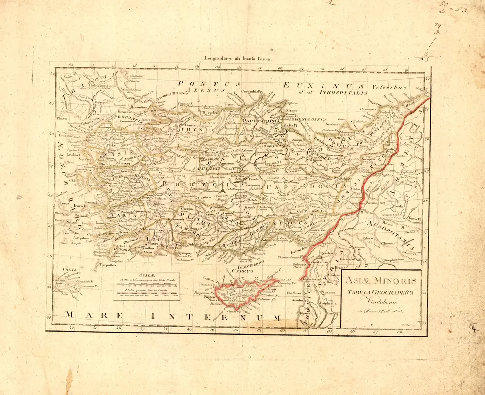
Asiae minoris tabula geographica
1815
in Officina J. Riedl
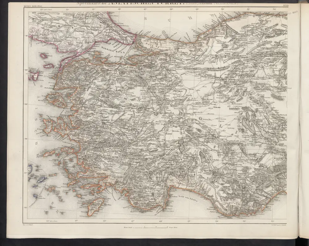
[Specialkarte der Asiatischen Türkey, I. Blatt; Anadoli (Kleinasien)]
1860
Meyer, J.
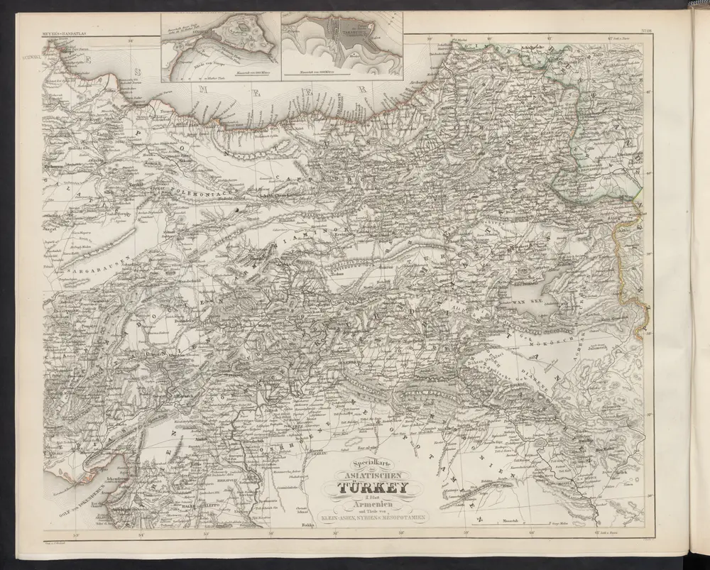
[Specialkarte der Asiatischen Türkey, II. Blatt, Armenien und Theile von Klein-Asien, Syrien & Mesopotamien]
1860
Meyer, J.
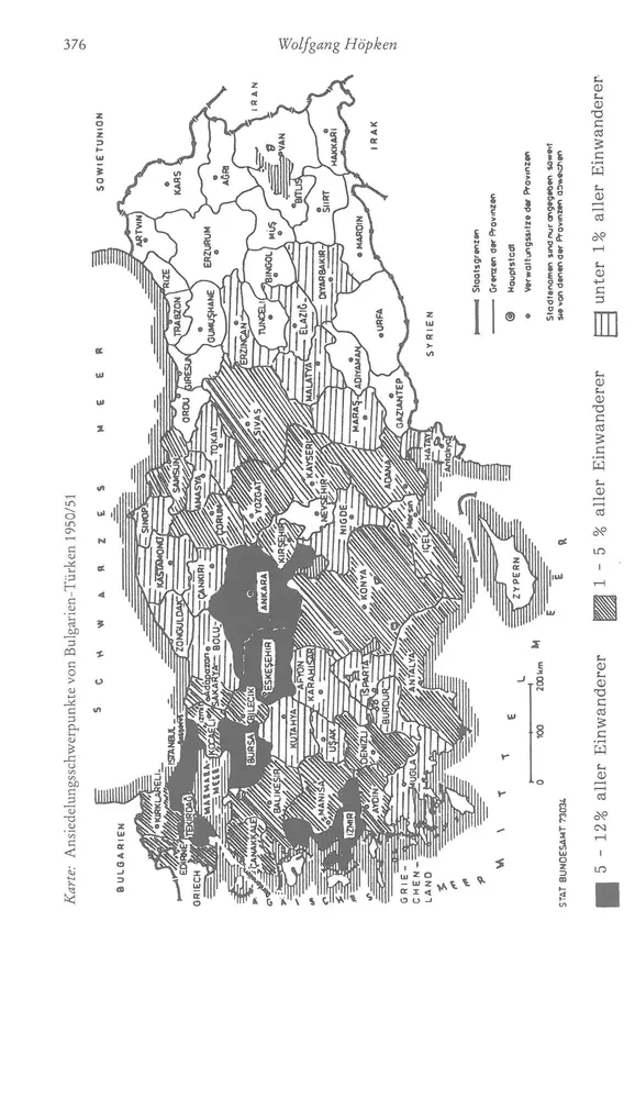
Ansiedelungsschwerpunkte von Bulgarien-Türken 1950/51
1951
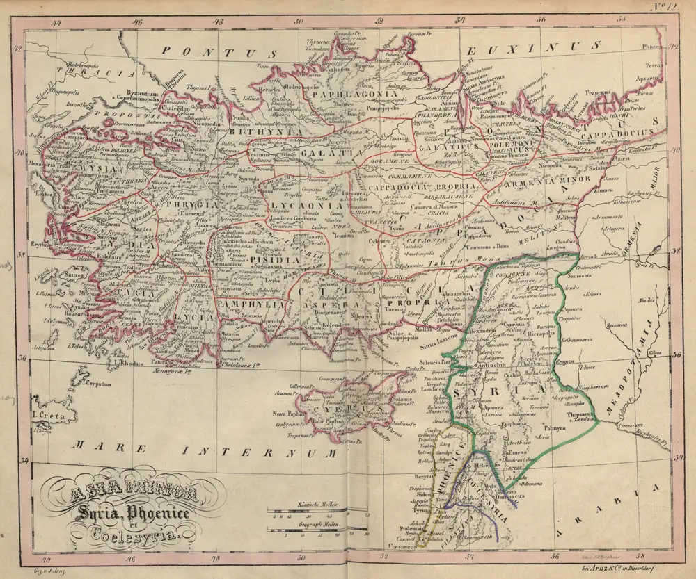
Asia Minor, Syria, Phoenice et Coelesyria
1843
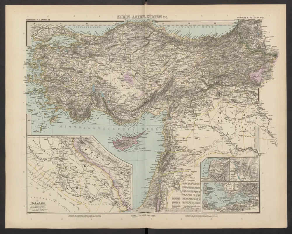
Klein-Asien, Syrien & c.
1892
Stieler, Adolf
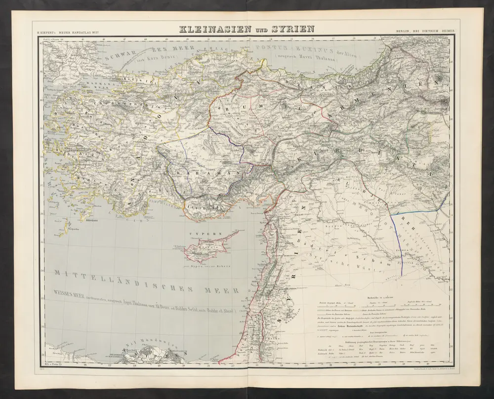
Kleinasien und Syrien
1860
Kiepert, Heinrich
Kleinasien
1901
Bibliographisches Institut
1:5m

Asia Minor et Syria
1838
bei Justus Perthes
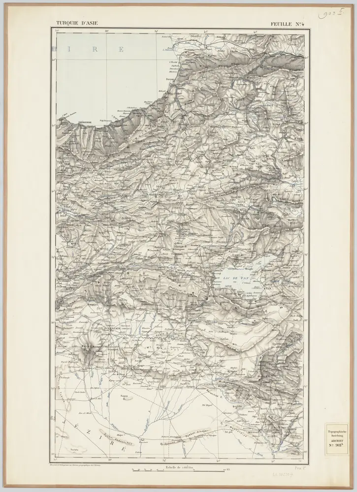
Feuille No. 4, uit: Carte de la Turquie d'Asie (moins l'Arabie) / dessiné et héliogravé au Service géographique de l'Armée
1897
Service géographique de l'Armée
1:1m