Mapa catalogado
Section Weilburg, uit: Charte von dem Grossherzogtum Hessen und dem Herzogtum Nassau / trigonometrisch aufgenommen und hrsg. von C.L.P. Eckhardt

Título completo:Section Weilburg, uit: Charte von dem Grossherzogtum Hessen und dem Herzogtum Nassau / trigonometrisch aufgenommen und hrsg. von C.L.P. Eckhardt
Año de ilustración:1818
Editorial:Darmstadt : Joh. Wilh. Heyer
Tamaño físico:20 x 30 cm
Escala del mapa:1:200 000
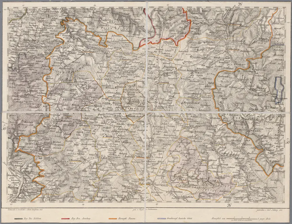
161 Coblenz, uit: Topographische Special-Karte von Deutschland (von Central-Europa) / begründet von D.G. Reymann ; [entworfen und gezeichn. von Heinrich Berghaus... [et al.]]
1816
Reymann, Daniel Gottlob; Berghaus, Heinrich
1:200k
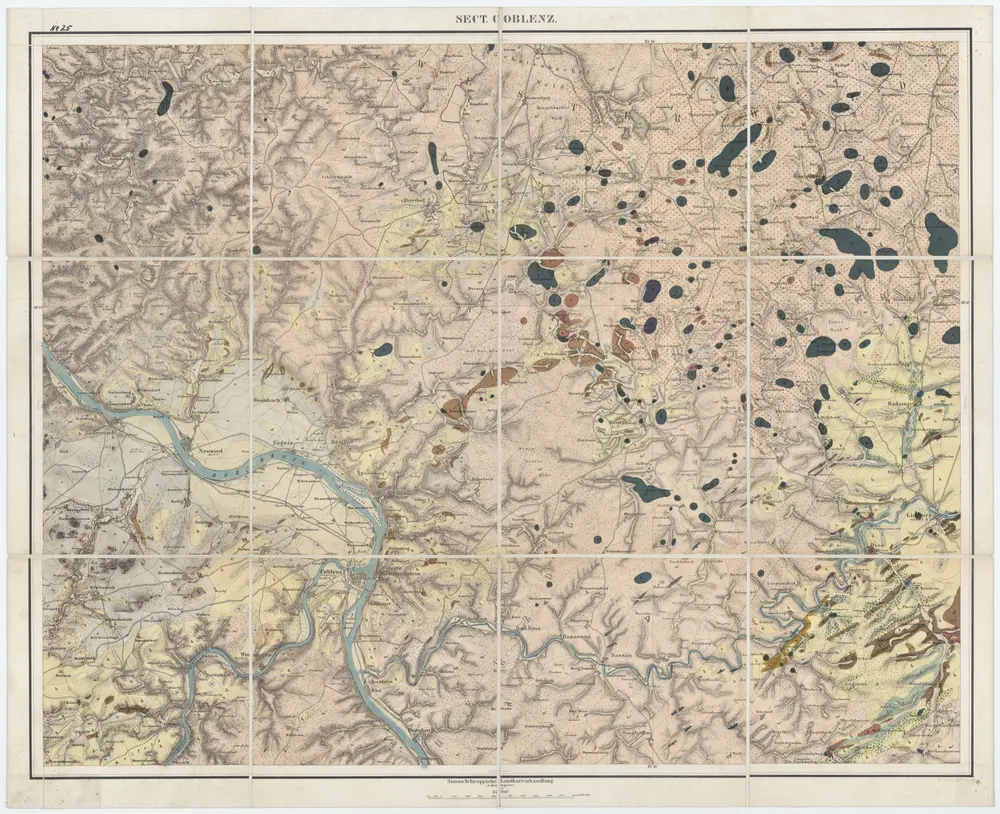
[25] Sect. Coblenz, uit: Geologische Karte der Rheinprovinz und der Provinz Westphalen / ausgeführt durch H. von Dechen
1855
Heinrich von Dechen
1:80k
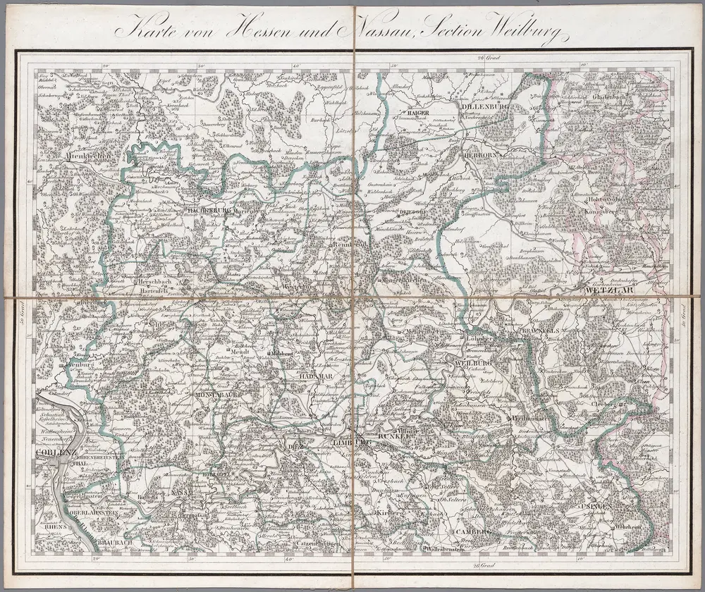
Section Weilburg, uit: Charte von dem Grossherzogtum Hessen und dem Herzogtum Nassau / trigonometrisch aufgenommen und hrsg. von C.L.P. Eckhardt
1818
Eckhardt, C. L. P
1:200k
Meßtischblatt 3217 : Meudt, 1907
1907
1:250k
Meßtischblatt Girod
1877
1:250k
Meßtischblatt 3216 : Montabaur, 1902
1902
1:250k
Meßtischblatt 3216 : Montabaur, 1896
1896
1:250k
Meßtischblatt 3161 : Westerburg, 1935
1935
1:250k
Meßtischblatt 3160 : Selters, 1877
1877
1:250k
Meßtischblatt Marienberg
1927
1:250k
Meßtischblatt 3102 : Marienberg, 1907
1907
1:250k
Meßtischblatt 3102 : Marienberg, 1886
1886
1:250k