编目地图
[Kaart], uit: Ezo kōkyō yochi zenzu

完整标题:[Kaart], uit: Ezo kōkyō yochi zenzu
描述:1854
出版商:Edo : Harimaya Katsugorō
物理尺寸:20 x 30 cm
地图比例尺:1:1 200 000
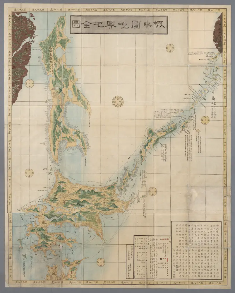
[Kaart], uit: Ezo kōkyō yochi zenzu
1854
Edo : Harimaya Katsugorō
1:1m
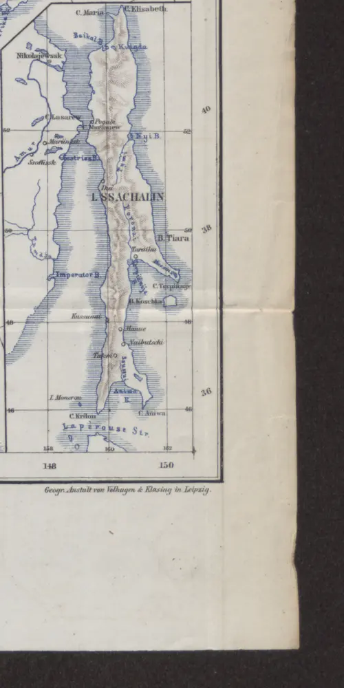
[Nebenkarte : Sachalin]
1874
Charte von der Nordwestküste Americas nach Vancouver
1818
Martius, C. von
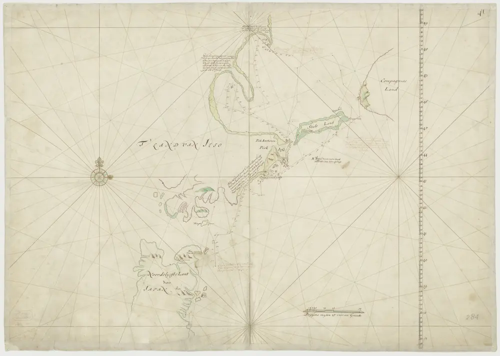
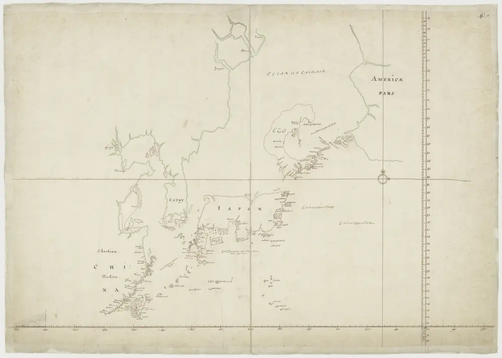
Kaart van het Noordoostelijke deel van Japan met de reis van Commandeur Fries
1643
Maarten Gerritsz. Fries
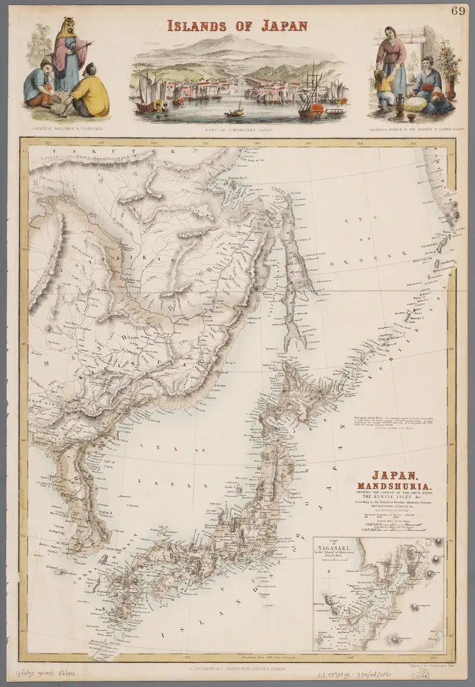
Japan, Mandshuria (showing the course of the Amur river), the Kurile Isles &c. : according to the British & Russian Admiralty surveys, Krusenstern, Siebold &c. / by J. Bartholomew Jun.r ; engraved by J. Bartholomew
1860
Bartholomew, John (1831-1893)
1:9m
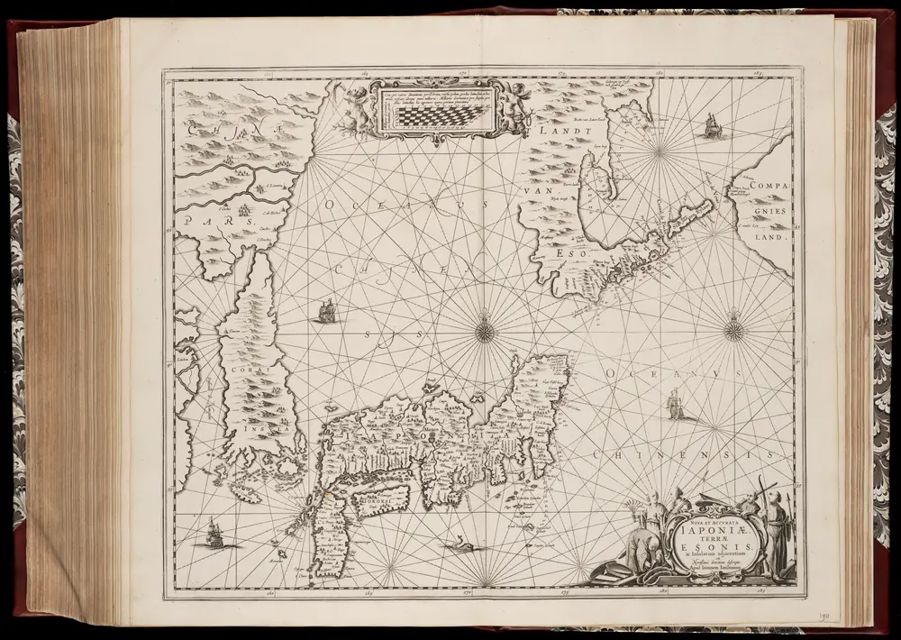
Nova et accvrata Iaponiæ, Terræ Esonis ac insularum adjacentium ex novißima detectione descriptio
1658
Johannes Janssonius 1588-1664
1:5m
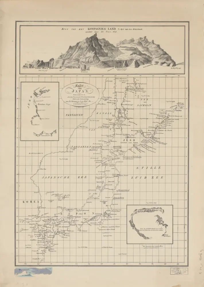
Kaart van Japan / [getekend door] R. van Wijk
1828
Dordrecht : J. de Vos
中俄交界詳圖 (第六幅)
1910
武昌:武昌亞新地學社
1:14m
Kaart van Japan, Korea en West-Amerika
1700
Map of the Japan Islands
1855
Maury, William L
1:7m