Maps of Luthern

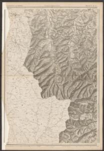
Topographische Karte des Kantons Luzern
1 : 25000 Blatt 5 H. Müllhaupt u. Sohn H. Müllhaupt u. Sohn
Übersichtskarte zum Marsch der Berner Reservedivision durchs Entlibuch am 22ten und 23ten November 1847
1 : 40000 1 Karte Lithog. von F. Bruder in Basel [Friedrich Schulthess], [Zürich]
Canton Lucern sive illustris helvetiorum respublica Lucernensis cum subditis suis et confinibus
1 Karte : Kupferdruck ; 46 x 55 cm Walser edentibus Homannianis Heredibus
Canton Lucern sive illustris helvetiorum respublica Lucernensis cum subditis suis et confinibus
1 Karte : Kupferdruck ; 46 x 55 cm Walser edentibus Homannianis Heredibus
Die Gegend um Lucern
1 : 300000 Mollova mapová sbírka Bodenehr, Gabriel Bodenehr, Gabriel
[Malerisches Relief der Schweizer- und angränzenden Alpen]
1 : 135000 11 Vogelschaukarten Nach der Natur aufgenommen und gezeichnet von F.W. Delkeskamp ; gestochen v. Knopfmacher u. J.Ph. Dauch [Friedrich Wilhelm Delkeskamp], [Frankfurt am Main]
Canton inter catholicos primaria, sive illustris Helvetiorum respublica Lucernensis cum subditis suis et confinibus
1 Karte : Kupferdruck ; 48 x 56 cm Walser; Seutter Albrecht Carl Seutter
Bern, das Entlibuch, die Thäler der Emme, Ilfis, Aare und Sense
Bern (Švýcarsko)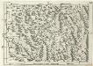
Geographica Provinciarum Sveviae Descriptio =
Mollova mapová sbírka Hurter, Johann Christoph Bodenehr, Gabriel
Canton Lucern sive illustris helvetiorum respublica Lucernensis
1 Karte : Kupferdruck ; 23 x 25 cm Walser Homännische Erben
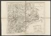
Canton Inter Catholicos primaria, Sive Illustris Helvetiorum Respublica Lucernensis cum Subditis suis et confinibus recenter et accurate delineata
1 : 100000 Mollova mapová sbírka Walser, Gabriel Seutter, Albrecht Carl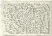
Geographica Provinciarum Sveviae Descriptio =
Mollova mapová sbírka Hurter, Johann Christoph Bodenehr, Johann Georg
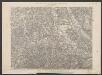
Karte vom Kanton Luzern
1 : 150000 1 Karte entworfen mit Benutzung ungedruckter Materialien u. Zeichnungen nach der Natur [von] F. Dula ; gez. von H. Keller, Sohn ; hrsg. von H. Keller [Vater] Keller, Zürich
Karte des Kantons Luzern
1 : 200000 1 Karte von J.S. Gerster ; auf Anordnung des Erziehungsrathes des Kantons Luzern Topogr. Anst. v. Wurster, Randegger & Co., Winterthur
Taschen-Atlas der Schweiz
1 Atlas (25 S., 20 Taf.) gezeichnet und gestochen von Emil Wagner = Atlas de poche de la Suisse : 26 cartes en couleurs / dessinées et gravées par Émile Wagner Eggimann, Genf
Canton Lucern sive Illustris Helvetiorum Respublica Lucernensis cum Subditis suis cum Subditis suis et Confinibus denuo correcta
1 : 100000 Mollova mapová sbírka Walser, Gabriel Homann, Johann Baptista - dědici
Canton Lucern sive Illustris Helvetiorum Respublica Lucernensis cum Subditis suis cum Subditis suis et Confinibus denuo correcta
1 : 100000 Mollova mapová sbírka Walser, Gabriel Homann, Johann Baptista - dědici
Der Canton Luzern
1 : 218000 Luzern (Švýcarsko : kanton)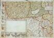
Inclitae Bernatum urbis, cum omni ditionis suae agro et provinciis delineatio chorographica, 7/8
2 Blätter : Adelbert Saueracher
<<Der>> Canton Luzern
1 : 270000 1 Karte [Orell Füssli & Comp.], [Zürich]
<<Der>> Canton Luzern
1 : 270000 1 Karte [Orell Füssli & Comp.], [Zürich]
Wandkarte vom Kanton Luzern
1 : 50000 1 Karte in 4 Teilen von Hch. Keller, Sohn ; hrsg. auf Anordnung des hohen Erziehungsrathes des Kant. Luzern ; Lith. von J. Schweizer Lehrmittelverlag, [Luzern]
Canton Luzern
1 : 270000 Pfyffer von Altishofen, Jost ; Scheuermann, Johann Jakob Orell, Füssli & Comp.
Bern, Burgdorf, Willisau
1 Vogelschaukarte Orell Füssli, Zürich
Karte des Kantons Luzern
1 : 200000 Müllhaupt, Fritz Schiffmann
Uebersichtskarte der Eisenbahn von Huttwil nach Wohlhusen
1 : 100000 Kümmerly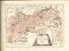

Topographische Tabelle der beiden Entlibucher=Æmter Schupfheim und Eschlismatt im Canton Lucern
1 Karte : Kupferdruck ; 54 x 45 cm Schnyder von Wartensee; Clausner chez Jos. Clausner graveur