Mappa catalogata
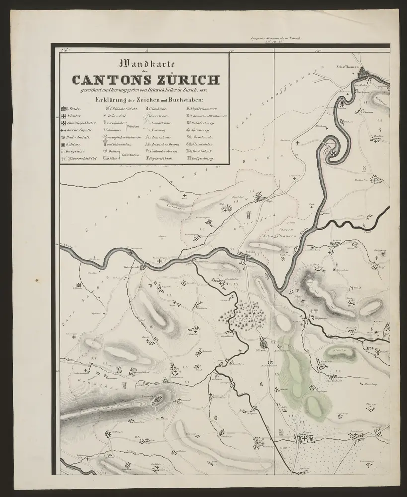
Wandkarte des Cantons Zürich

Titolo completo:Wandkarte des Cantons Zürich
Anno di illustrazione:1833
Data di pubblicazione:1833
Editore:Heinrich Keller
Dimensione fisica:20 x 30 cm
Scala della mappa:1:50 000
Meßtischblatt [8417] : Blatt 170, 1883
1883
1:250k
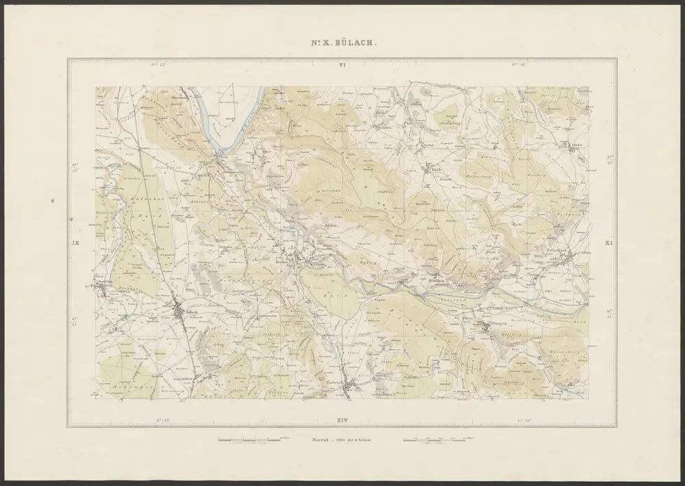
Bülach
1858
Graf, Josef
1:25k
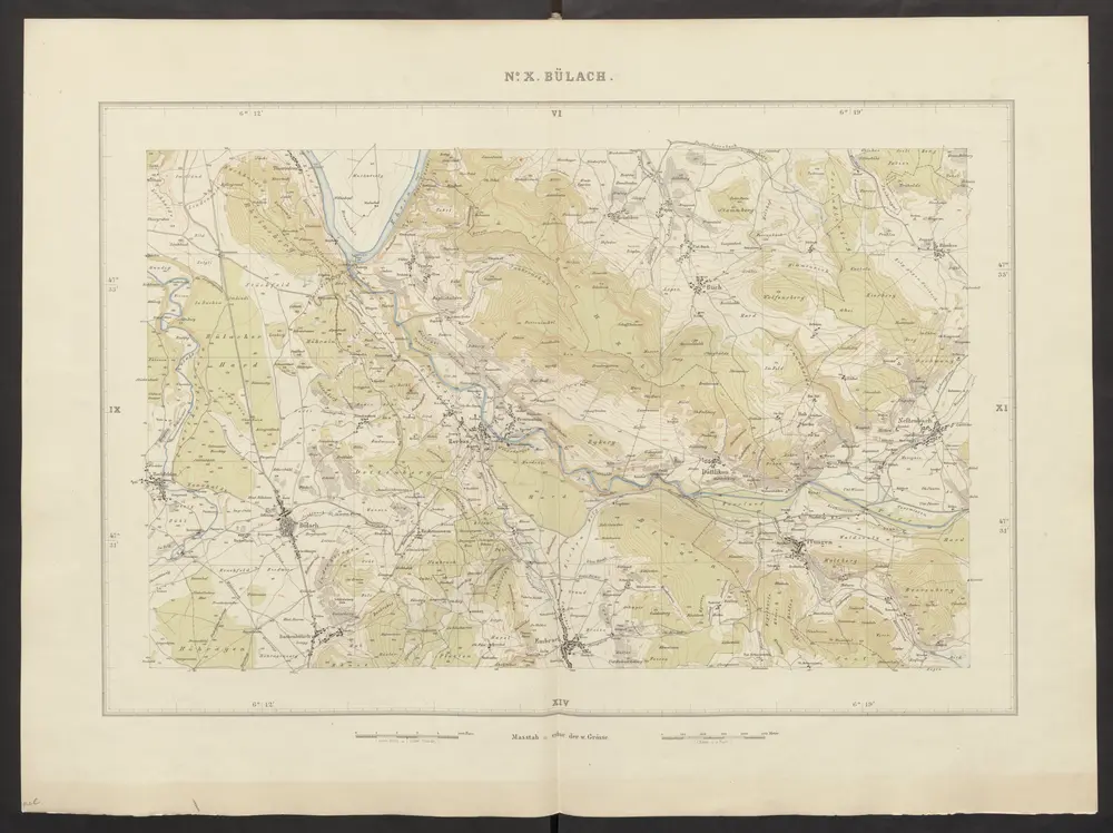
Bülach
1852
Wild, Johannes
1:25k
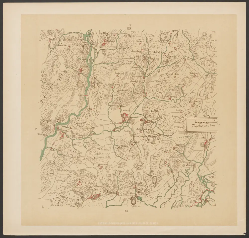
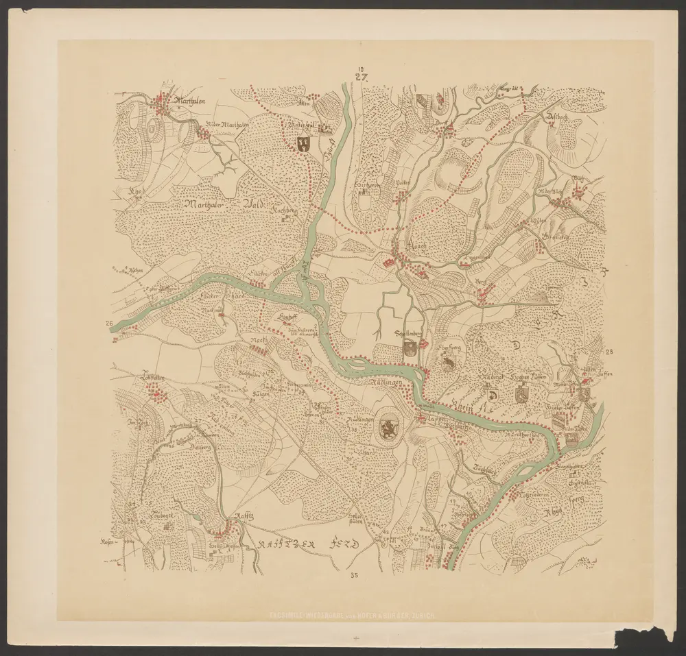
Hans Konrad Gyger's Züricher-Cantons-Carte
1667
Gyger, Hans Conrad ; Zeller-Werdmüller, Heinrich
1:32k
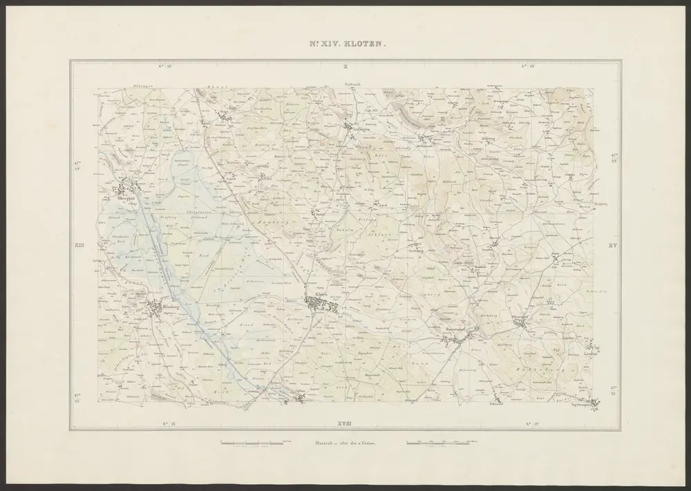
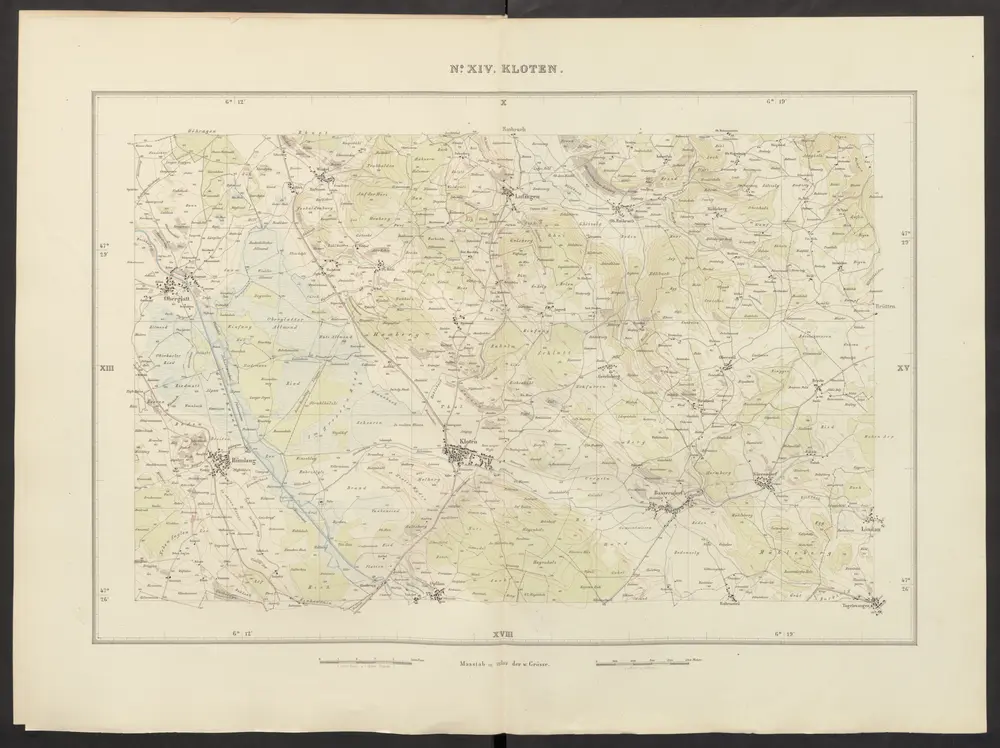
Kloten
1854
Graf, Josef
1:25k
Hans Konrad Gyger's Züricher-Cantons-Carte
1667
Gyger, Hans Conrad ; Zeller-Werdmüller, Heinrich
1:32k
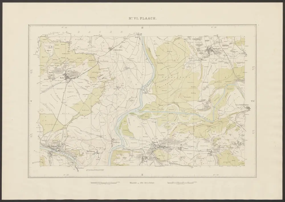
Flaach
1864
Brack, Johann Jakob
1:25k
Kloten
1852
Wild, Johannes
1:25k
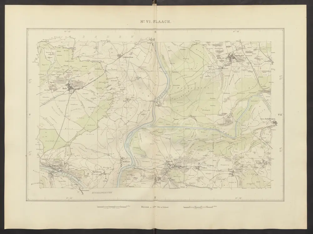
Flaach
1852
Wild, Johannes
1:25k
Wandkarte des Cantons Zürich
1833
Keller, Heinrich
1:50k