Maps of Haut-Rhin

Carte du chemin de fer de Strasbourg à Bâle
1 : 80000 Lithographie de Ve Levrault
Carte du chemin de fer de Strasbourg à Bâle
1 : 80000 Lithographie de Ve Levrault
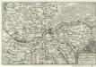
Alsatia Landgraviatus, cum Svntgoia et Brisgoia
1 : 250000 Mollova mapová sbírka Mercator, Gerhard Blaeu, Joan I.
Alsatia superior cu[m] Suntgoa et Brisgoia
1 Karte : Kupferdruck ; 17 x 24 cm Mercator Cloppenburgh
Alsatia superior cu[m] Suntgoia [et] Brisgoia
1 Karte : Kupferdruck ; 34 x 46 cm Mercator s.n.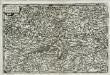
Alsatia svperior
1 Karte : Kupferdruck ; 14 x 22 cm Lambert Andreae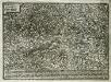
Elsatia svperior
1 Karte : Kupferdruck ; 17 x 27 cm Quad Johannes Bussemacher
Dept. Du Haut Rhin.
1 : 571000 Levasseur, Victor.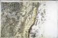
[Colmar]
1 Blatt : 60 x 91 cm s.n.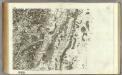
163 Colmar.
1 : 86400 Cassini family; Cassini, Cesar-Francois, 1714-1784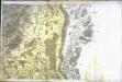
[Neuf-Brisach]
1 Blatt : 61 x 90 cm s.n.
Freiburg
1 : 200000 Herder, Bartholomew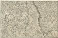
Le Cours du Rhein, depuis Spire jusqu'a Mayence
1 : 180000 Mollova mapová sbírka Fer, Nicolas de Starckman, P. Fer, Nicolas de
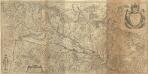
Le Theatre de la Guerre Sur le Haut Rhein
1 : 142000 Mollova mapová sbírka Sanson, Guillaume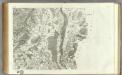
164 Neuf-Brisach.
1 : 86400 Cassini family; Cassini, Cesar-Francois, 1714-1784
Alasatia superior et inferior III. tabulis delineata, 1
1 Blatt : 62 x 62 cm s.n.
Alasatia superior et inferior III. tabulis delineata, 2
1 Blatt : 62 x 59 cm s.n.
Le cours du Rhin de Bâle à Hert près Philisbourg contenant l'Alsace et partie du Brisgau, 3
1 Blatt : 77 x 52 cm Le Rouge
Le cours du Rhin de Bâle à Hert près Philisbourg contenant l'Alsace et partie du Brisgau, 2
1 Blatt : 75 x 52 cm Le Rouge
Le Theatre de la Guerre Sur le Haut Rhein
1 : 142000 Mollova mapová sbírka Sanson, Guillaume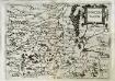
Svnggoia
1 Karte : Kupferdruck ; 15 x 20 cm Lambert Andreae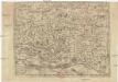
Abcon Terfeitv[n]g der Bistv[m]bs Strassbvrg samt andern angrenzende landschaften
1 : 400000 Štrasburk (Francie)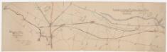
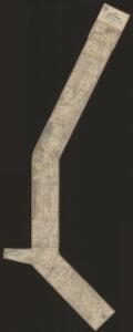
Laufen-Uhwiesen bis Ensisheim (Frankreich): Projektierte Schifffahrtsverbindung Ill-Rhein-Bodensee-Donau; Situationspläne: Fluss- und Kanalsystem zwischen Ensisheim (Frankreich) und Hüningen (Frankreich) mit projektierter Kanalanlage zwischen der Ill bei Mülhausen und dem Hüninger Zweigkanal; Situationsplan
1 : 25000 Mit Legende. Nico, Eugène

Le Flambeau de la Guerre Allumee au Rhin
Mollova mapová sbírka Delisle, Guillaume Schenk, Peter II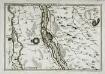
Les environs des deux Brisachs
1 Karte : Kupferdruck ; 23 x 33 cm Fer; Inselin Nicolas de Fer
Le Flambeau de la Guerre Allumee au Rhin
Mollova mapová sbírka Delisle, Guillaume Schenk, Peter II
Wandkarte von Basel und Umgebung
1 : 50000 1 Karte in 4 Teilen bearbeitet von J. Randegger Carl Detloff, Basel