Mapa catalogado
Alpen-Panorama und Orientirungstafel vom Hohentwiel


Título completo:Alpen-Panorama und Orientirungstafel vom Hohentwiel
Año de ilustración:1892
Fecha de publicación:1892
Editorial:Hohentwiel-Verein
Tamaño físico:20 x 30 cm
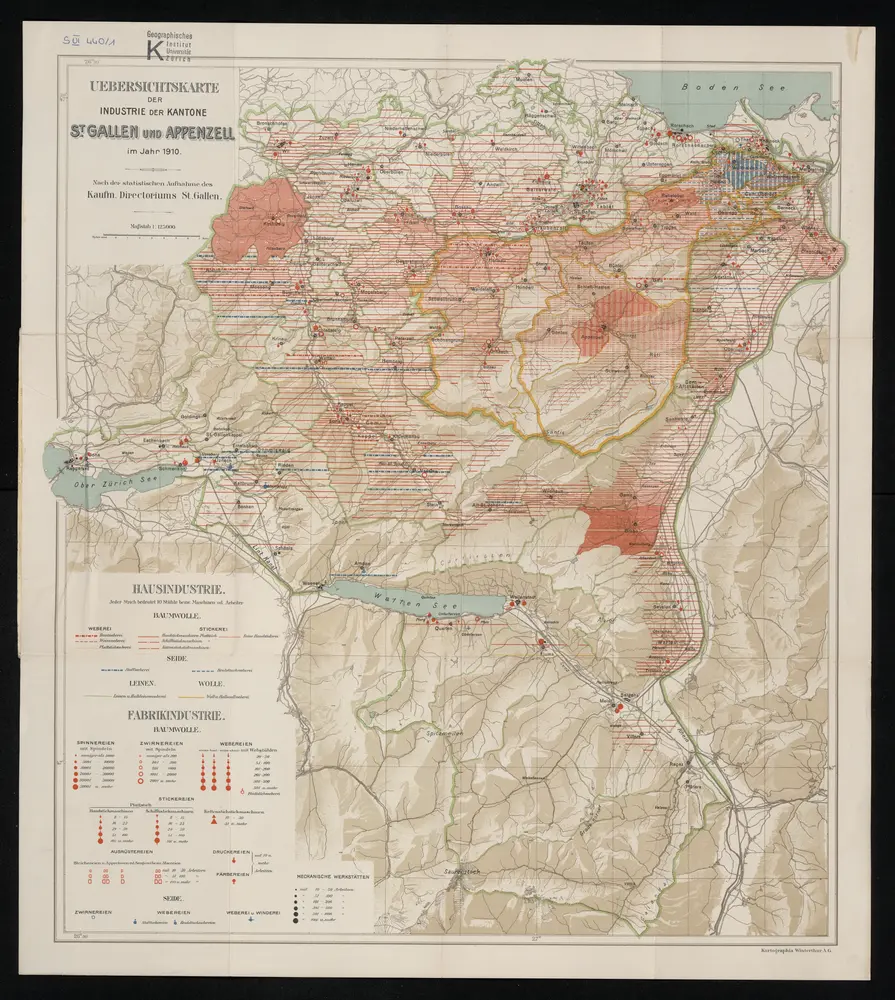
Übersichtskarte der Industrie der Kantone St. Gallen und Appenzell im Jahr 1910
1910
Winterthur : Kartographia Winterthur AG
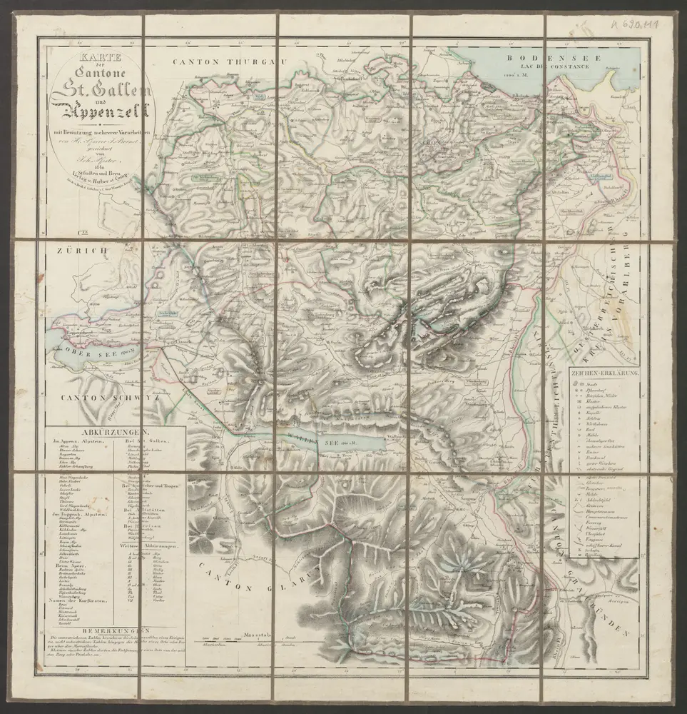
Karte der Cantone St. Gallen und Appenzell
1840
Bernet, J. ; Pfister, Johann
1:145k
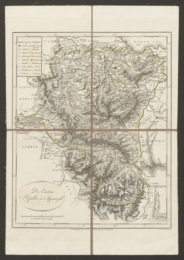
Cantone St. Gallen und Appenzell
1822
Scheuermann, Johann Jakob
1:300k
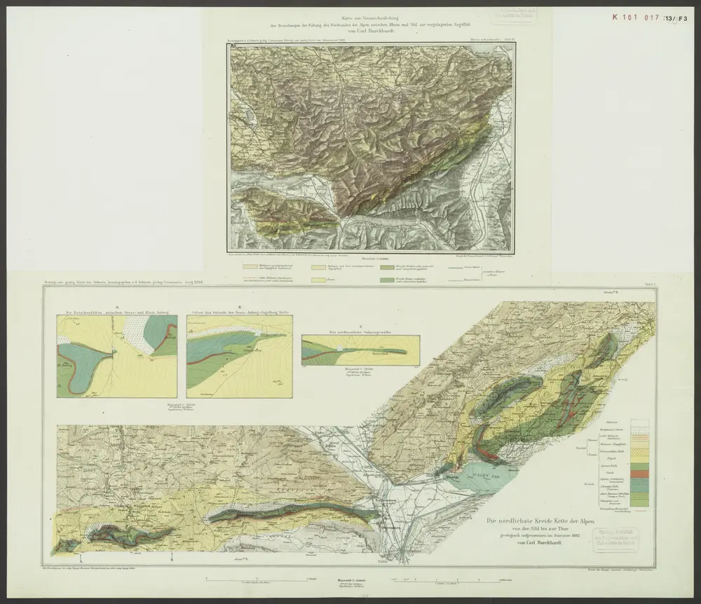
nördlichste Kreidekette der Alpen von der Sihl bis zur Thur
1892
Burckhardt, Carl
1:50k
n/a
1791
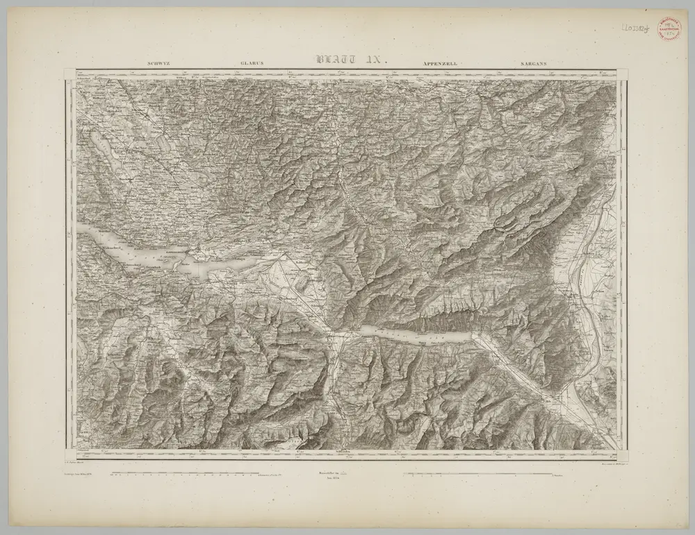
Blatt IX: Schwyz, Glarus, Appenzell, Sargans, uit: Topographische Karte der Schweiz / vermessen und hrsg. ... unter Aufsicht des Generals G.H. Dufour
1833
Dufour, G. H.
1:100k
Le païs de Toggenbourg
1778
Scheuchzer
n/a
1791
Die zwey erste zugewandte Orte der Eidgnosschaft nemlich: der fürstliche Abt von St. Gallen und die Stadt St.Gallen
1768
Walser
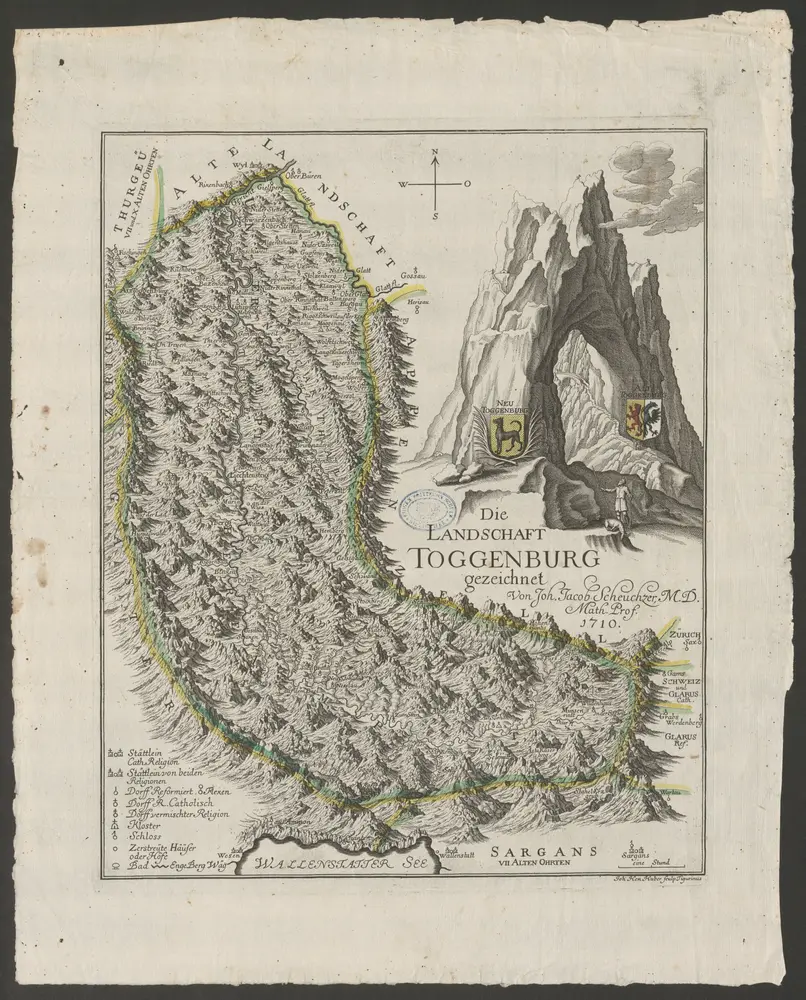
Landschaft Toggenburg
1710
Scheuchzer, Johann Jakob ; Huber, Johann Heinrich
1:124k