Maps of Sumiswald
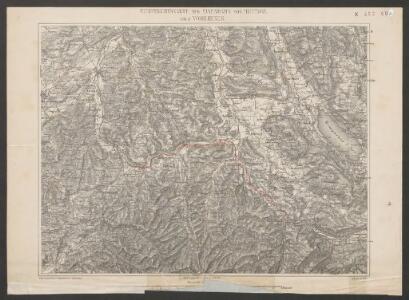
Uebersichtskarte der Eisenbahn von Huttwil nach Wohlhusen
1 : 100000 Kümmerly
Topographische Karte des Kantons Luzern
1 : 25000 Blatt 2 H. Müllhaupt u. Sohn H. Müllhaupt u. Sohn
Topographische Karte des Kantons Luzern
1 : 25000 Blatt 1 H. Müllhaupt u. Sohn H. Müllhaupt u. Sohn
Topographische Karte des Kantons Luzern
1 : 25000 Blatt 5 H. Müllhaupt u. Sohn H. Müllhaupt u. Sohn
Topographische Karte des Kantons Luzern
1 : 25000 Blatt 6 H. Müllhaupt u. Sohn H. Müllhaupt u. Sohn
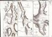
Geometrischer Grundriss aller Marken der Gerichtsherlikeit dess Gottshauses Wettingen
1 Karte : Kupferdruck ; 47 x 47 cm, Bildgrösse 56 x 47 cm Mejer; Speth; Meyer; Gyger s.n.
Blatt VIII: Aarau, Luzern, Zug, Zürich, uit: Topographische Karte der Schweiz / vermessen und hrsg. ... unter Aufsicht des Generals G.H. Dufour
1 : 100000 Annotatie: Met plaatsnamenregister (bl. V), bladwijzer (bl. XXI) en hoogteregister (bl. XXV); Voor aanwezige bladen zie overzichtsblad Dufour, G. H. [Bern : Eidg. Topogr. Bureau]
Der Canton Luzern
1 : 218000 Luzern (Švýcarsko : kanton)
Canton Lucern sive illustris helvetiorum respublica Lucernensis cum subditis suis et confinibus
1 Karte : Kupferdruck ; 46 x 55 cm Walser edentibus Homannianis Heredibus
Canton Lucern sive illustris helvetiorum respublica Lucernensis cum subditis suis et confinibus
1 Karte : Kupferdruck ; 46 x 55 cm Walser edentibus Homannianis Heredibus
<<Der>> Canton Luzern
1 : 270000 1 Karte [Orell Füssli & Comp.], [Zürich]
Canton Lucern sive Illustris Helvetiorum Respublica Lucernensis cum Subditis suis cum Subditis suis et Confinibus denuo correcta
1 : 100000 Mollova mapová sbírka Walser, Gabriel Homann, Johann Baptista - dědici
Canton Lucern sive Illustris Helvetiorum Respublica Lucernensis cum Subditis suis cum Subditis suis et Confinibus denuo correcta
1 : 100000 Mollova mapová sbírka Walser, Gabriel Homann, Johann Baptista - dědici
<<Der>> Canton Luzern
1 : 270000 1 Karte [Orell Füssli & Comp.], [Zürich]
Canton inter catholicos primaria, sive illustris Helvetiorum respublica Lucernensis cum subditis suis et confinibus
1 Karte : Kupferdruck ; 48 x 56 cm Walser; Seutter Albrecht Carl Seutter
Canton Lucern sive illustris helvetiorum respublica Lucernensis
1 Karte : Kupferdruck ; 23 x 25 cm Walser Homännische Erben

Karte vom Kanton Luzern
1 : 150000 1 Karte entworfen mit Benutzung ungedruckter Materialien u. Zeichnungen nach der Natur [von] F. Dula ; gez. von H. Keller, Sohn ; hrsg. von H. Keller [Vater] Keller, Zürich
Topographische Karte des eidgenössischen Kantons Aargau
1 : 50000 1 Karte auf 4 Bl. im Auftrage der Staatsbehörden nach dem Massstabe von 1:25 000 in den Jahren 1837 bis 1843 aufgenommen und 1844/45 in den Massstab von 1:50 000 übertragen durch Ernst Heinrich Michaelis ; den Kupferstich besorgte 1845 bis 1848 Th. Delsol ; die Schrift J.M. Hacq Rud. Foppert, Zürich
Canton Inter Catholicos primaria, Sive Illustris Helvetiorum Respublica Lucernensis cum Subditis suis et confinibus recenter et accurate delineata
1 : 100000 Mollova mapová sbírka Walser, Gabriel Seutter, Albrecht Carl
Karte des Kantons Luzern
1 : 200000 Müllhaupt, Fritz Schiffmann
Die Gegend um Lucern
1 : 300000 Mollova mapová sbírka Bodenehr, Gabriel Bodenehr, Gabriel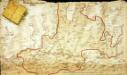
Das undere Argaw mit seinen anstossenden Gränzen
1 Manuskriptkarte : 43 x 74 cm Bodmer s.n.
Canton Solothurn Sive Pagus Helvetiae Solodurensis cum Confinibus recenter delineatus
1 : 110000 Mollova mapová sbírka Walser, Gabriel Homann, Johann Baptista - dědici
Nova descriptio ditionis Tigurinae regionumque finitimarum
1 : 95000 1 Karte auf 6 Bl. Joh. Conradus Gygerus, P. delineavit ; Joh. Georgius Gygerus, F. in aes incidi ; curavit per Johannem Meyerum Ao. 1685
Hans Konrad Gyger's Züricher-Cantons-Carte 1667
1 : 32000 1 Karte in 56 Teilen Hans Konrad Gyger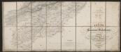
Carte des Cantons Solothurn
1 : 60000 Südblatt Walker, Josef Engelmann & Compagnie
Topographische Tabelle des untern Amtes der Lucernischen Vogtei Entlibuch
1 Karte : Kupferdruck ; 53 x 44 cm Schnyder von Wartensee; Clausner s.n.
Topographische Tabelle des untern Amtes der Lucernischen Vogtei Entlibuch
1 Karte : Kupferdruck ; 53 x 44 cm Schnyder von Wartensee; Clausner s.n.