Maps of Vaulruz

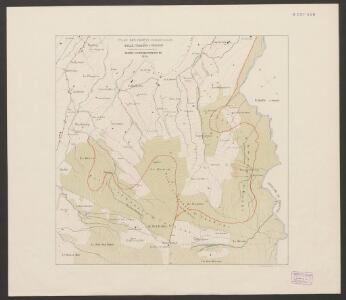
Plan des forêts communales de Bulle, Vuadens & Vaulruz
1 : 10000 Schweizerischer Forstverein Wurster, Randegger & Co.
Carte topographique du canton de Fribourg
1 : 50000 Südwest-Blatt Stryienski, Alexandre ; Delsol, Théodore ; Hacq, J.M. ; Carré, ... F. Chardon ainé
Topographische Karte des Kantons Freiburg: Blatt 2
1 : 50000 Stryienski, Casimir Napoléon Alexandre (1804-1875), Ingenieur, von Polen Kupferstich: Delsol, Théodore (1819-1870), von Frankreich; Hacq, J. M.; Carré. V.
Carte de la Suisse romande, 4
1 Blatt : s.n.
Carte de la Suisse romande, 4
1 Blatt : s.n.
Carte archéologique du Canton de Fribourg
1 : 100000 Bonstetten, Gustav Karl <
Inclitae Bernatum urbis, cum omni ditionis suae agro et provinciis delineatio chorographica, 9/10
2 Blätter : Adelbert Saueracher
Carte des alpes fribourgeoises
1 : 100000 1 Karte E. Wagner Josué Labastrou, Fribourg
Der Canton Freyburg
1 : 228000 Fribourg (Švýcarsko : kanton) Scheurmann, J. J.
Atlas der Schweiz
1 : 450000 1 Atlas (18 Bl.) gez. u. gest. v. J. Scheurmann Orell Fussli, Zurich
Canton Freyburg
1 : 270000 Scheuermann, Johann Jakob [Orell Füssli]
Carte du canton de Fribourg à l'usage des écoles
1 : 100000 Stryienski, Alexandre J. Wurster et Comp.
Canton Freiburg sive Pagus Helvetiae Friburgensis cum confinibus recenter delineatus
1 : 120000 Mollova mapová sbírka Walser, Gabriel Dorn, Sebastian Homann, Johann Baptista - dědici
Carte du canton de Fribourg
1 : 200000 1 Karte J.S. Gerster Wurster, Randegger & Cie., Winterthur
Canton Freiburg sive pagus Helvetiæ Friburgensis cum confinibus
1 Karte : Kupferdruck ; 45 x 55 cm Walser; Dorn edentibus Homannianis Heredibus
Canton Freiburg sive pagus Helvetiæ Friburgensis cum confinibus
1 Karte : Kupferdruck ; 45 x 55 cm Walser; Dorn edentibus Homannianis Heredibus
Topographische Karte der Schweiz
1 : 100000 25 Karten vermessen und hrsg. auf Befehl der Eidgenössischen Behörden ; aufgenommen unter der Aufsicht des Generals G.H. Dufour Eidg. Topographisches Bureau, [Genève], [später: Bern]
Plus grande partie de la Suisse romande ou canton du Léman
1 : 108000 Weiss, Johann Heinrich ; Guérin, Christophe ; Meyer, Johann Rudolf J. R. Meyer
Canton Freiburg sive pagus Helvetiæ Friburgensis cum confinibus
1 Karte : Kupferdruck ; 22 x 26 cm Walser Homännische Erben
Carte du canton de Fribourg à l'usage des écoles
1 : 100000 1 Karte dressée en 1851 par Alexandre Stryienski d'après la grande carte topogr. du canton ; gravé par P. Steiner et R. Leuzinger J. Wurster et Comp., Winterthur
Carte du Lac de Geneve et des Pays Circonvoisins
1 : 150000 Mollova mapová sbírka Chopy, Antoine Daudet, Jean-Louis Chopy, Antoine
Taschen-Atlas der Schweiz
1 Atlas (25 S., 20 Taf.) gezeichnet und gestochen von Emil Wagner = Atlas de poche de la Suisse : 26 cartes en couleurs / dessinées et gravées par Émile Wagner Eggimann, Genf
<<Der>> Canton Freyburg
1 : 270000 1 Karte gez. u. gest. von J.J. Scheurmann [Orell Füssli], [Zürich]
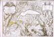
Carte chorographique de la partie occidentale de l'Oberland ou le comté de Gruyéres divisé en quatre bailliages ou gouvernements assavoir Gruyeres, Sanen, Ober Sibenthal et Nider Sibenthal, ou se trouve le gouvernement d'Aigle et le baillaige de Vevay
1 Karte : Kupferdruck ; 54 x 71 cm Loup; Benning s.n.
<<Der>> Canton Freyburg
1 : 270000 1 Karte gez. u. gest. von J.J. Scheurmann [Orell Füssli], [Zürich]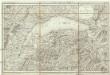
Carte du Lac de Geneve et de ses environs
1 : 320000 Ženeva (Švýcarsko : kanton)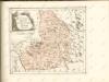
Carte du lac de Geneve et des pays circonvoisins
1 Karte auf 2 Blatt : Kupferdruck ; 55 x 80 cm Rovéréa; Fatio de Duillier; Daudet; Chopy Antoine Chopy