Maps of Bas-Rhin

Maps of Bas-Rhin

$title$

Militair Karte von Süd-Deutschland in 20 Sectionen

1 : 400000 9. Section Coulon, Alois von A. von Coulon
$title$

Département du Bas Rhin

1 Karte : Kupferdruck ; 49 x 48 cm Houdan au bureau de l'atlas national rue de la Harpe no. 26, et au dépot du dit atlas rue de la Monnoye no. 5
$title$

Département du Bas Rhin

1 : 250000 Bas-Rhin (Francie) Chanlaire, Pierre-Grégoire P.G. Chanlaire
$title$

Landgraviatus Alsatiae Inferioris Novissima Tabula

1 : 280000 Mollova mapová sbírka Visscher, Nicolaes Jansz. Schenk, Peter II
$title$

Landgraviatus Alsatiae Inferioris novissima tabula, in qua simul Marchionatus Badensis, Ortenavia caeteraque tam Lotharingica quam alia confinia / accuratissimè describuntur per Nicolaum Visscher

1 : 300000 Annotatie: Cum privilegio Ordinum Hollandiæ et Westfrisiæ; Origineel is Blad 113 in atlas factice; Annotatie geografische gegevens: Schaalstokken: Milliaria Germanica communia, en: Milliaria Gallica communia Nicolaes Jansz. Visscher jr. 1649-1702 [Amsterdam : Nicolaus Visscher]
$title$

Die untere Markgrafschaft Baaden oder die Grafschaft Eberstein mit den Durlachischen Landen : Nro. 192

Reilly, Franz Johann Joseph von
$title$

Landgraviatus Alsatiae Inferioris Novissima Tabula [...] [Karte], in: Novus atlas absolutissimus, Bd. 2, S. 200.

1 Karte aus Atlas Janssonius Offizin
$title$

Landgraviatus Alsatiæ inferioris novissima tabula

1 Karte : Kupferdruck ; 45 x 55 cm Visscher; Schenk nunc apud Petrum Schenk iunior
$title$

La Basse Diviseé en Balliages et Seugneries deca et de la Rhin, ou sont le Grand Balliage. D Haguenau, les Terres D'Hanau, de l'Evesché de la Ville de Strasbourg et des Nobles les Montagnes noires Seples. L Ortnaw le Grand Marquisat de Bade et partie du Wirtenberg levé sur les lieux pendant les guerres.

1 : 250000 Mollova mapová sbírka Jaillot, Alexis-Hubert Jaillot, Alexis Hubert
$title$

Sheet 4, uit: Stanford's large scale map of the seat of war / Stanford's Geographical Estab[lishmen]t

1 : 300000 Stanford's Geographical Establishment, Londen London : Stanford
$title$

Département du Bas Rhin

1 Karte : Kupferdruck ; 40 x 35 cm Capitaine s.n.
$title$

Département du Bas Rhin

1 : 265000 Bas-Rhin (Francie) Houdan, François d' Bureaou de l'Atlas national
$title$

Tribocci

1 : 240000 Mollova mapová sbírka Sanson, Guillaume Mariette, Pierre Sanson, Guillaume
$title$

Departement du Bas Rhin

1 Karte : Kupferdruck ; 16 x 15 cm au dépot de l'Atlas national rue de la Monnoye no. 5
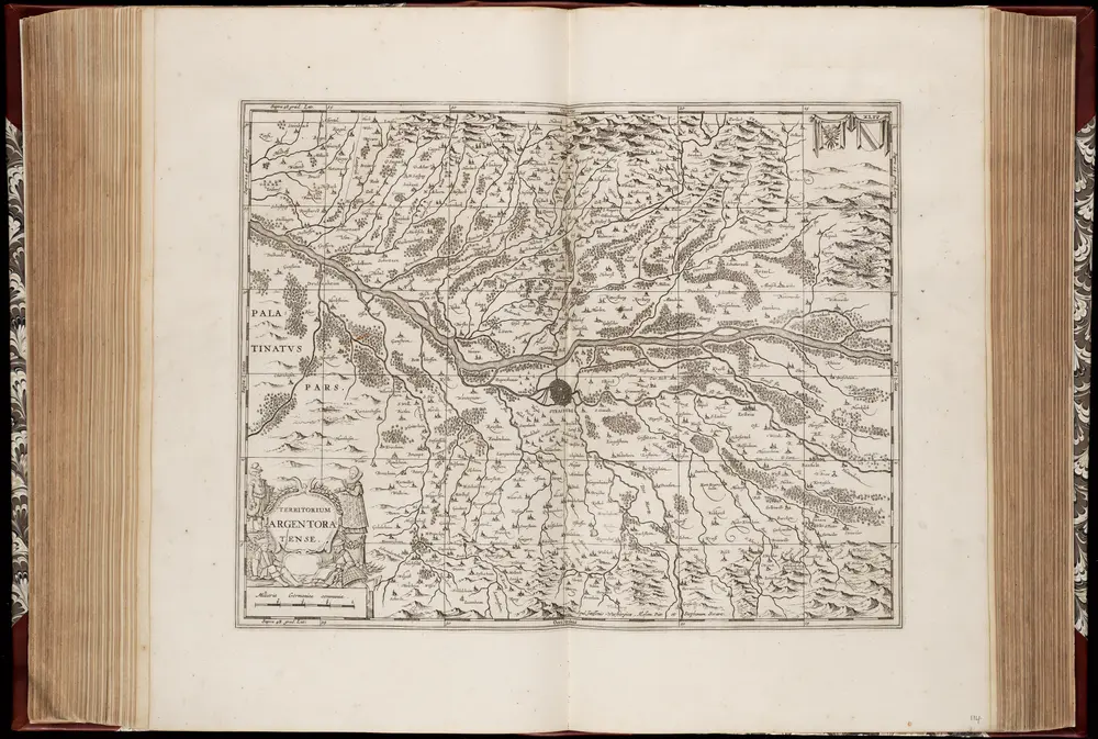
$title$

Les frontieres de Lorraine ou sont Espinal S'Diey, Luneville Marsal Vic La Basse Alsace divisée en balliages et seigneuries deça et de la le Rhin ou sont le Grand Balliage dHaugenau, les terres d'Hanau, de l'evesché de la ville de Strasbourg et des nobles les sources de rivieres de la Seille de la Sare de la Meurte et de la Mosele [l]es montagnes noires Sep.les lortnaw le grand marquisat de Bade et partie du Wirtenberg levé sur les lieux pendant les guerres

1 : 200000 Alsasko (Francie) Sengre, Henri Jaillot, Alexis-Hubert Iaillot
$title$

Département du Bas Rhin

1 : 260000 Bas-Rhin (Francie) Houdan, d' P.G. Chanlaire
$title$

Totius S. R. I. Circuli Suevici Tabula Chorographica

1 : 310000 Mollova mapová sbírka Lamsvelt, Jan Ottens, Josua
$title$

Dept. Du Bas Rhin.

1 : 455000 Levasseur, Victor.
$title$

Alsatia inferior

1 Karte : Kupferdruck ; 34 x 42 cm Mercator; Hondius excusum apud Henricum Hondium sub insigno atlantis
$title$

L'Alsace Divisée En Ses Principales Parties.

1 : 250000 Mollova mapová sbírka Jaillot, Alexis-Hubert Jaillot, Alexis Hubert
$title$

Suevia universa IX. tabulis delineata, 4

1 Blatt : s.n.
$title$

Alsatia inferior

1 Karte : Kupferdruck ; 35 x 42 cm Hondius; Mercator Jodocus Hondius
$title$

Alsatia inferior

1 Karte : Kupferdruck ; 34 x 41 cm Mercator s.n.
$title$

$title$

D.O.M.S. Serenissimo Celsissimoque Principi ac Domino Domino Eberhardo Ludovico Duci Würtenbergiae et Thecciae Comiti Montis belgardi, Dynastae in Haydenheim etc. Sac. Caes. Mai. ac Rom. Imp. ut et Circuli Suevici General Mareschallo Campi et Generali Equitatiis etc. Domino suo Clementißimo Tabulam hanc in debitae submissionis tessoniman

1 : 315000 [S.l.] : [s.n.]
$title$

Alsatia inferior

1 Karte : Kupferdruck ; 19 x 29 cm Merian Merian
$title$

Doms Serenißimo Celsißimoq;

1 : 250000 Mollova mapová sbírka Homann, Johann Baptist Homann, Johann Baptista - dědici
$title$

Alsatia inferior

1 Karte : Kupferdruck ; 17 x 24 cm Mercator; Keere Cloppenburgh
$title$

D.O.M.S. Serenissimo Celsissimoque Principi ac Domino Domino Eberhardo Ludovico Duci Würtenbergiae et Thecciae Comiti Montis belgardi, Dynastae in Haydenheim etc. Sac. Caes. Mai. ac Rom. Imp. ut et Circuli Suevici General Mareschallo Campi et Generali Equitatiis etc. Domino suo Clementißimo Tabulam hanc in debitae submissionis tessoniman

1 : 315000 [S.l.] : [s.n.]
$title$

© MapTiler © OpenStreetMap contributors
How does it work?
These instructions will show you how to find historical maps online.
Getting started
Type the place name in the search box to find the exact location. You can further adjust the search by zooming in and out.
Zoom
Zoom in and out with the buttons or use your mouse or touchpad natively.
Exact Area tool
Click here and draw a rectangle over the map to precisely define the search area.
Set filters
Narrow your search with advanced settings, such as Years (from/to), Fulltext, Publisher, etc.
Results
See the results of your search on the right side. You can scroll down to find more maps of this location.
?

Download OldMapsOnline Mobile