Maps of Switzerland
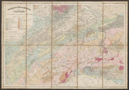
Geologische Übersichtskarte der Schweiz
1 : 760000 Escher von der Linth, Arnold ; Studer, Bernhard Verlag d. topogr. Anstalt v. J. Wurster u. Comp.
Mineral-Quellen der Schweiz und ihrer nächsten Umgebungen
1 : 1200000 Topographische Anstalt von Joh. Wurster u. Comp. (Winterthur) [Naturforschende Gesellschaft?]
Geologische Karte der Schweiz
Originaltitel: Carte géologique de la Suisse. Mit Legende der Farben. Studer, Bernhard (1794-1887), Theologe und Naturwissenschafter, von Bern; Escher von der Linth, Arnold (1807-1872), Geologe, von Zürich Zeichnung: Ziegler, Jakob Melchior (1801-1883), Kartograf Verlag: Joh. Wurster und Comp., in Winterthur
Reisekarte der Schweiz
1 : 355000 1 Karte dressée et gravée par Mullhaupt ; écrit par Bressanini Leuthold, Zürich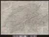
Roadmap of Switzerland
1 : 400000 1 Karte dressée et gravée par Mullhaupt ; écrit par Bressanini ; publiée par H.F. Leuthold H.F. Leuthold, Zürich
Roadmap of Switzerland
1 : 400000 1 Karte dressée et gravée par Mullhaupt ; écrit par Bressanini ; publiée par H.F. Leuthold H.F. Leuthold, Zürich
Roadmap of Switzerland
1 : 400000 1 Karte dressée et gravée par Mullhaupt ; écrit par Bressanini ; publiée par H.F. Leuthold H.F. Leuthold, Zürich
Carte physique et routière de la Suisse
1 : 490000 1 Karte publiée par J. Andriveau-Goujon J. Andriveau-Goujon, Paris
Carte des treize cantons Suisses, des alliés et des pays qui leurs sont sujetz
1 : 1250000 1 Karte [David-François de Merveilleux] [Harding], [London]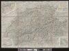
Roadmap of Switzerland
1 : 355000 1 Karte dressée et gravée par Mullhaupt ; écrit par Bressanini Leuthold, Zürich
Carte industrielle de la Suisse pour l'année 1882
1 : 500000 1 Karte élaborée sur la demande du Comité Central de l'Exposition Nationale à Zurich par Hermann Schlatter = Industrie-Karte der Schweiz für das Jahr 1882 / im Auftrage des Central-Comite der schweiz. Landesausstellung in Zürich bearb. von Hermann Schlatter Wurster, Randegger & Co., Winterthur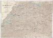
Spezialkarte der Schweiz und der lombardischen [sic] Alpen
1 : 510000 Švýcarsko Gronen, Eduard Mey und Widmayer
Schweiz
1 : 1450000 [Stumme Kartenskizzen der ganzen Schweiz und der einzelnen Kantone zu Unterrichtszwecken] Schulbuchhandlung Antenen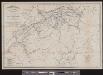
Eisenbahnkarte der Schweiz
1 : 500000 1 Karte gezeichnet von Rudolf Gross Verlag von Caesar Schmidt, Zürich
Roadmap of Switzerland
1 : 400000 1 Karte dressée et gravée par Mullhaupt ; écrit par Bressanini ; publiée par H.F. Leuthold H.F. Leuthold, Zürich
Neue Karte von der Schweiz in XIII Cantone eingetheilt, nebst ihren Bundsverwandten und Unterthanen
1 : 750000 1 Karte se vend vis-à-vis de la poste chez S. Schropp et Comp., Berlin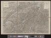
Randegger's Reisekarte der Schweiz
1 : 600000 1 Karte [Kartogr.:] Topogr. Anstalt v. Wurster, Randegger & Co. in Winterthur J. Wurster & Co., Zürich
Karte von der Schweiz
1 : 525000 1 Karte Fuessli & Comp., Zürich
Carte industrielle de la Suisse pour l'année 1882
1 : 500000 1 Karte élaborée sur la demande du Comité Central de l'Exposition Nationale à Zurich par Hermann Schlatter = Industrie-Karte der Schweiz für das Jahr 1882 / im Auftrage des Central-Comite der schweiz. Landesausstellung in Zürich bearb. von Hermann Schlatter Wurster, Randegger & Co., Winterthur
Roadmap of Switzerland
1 : 355000 1 Karte dressée et gravée par Mullhaupt ; écrit par Bressanini Leuthold, Zürich
Randegger's Reisekarte der Schweiz
1 : 600000 1 Karte [Kartogr.:] Topogr. Anstalt v. Wurster, Randegger & Co. in Winterthur J. Wurster & Co., Zürich
Karte der Schweiz
1 : 400000 1 Karte auf 32 Blättern auf 1 Leinwand aufgezogen Gezeichnet u. gestochen von R. Leuzinger ; Imp. méc. F. Lips = Carte de la Suisse : par R. Leuzinger chez J. Dalp (C. Schmid) libraire e éditeur, Bern
Eisenbahnkarte der Schweiz
1 : 500000 1 Karte gezeichnet von Rudolf Gross Schabelitz, Zürich
Dritte Karte der Schweiz
1 : 380000 Ziegler, Jakob Melchior Wurster & Randegger & Co.
Roadmap of Switzerland
1 : 400000 1 Karte dressée et gravée par Mullhaupt ; écrit par Bressanini ; publiée par H.F. Leuthold H.F. Leuthold, Zürich
Roadmap of Switzerland
1 : 400000 1 Karte dressée et gravée par Mullhaupt ; écrit par Bressanini ; publiée par H.F. Leuthold H.F. Leuthold, Zürich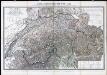
Neue Schweizerkarte von 1847 : als Wand- und Reisekarte topisch und politisch dargestellt
Winckelmann, Eduard Tannheimer
Hypsometrische Karte der Schweiz
1 : 380000 1 Karte auf 4 Blättern von J.M. Ziegler = Carte hypsométrique de la Suisse / par J.M. Ziegler Verlag von Joh. Wurster u. Comp., Winterthur
Relief-Karte der Schweiz
1 : 530000 1 Karte von R. Leuzinger ; [Kartogr.:] Topogr. Anstalt v. Wurster, Randegger & Co. in Winterthur J. Wurster & Co., Zürich