Mapa catalogado
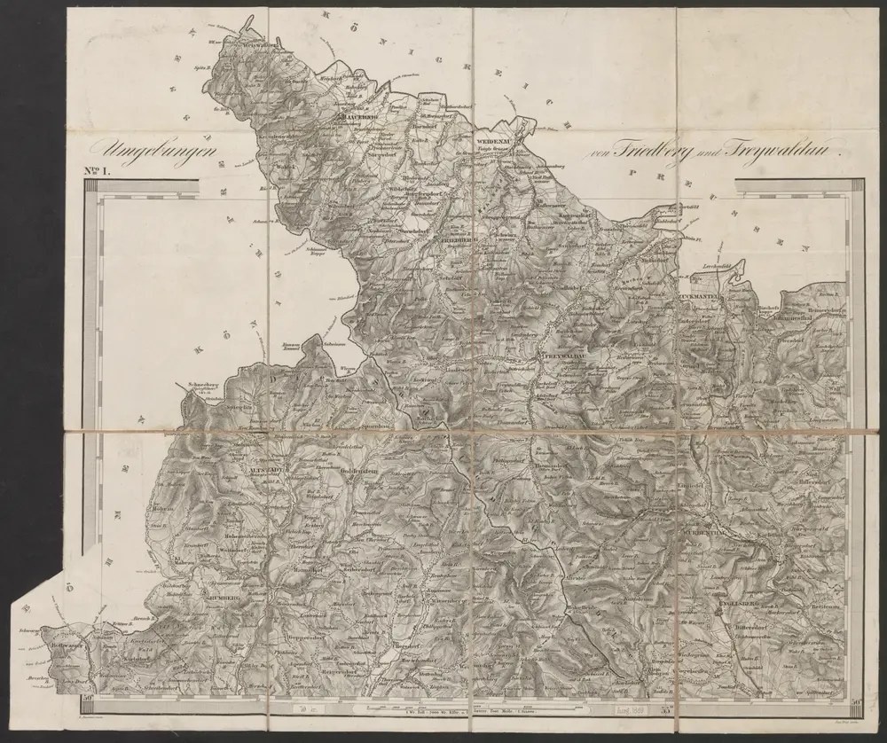
Umgebungen von Friedberg und Freywaldau

Título completo:Umgebungen von Friedberg und Freywaldau
Año de ilustración:1869
Fecha de publicación:1869
Editorial:K.K. Militärisches Geographisches Institut
Tamaño físico:20 x 30 cm
Escala del mapa:1:144 000
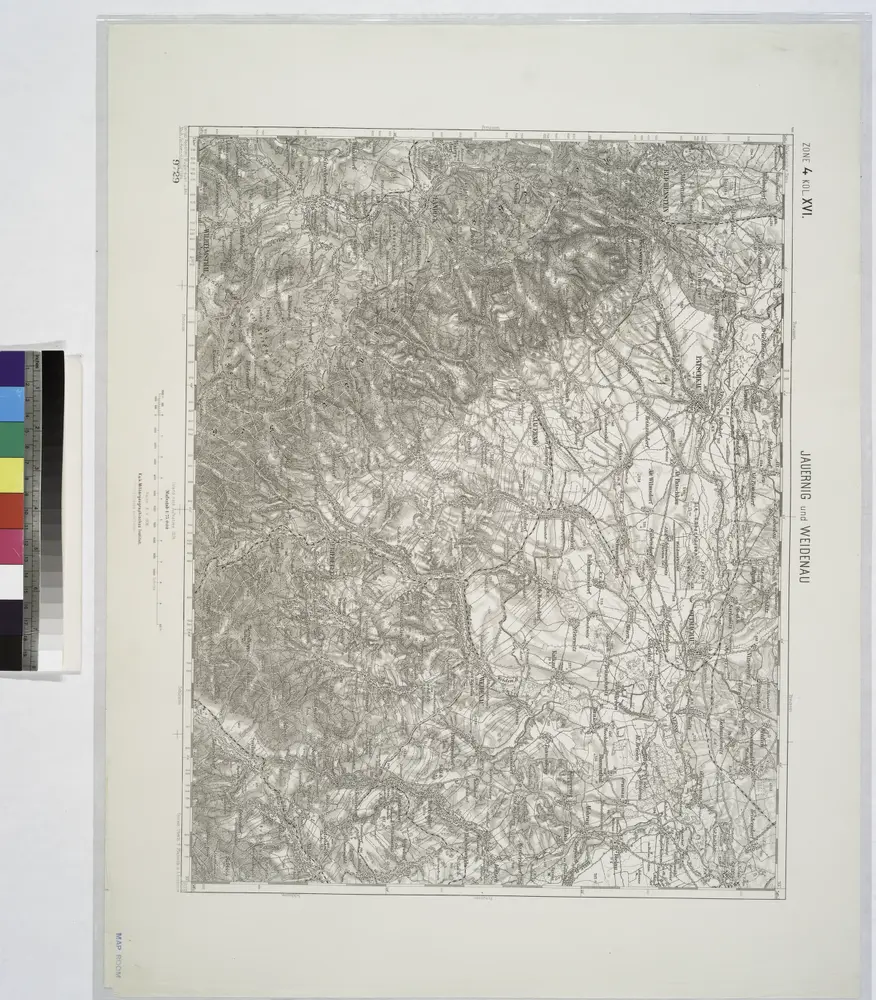
Jauernig und Weidenau.
1914
Umgebungen von Friedberg und Freywaldau
1869
K.K. Militärisches Geographisches Institut
1:144k
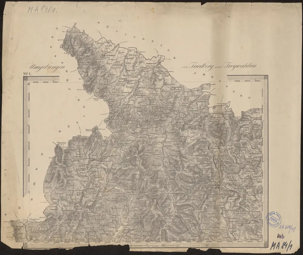
Umgebungen von Friedberg und Freywaldau
1869
K.K. Militaerischen Geographischen Institute
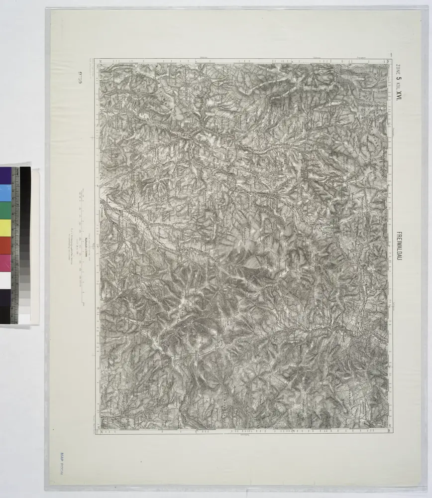
Freiwaldeau.
1914
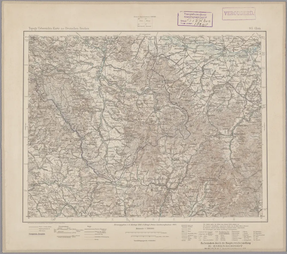
145. Glatz, uit: Topographische Uebersichtskarte des Deutschen Reiches / herausgegeben v. d. Kartogr. Abt. d. Königl. Preuß. Landesaufnahme
1899
Königlich Preußische Landesaufnahme. Kartographische Abtheilung
1:200k
Special-Carte des Fürstenthums Grotkau oder Neisse, in Ober-Schlesien, an den böhmischen und mährische[n] Grentzen
1750
Wieland, Johann Wolfgang
1:300k
Meßtischblatt 3343 : Bielendorf, 1936
1936
1:250k
Meßtischblatt 5668 : Ober Hermsdorf, 1936
1936
1:250k
Meßtischblatt 3299 : Kaindorf, 1936
1936
1:250k
Thomasdorf - m0555-1-001 - Kaiserpflichtexemplar der Landkarten des stabilen Katasters
1836
1:3k
Thomasdorf - m0555-1-002 - Kaiserpflichtexemplar der Landkarten des stabilen Katasters
1836
1:3k
Thomasdorf - m0555-1-003 - Kaiserpflichtexemplar der Landkarten des stabilen Katasters
1836
1:3k
Thomasdorf - m0555-1-004 - Kaiserpflichtexemplar der Landkarten des stabilen Katasters
1836
1:3k
Thomasdorf - m0555-1-005 - Kaiserpflichtexemplar der Landkarten des stabilen Katasters
1836
1:3k
Thomasdorf - m0555-1-006 - Kaiserpflichtexemplar der Landkarten des stabilen Katasters
1836
1:3k
Thomasdorf - m0555-1-007 - Kaiserpflichtexemplar der Landkarten des stabilen Katasters
1836
1:3k
Thomasdorf - m0555-1-008 - Kaiserpflichtexemplar der Landkarten des stabilen Katasters
1836
1:3k
Thomasdorf - m0555-1-009 - Kaiserpflichtexemplar der Landkarten des stabilen Katasters
1836
1:3k
Thomasdorf - m0555-1-010 - Kaiserpflichtexemplar der Landkarten des stabilen Katasters
1836
1:3k
Thomasdorf - m0555-1-011 - Kaiserpflichtexemplar der Landkarten des stabilen Katasters
1836
1:3k
Thomasdorf - m0555-1-012 - Kaiserpflichtexemplar der Landkarten des stabilen Katasters
1836
1:3k