Maps of Rhinau

[Geologische Karte der Umgebungen von Lahr und Offenburg]
1 : 50000 Südblatt Platz, Ph. Chr. Fr. Müller'sche Hofbuchhandlung
Meßtischblatt [7713] : Schweighausen, 1877
1 : 250000 Schweighausen. - 1:25000. - Leipzig: Giesecke & Devrient, 1877. - 1 Kt.
Meßtischblatt [7712] : Ettenheim, 1879
1 : 250000 Ettenheim. - 1:25000. - Leipzig: Giesecke & Devrient, 1879. - 1 Kt.
Charte über das Grosherzogthum Baaden
1 : 180000 Bádensko (Německo)
Meßtischblatt [7813] : Emmendingen, 1878
1 : 250000 Emmendingen. - 1:25000. - Leipzig: Giesecke & Devrient, 1878. - 1 Kt.
Carte über den Lauf des Rheins von Basel bis Lauterburg längs der Badisch - Französischen Grenze

Meßtischblatt [7613] : Lahr, 1931
1 : 250000 Lahr. - Hrsg. 1874/79, bericht. 1890, wichtigere Nachtr. 1932. - 1:25000. - Leipzig: Giesecke & Devrient, 1932. - 1 Kt.
Blatt 9. Kappel, uit: Topographische Karte des Rheinstromes und seiner beiderseitigen Ufer von Hueningen bis Lauterburg oder längs der Französich-Badischen Gränze, ... / ... reducirt und gezeichnet ... im Bureau der Grossherzoglich Badischen Rheingränz-Berichtigungs Commission
1 : 20000 titelvariant: Rheingränz-Carte; Annotatie: Voor aanwezige bladen zie overzichtsblad Grossherzogliche Badische Rheingränz-Berichtigungs Commission. Bureau Freiburg im Breisgau : im Herder'schen Künst-Institut
Topographische - Carte des Rheinstromes und seiner beiderseitigen Ufer von Hüningen bis Lauterburg...

Meßtischblatt [7811] : Markolsheim, 1886
1 : 250000 Markolsheim. - Aufn. 1884. - 1:25000. - [Berlin]: Reichsamt für Landesaufnahme, 1886. - 1 Kt.
Meßtischblatt [7812] : Endingen, 1878
1 : 250000 Endingen. - 1:25000. - Leipzig: Giesecke & Devrient, 1878. - 1 Kt.
Meßtischblatt 3637 : Gerstheim, 1884
1 : 250000 Gerstheim. - Aufn. 1883. - 1:25000. - [Berlin]: Reichsamt für Landesaufnahme, 1884. - 1 Kt.
Geographica Provinciarum Sveviae Descriptio =
Mollova mapová sbírka Hurter, Johann Christoph Bodenehr, Johann Georg
177. Offenburg, uit: Topographische Uebersichtskarte des Deutschen Reiches / herausgegeben v. d. Kartogr. Abt. d. Königl. Preuß. Landesaufnahme
1 : 200000 titelvariant: Topogr. Übersichtskarte des Deutschen Reiches; Annotatie: Titel boven bladen ook: Topogr. Übersichtskarte des Deutschen Reiches; Annotatie geografische gegevens: Op elk blad twee maatstokken: 10 Kilometer = 5,5 cm; 1 geogr. Meile = 3,6 cm; Legenda onder op elk blad Königlich Preußische Landesaufnahme. Kartographische Abtheilung [S.l : Königlich Preußische Landesaufnahme, Kartographische Abtheilung]
Rottweil
1 : 100000 Annotatie: Linksonder: T-28 [Paris : Depôt de la Guerre]
Le Cours du Rhein, depuis Spire jusqu'a Mayence
1 : 180000 Mollova mapová sbírka Fer, Nicolas de Fer, Nicolas de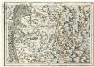
Geographica Provinciarum Sveviae Descriptio =
Mollova mapová sbírka Hurter, Johann Christoph Bodenehr, Gabriel
Alasatia superior et inferior III. tabulis delineata, 2
1 Blatt : 62 x 59 cm s.n.
Le Theatre de la Guerre Sur le Haut Rhein
1 : 142000 Mollova mapová sbírka Sanson, Guillaume
[Carte eines Theils des Schwartzwaldes]

Territorium Argentoriatense. [Karte], in: Novus atlas absolutissimus, Bd. 2, S. 208.
1 Karte aus Atlas Janssonius Offizin
163 Colmar.
1 : 86400 Cassini family; Cassini, Cesar-Francois, 1714-1784
[Colmar]
1 Blatt : 60 x 91 cm s.n.
Le cours du Rhin de Bâle à Hert près Philisbourg contenant l'Alsace et partie du Brisgau, 3
1 Blatt : 77 x 52 cm Le Rouge
Argentoratensis Agri Descriptio. [Karte], in: Theatrum orbis terrarum, S. 175.
1 Karte aus Atlas Ortelius, Abraham
Le Flambeau de la Guerre Allumee au Rhin
Mollova mapová sbírka Delisle, Guillaume Schenk, Peter II
Nieuwe en naukeurige aftekening van Freiburg met alle zyne sterktens en omleggende landen etc
1 Karte : Kupferdruck ; 43 x 55 cm Ottens; Ottens chez R. et I. Ottens
Le Flambeau de la Guerre Allumee au Rhin
Mollova mapová sbírka Delisle, Guillaume Schenk, Peter II
Le Flambeau de la Guerre Allumee au Rhin
Mollova mapová sbírka Delisle, Guillaume Schenk, Peter II
![[Geologische Karte der Umgebungen von Lahr und Offenburg]](https://images-2.georeferencer.com/images/iiif/690236761182/full/,300/0/native.jpg)

