Maps of Asia
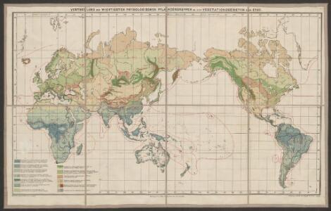
Vertheilung der wichtigsten physiologischen Pflanzengruppen in den Vegetationsgebieten der Erde
1 : 85000000 Engler, Adolf Wagner & Debes
Weltverkehrs, Meeresstromungen.
1 : 90000000 Andree, Richard
Welt-Karte zur Ubersicht der Luft-Stromungen und der See-Wege.
1 : 115000000 Berghaus, Hermann
Welt-Karte zur Ubersicht der Meeres-Stromungen und des Schnellverkehrs.
1 : 115000000 Berghaus, Hermann
Navigation, les oceans.
1 : 67000000 Garnier, F. A., 1803-1863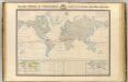
Thermometrie.
1 : 70000000 Garnier, F. A., 1803-1863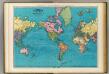
World, Mercator's projection.
1 : 64000000 Rand McNally and Company
Planiglob in Mercators Projection
země světa Berra, Marco bei Marco Berra
The "time and tide" map of the Atlantic charter / [cartography] London Geographical Institute
1 : 450000 Annotatie: Bevat de 8 punten van het Atlantisch charter The London Geographical Institute, London London : Philip & Son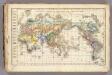
Distribution primitive du genre humain.
1 : 95000000 Vincent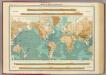
World - bathy-orographical.
1 : 83000000 John Bartholomew and Son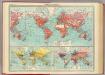
World - commerce.
1 : 92000000 John Bartholomew and Son
DIE ERDE in Zwey Halbkugeln der östlichen und westlichen
země světa
Geographische Verbreitung der Menschen-Rassen.
1 : 140000000 Berghaus, Heinrich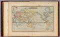
Mercator's Chart.
1 : 91000000 Lucas, Fielding Jr.
India Extrema; XIX. Nova Tabula. [Karte], in: Claud. Ptolemaeus. Geographia lat. cum mappis [...], S. 413.
1 Karte aus Atlas Münster, Sebastian [und Ptolemaeus, Claudius]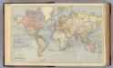
The World.
1 : 65000000 Letts, Son & Co.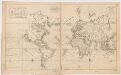
Carte generale de toutes les costes du Monde : et les pays nouvellement decouvert
1 : 450000 Cóvens et Mortier chez Iean Cóvens et Corneille Mortier Libraires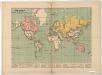
The world on Mercator's projection : showing the British possessions and chief ports coloured red
Relief shown by hachures. "Supplement to the Illustrated London News, May 9, 1885." Marginal notes on the population, revenue, imports and exports value and distance from Great Britain for each colony. London : Illustrated London News
[Verbreitungsbezirke der wichtigsten Kulturgewächse]
Zweiter Band, enthaltend in vier Abtheilungen die Vertheilung der Organismen: 5. Pflanzen-Geographie, 6. Thier-Geographie, 7. Anthropographie, 8. Ethnographie Humboldt, Alexander von Verlag von Justus Perthes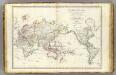
Mappe-monde.
1 : 55000000 Brue, Adrien Hubert, 1786-1832
[Survey of the Geographical distribution and cultivation of the most important Plants which are used as food for man]
The physical atlas Johnston, Alexander Keith William Blackwood & Sons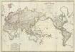
Composite: Mappe-monde
1 : 27000000 Brue, Adrien Hubert, 1786-1832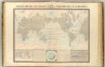
Courants atmospheriques, oceaniques.
1 : 70000000 Garnier, F. A., 1803-1863
I. Charte für die allgemeine Geschichte von den frühesten bekannten Zeiten bis zur Zerstörung von Troja
Entworfen von F.W. Benicken Weimar : im Verlage des L. Industrie-Comptoirs
Orbis Typus Universalis Iuxta Hydrographorum Traditionem [Karte], in: Claudii Ptolemei viri Alexandrini mathematice discipline philosophi doctissimi geographie opus [...], S. 230.
1 Karte aus Atlas Waldseemüller, Martin [und Ptolemaeus, Claudius] Übelin, Georg
Windkarte der Erde
Erster Band, enthaltend in vier Abtheilungen die Erscheinungen der anorganischen Natur: 1. Meteorologie und Klimatographie. 2. Hydrologie und Hydrographie. 3. Geologie. 4. Tellurischer Magnetismus Humboldt, Alexander von Verlag von Justus Perthes
Verbreitung der Vögel I.
Atlas der Tierverbreitung Marshall, William Justus Perthes
Nova totius terrarum orbis geographica ac hydrographica tabula / autore N.I. Piscator
1 : 50000000 Annotatie: Origineel is Blad 1 in atlas factice; Met talrijke kostuumfiguren in kaartrand Visscher, Claes Jansz. [Amsterdam : C.J. Visscher excudebat]