Maps of Germany

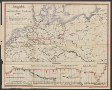
Übersichtskarte der norddeutschen Wasserstrassen
1 : 2000000 Jänecke
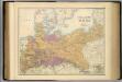
Karte vom Preussischen Staate mit den Bundesstaaten in Nord-Deutschland
1 : 2400000 Neuchâtel (Švýcarsko) Bimbé, Wilhelm K.A. Kümmel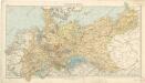
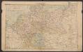
Norddeutsche Staaten
XI. Die Provinzen des Königreichs Preußen mit den Regierungsbezirken
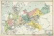
Preußen Verwaltungsgliederung
Carte Generale du Royaume de Prusse.
1 : 3000000 Vivien de St Martin, L.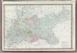
Germany Northern Portion.
1 : 2500000 Rand McNally and Company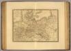
Monarchie Prussienne.
1 : 2400000 Picquet, C.
Wandkarte des Deutschen Reiches.zum Schul- und Comptoir- Gebrauch
mapa VKOL Kiepert, Heinrich Verlag von Dietrich Reimer
Die Preussische Monarchie
Preußen
Politische Übersicht von Nord-Deutschland und Preussen
E. von Sydow's Schul-Atlas in sechs und dreissig Karten Sydow, Emil von bei Justus Perthes
Prussia.
1 : 4118400 Tallis, J. & F.
Prussia.
1 : 3200000 Mitchell, Samuel Augustus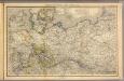
Nord- u. Mittel-Deutschland, nebst Daenemark.
1 : 1900000 Stein, Christ. Gottfr. Dan.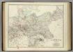
Empire of Germany (northern portion).
1 : 2032000 Johnston, Alexander Keith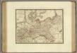
Monarchie Prussienne.
1 : 2400000 Brue, Adrien Hubert, 1786-1832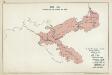
VIII. 1807 - 1815. Preußen nach dem Frieden von Tilsit
Preußen Tilsit / Friede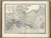
Preussische Staate.
1 : 1800000 Weiland, C. F. (Carl Ferdinand), d. 1847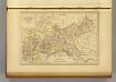
Prusse.
1 : 4100000 Malte-Brun, Conrad, 1775-1826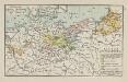
Kurstaat Brandenburg
Brandenburg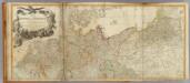
Germany (north)
1 : 1250000 Robert Laurie & James Whittle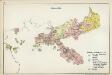
VI. 1740 - 1786
Preußen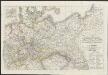
[Neuer Atlas der ganzen Erde nach den neuesten Bestimmungen ... : XVI.] Charte von Preussischen Staate, Gebirgs- und Fluss-Charte des nördlichen Teutschlands
Neu entworfen und gezeichnet von F.W. Streit gest. v. H. Leutemann Leipzig : J.C. Hinrichssche Buchhandlung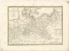
North German Confederation and Prussia.
1 : 2217600 Fullarton, A. & Co.
Mapa teatru wojny na morzu i na lądzie
1 : 3000000 Belgie Scheda, Joseph von Steinhauser, Anton Artaria

Preussen, Neuchatel, Valengin.
1 : 3200000 Radefeld, Carl Christian Franz, 1788-1874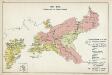
IX. 1815 - 1861. Preußen nach dem Wiener Kongreß
Preußen Wiener Kongress (1814-1815 : Wien)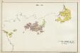
III. 1608 - 1619
Brandenburg Expansion