Maps of Žeraviny

Zierawin - m3653-1-002 - Kaiserpflichtexemplar der Landkarten des stabilen Katasters
1 : 2880
Zierawin - m3653-1-001 - Kaiserpflichtexemplar der Landkarten des stabilen Katasters
1 : 2880
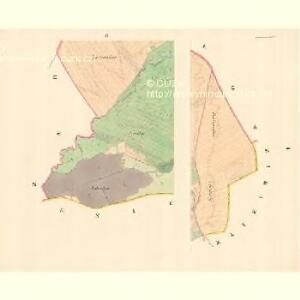
Kozaydek (Kozogidek) - m1323-1-001 - Kaiserpflichtexemplar der Landkarten des stabilen Katasters
1 : 2880
Kozaydek (Kozogidek) - m1323-1-002 - Kaiserpflichtexemplar der Landkarten des stabilen Katasters
1 : 2880
Kozaydek (Kozogidek) - m1323-1-003 - Kaiserpflichtexemplar der Landkarten des stabilen Katasters
1 : 2880

[Gradkartenblatt]
1 : 25000 Bílé Karpaty (Česko a Slovensko) Vojenský zeměpisný ústav
III. vojenské mapování 4459/1
1 : 25000
Gradkartenblatt
1 : 25000 Bílé Karpaty (Česko a Slovensko) Bellschan, Anton

III. vojenské mapování 4459
1 : 75000
Ung. Ostra und Waag-Neustadtl
1 : 75000 Uherský Ostroh, Nové Mesto nad Váhom Geripp: Assist. Jersche. Terrain: Hptm. Platenik
Bzenec a okolí
1 : 75000 Bzenec (Česko : oblast) Vojenský zeměpisný ústav
Nové Mesto n. Váhom
1 : 75000 Nové Mesto nad Váhom-oblast (Slovensko) Vojenský zeměpisný ústav
Nové Mesto n. Váhom a Uherský Ostroh
1 : 75000 Morava (Česko) Vojenský zeměpisný ústav
Nové Mesto n. Váhom a Uherský Ostroh
1 : 75000 Morava (Česko) Vojenský zeměpisný ústav
Karte des Gemeindegrenzen

Podrobná mapa Markrabství moravského a Vévodství slezského
1 : 100000 Hodonín (Česko : oblast) Srp, Jan Jos. R. Vilímek
Podrobná místopisná mapa Království Českého

Podrobná mapa Království českého, Markrabství moravského a Vévodství slezského
1 : 100000 Hodonín (Česko : oblast) Srp, Jan Jos. R. Vilímek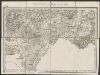
Umgebungen von Gaya und Göding
1 : 144000 K.K. Militärisches Geographisches Institut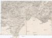
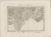
Umgebungen von Gaya und Göding
1 : 144000 Hodonín (Česko : oblast) K.K. Militärisch-Geographisches Institut
Ungostra und Waag-Neustadtl.
from Spezialkarte der osterreichisch-ungarischen Monarchie.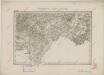
II. vojenské mapování 18
1 : 144000
Goding und Lundenburg.
from Spezialkarte der osterreichisch-ungarischen Monarchie.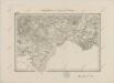
II. vojenské mapování 18
1 : 144000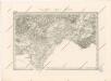
Special - Karte der Markgrafschaft Maehren und des Herzogthums Schlesien
II. vojenské mapování 18
1 : 144000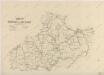
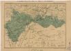
Náčrt Moravy a Slezska