Maps of Hartinkov

Hartinkau - m0672-1-003 - Kaiserpflichtexemplar der Landkarten des stabilen Katasters
1 : 2880
Hartinkau - m0672-1-004 - Kaiserpflichtexemplar der Landkarten des stabilen Katasters
1 : 2880
Hartinkau - m0672-1-001 - Kaiserpflichtexemplar der Landkarten des stabilen Katasters
1 : 2880
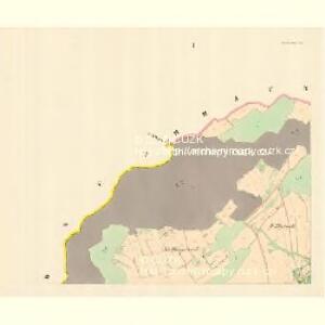
Hartinkau - m0672-1-002 - Kaiserpflichtexemplar der Landkarten des stabilen Katasters
1 : 2880
Brohsen (Wraznj) - m3480-1-002 - Kaiserpflichtexemplar der Landkarten des stabilen Katasters
1 : 2880
Brohsen (Wraznj) - m3480-1-003 - Kaiserpflichtexemplar der Landkarten des stabilen Katasters
1 : 2880
Brohsen (Wraznj) - m3480-1-001 - Kaiserpflichtexemplar der Landkarten des stabilen Katasters
1 : 2880
Braunöhlhütten (Wranowalhotta) - m3472-1-005 - Kaiserpflichtexemplar der Landkarten des stabilen Katasters
1 : 2880
Braunöhlhütten (Wranowalhotta) - m3472-1-002 - Kaiserpflichtexemplar der Landkarten des stabilen Katasters
1 : 2880
Braunöhlhütten (Wranowalhotta) - m3472-1-004 - Kaiserpflichtexemplar der Landkarten des stabilen Katasters
1 : 2880
Braunöhlhütten (Wranowalhotta) - m3472-1-001 - Kaiserpflichtexemplar der Landkarten des stabilen Katasters
1 : 2880
Braunöhlhütten (Wranowalhotta) - m3472-1-003 - Kaiserpflichtexemplar der Landkarten des stabilen Katasters
1 : 2880
Swanow - m2990-1-005 - Kaiserpflichtexemplar der Landkarten des stabilen Katasters
1 : 2880
Swanow - m2990-1-002 - Kaiserpflichtexemplar der Landkarten des stabilen Katasters
1 : 2880
Swanow - m2990-1-004 - Kaiserpflichtexemplar der Landkarten des stabilen Katasters
1 : 2880
Swanow - m2990-1-003 - Kaiserpflichtexemplar der Landkarten des stabilen Katasters
1 : 2880
Swanow - m2990-1-001 - Kaiserpflichtexemplar der Landkarten des stabilen Katasters
1 : 2880
Wisoka - m3509-1-001 - Kaiserpflichtexemplar der Landkarten des stabilen Katasters
1 : 2880
Wisoka - m3509-1-002 - Kaiserpflichtexemplar der Landkarten des stabilen Katasters
1 : 2880

[Kartenblatt]
1 : 25000 Jevíčko (Česko : oblast) Reichsamt für Landesaufnahme
Dislocation du regiment de Grunne
1 : 150000 Mohelnice-oblast (Šumperk, Česko) Breye
Olmütz
1 : 75000 Loštice (Česko : oblast) Lampe K. u. k. Militärgeographisches Institut
Podrobná mapa Markrabství moravského a Vévodství slezkého
1 : 100000 Lanškroun (Česko : oblast) Srp, Jan Jos. R. Vilímek
Vilímkovy místopisné mapy zemí Koruny české
1 : 100000 Lanškroun (Česko : oblast) Srp, Jan Jos. R. Vilímek
Podrobná mapa Království českého, Markrabství moravského a Vévodství slezského
1 : 100000 Lanškroun (Česko : oblast) Srp, Jan Jos. R. Vilímek
Podrobná mapa Království českého
1 : 100000 Lanškroun (Česko : oblast) Srp, Jan Jos. R. Vilímek
Eisenbahn Karte Wien-Dresden, Ollmütz-Trübau
1 : 72000 Blatt 9 Minarzik, Anselm J. Rauh
[Železniční trať Krasíkov-Olomouc]
1 : 60000 Krasíkov (Ústí nad Orlicí, Česko)