Maps of Bušín

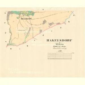
Hakelsdorf - m0671-1-002 - Kaiserpflichtexemplar der Landkarten des stabilen Katasters
1 : 2880
Hakelsdorf - m0671-1-001 - Kaiserpflichtexemplar der Landkarten des stabilen Katasters
1 : 2880
Jokelsdorf (Jakubowice) - m1019-1-002 - Kaiserpflichtexemplar der Landkarten des stabilen Katasters
1 : 2880
Jokelsdorf (Jakubowice) - m1019-1-004 - Kaiserpflichtexemplar der Landkarten des stabilen Katasters
1 : 2880
Jokelsdorf (Jakubowice) - m1019-1-003 - Kaiserpflichtexemplar der Landkarten des stabilen Katasters
1 : 2880
Jokelsdorf (Jakubowice) - m1019-1-001 - Kaiserpflichtexemplar der Landkarten des stabilen Katasters
1 : 2880
Hosterlitz (Hostize) - m0856-1-005 - Kaiserpflichtexemplar der Landkarten des stabilen Katasters
1 : 2880
Hosterlitz (Hostize) - m0856-1-001 - Kaiserpflichtexemplar der Landkarten des stabilen Katasters
1 : 2880
Hosterlitz (Hostize) - m0856-1-003 - Kaiserpflichtexemplar der Landkarten des stabilen Katasters
1 : 2880
Hosterlitz (Hostize) - m0856-1-002 - Kaiserpflichtexemplar der Landkarten des stabilen Katasters
1 : 2880
Hosterlitz (Hostize) - m0856-1-004 - Kaiserpflichtexemplar der Landkarten des stabilen Katasters
1 : 2880
Janouschendorf (Janussow) - m1031-1-003 - Kaiserpflichtexemplar der Landkarten des stabilen Katasters
1 : 2880
Janouschendorf (Janussow) - m1031-1-001 - Kaiserpflichtexemplar der Landkarten des stabilen Katasters
1 : 2880
Janouschendorf (Janussow) - m1031-1-002 - Kaiserpflichtexemplar der Landkarten des stabilen Katasters
1 : 2880
[Kartenblatt]
1 : 25000 Morava (Česko) Reichsamt für Landesaufnahme


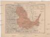
Podrobná mapa Království českého
1 : 100000 Králíky (Ústí nad Orlicí, Česko : oblast) Srp, Jan Jaroslav Bursík
[Vilímkovy místopisné mapy zemí Koruny české]
1 : 100000 Králíky (Ústí nad Orlicí, Česko : oblast) Srp, Jan Jos. R. Vilímek
Landskorn und Mhr. Trubau.
from Spezialkarte der osterreichisch-ungarischen Monarchie.
Mhr. Neustadt und Mgr. Schonberg.
from Spezialkarte der osterreichisch-ungarischen Monarchie.
Freiwaldeau.
from Spezialkarte der osterreichisch-ungarischen Monarchie.
II. vojenské mapování 4
1 : 144000
Senftenberg.
from Spezialkarte der osterreichisch-ungarischen Monarchie.
II. vojenské mapování 4
1 : 144000
Podrobná mapa Markrabství moravského a Vévodství slezkého
1 : 100000 Králíky (Ústí nad Orlicí, Česko : oblast) Srp, Jan Jos. R. Vilímek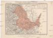
Generální mapa okresního hejtmanství Žamberského
1 : 220000 Žamberk-oblast (Česko) Wagner, Jan Eduard F. Kytka