Maps of Červená Řečice

Smischowitz - c9292-1-002 - Kaiserpflichtexemplar der Landkarten des stabilen Katasters
1 : 2880
Smischowitz - c9292-1-003 - Kaiserpflichtexemplar der Landkarten des stabilen Katasters
1 : 2880
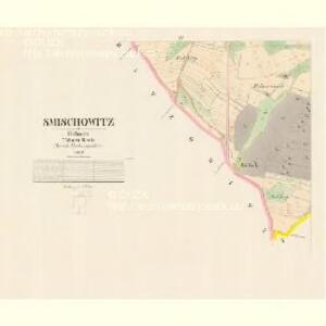
Smischowitz - c9292-1-001 - Kaiserpflichtexemplar der Landkarten des stabilen Katasters
1 : 2880
Popelischna - c6010-1-002 - Kaiserpflichtexemplar der Landkarten des stabilen Katasters
1 : 2880
Popelischna - c6010-1-001 - Kaiserpflichtexemplar der Landkarten des stabilen Katasters
1 : 2880
Rothrzetschitz - c0922-1-004 - Kaiserpflichtexemplar der Landkarten des stabilen Katasters
1 : 2880
Rothrzetschitz - c0922-1-002 - Kaiserpflichtexemplar der Landkarten des stabilen Katasters
1 : 2880
Rothrzetschitz - c0922-1-006 - Kaiserpflichtexemplar der Landkarten des stabilen Katasters
1 : 2880
Rothrzetschitz - c0922-1-005 - Kaiserpflichtexemplar der Landkarten des stabilen Katasters
1 : 2880
Rothrzetschitz - c0922-1-007 - Kaiserpflichtexemplar der Landkarten des stabilen Katasters
1 : 2880
Rothrzetschitz - c0922-1-003 - Kaiserpflichtexemplar der Landkarten des stabilen Katasters
1 : 2880
Rothrzetschitz - c0922-1-001 - Kaiserpflichtexemplar der Landkarten des stabilen Katasters
1 : 2880
Tiechoras - c7883-1-002 - Kaiserpflichtexemplar der Landkarten des stabilen Katasters
1 : 2880
Tiechoras - c7883-1-001 - Kaiserpflichtexemplar der Landkarten des stabilen Katasters
1 : 2880
Batzowitz - c0054-1-003 - Kaiserpflichtexemplar der Landkarten des stabilen Katasters
1 : 2880
Batzowitz - c0054-1-002 - Kaiserpflichtexemplar der Landkarten des stabilen Katasters
1 : 2880
Batzowitz - c0054-1-001 - Kaiserpflichtexemplar der Landkarten des stabilen Katasters
1 : 2880

Podrobné mapy zemí Koruny české v měřítku 1:75.000 a mapa vzdáleností všech míst při silnici ležících
1 : 75000 Humpolec (Pelhřimov, Česko : oblast) Bělohlav, Josef F. Topič
Geologická mapa okresu Humpoleckého
1 : 30000 Humpolec-oblast (Pelhřimov, Česko) Kobliha, Gustav
Podrobné mapy zemí Koruny české v měřítku 1:75.000 a mapa vzdáleností všech míst při silnici ležících - Pelhřimov - Humpolec. Průvodce statisticko-historický po všech místech na těchto mapách uvedených a rejstřík věcný názvů hor, potoků, řek, rybníků atd. Sešit 45. List 84,
1 : 75000
Pelhřimov - Humpolec
Podrobná místopisná mapa Království Českého

Podrobná mapa Království českého
1 : 100000 Humpolec (Pelhřimov, Česko : oblast) Srp, Jan Jaroslav Bursík
Podrobná místopisná mapa Království Českého
II. vojenské mapování 16
1 : 144000
Kamenitz a./d. Linde (Bohmen).
from Spezialkarte der osterreichisch-ungarischen Monarchie.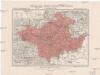
Generální mapa okresního hejtmanství Něm. Brodského
1 : 220000 Havlíčkův Brod-oblast (Česko) Wagner, Jan Eduard F. Kytka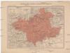
Generální mapa okresního hejtmanství Něm. Brodského
1 : 220000 Havlíčkův Brod-oblast (Česko) Wagner, Jan Eduard F. Kytka